

Ready to explore San Francisco Bay National Wildlife Refuge? Here's everything you need to know before you go!
Discover the trail
Oh no! We don't have any photos 😢
This trail hasn't been captured yet. Be the first to share your adventure!Trail description
The San Francisco Bay National Wildlife Refuge is one of the most remarkable natural areas in the entire Bay Area — a sprawling mosaic of tidal marshes, mudflats, salt ponds, and upland habitat sitting right at the edge of one of the most urbanized regions in the United States. It's the kind of place that surprises people. You drive past suburbs and industrial corridors, and then suddenly you're standing on a levee trail with the bay stretching out in front of you and shorebirds working the mudflats in every direction.
Managed by the U.S. Fish and Wildlife Service, this refuge was established in 1972 and was the first urban national wildlife refuge in the country — a distinction that still matters today. It set a precedent for protecting wild habitat within reach of millions of city residents, and it continues to serve that role for the communities around the South Bay.
The Terrain
The landscape here is flat and open, which makes it feel very different from the wooded ridge trails you'll find elsewhere in the Bay Area. Most of the walking is done on levee tops — wide, compacted dirt paths that run along the edges of former salt evaporation ponds and restored tidal marshes. The views are long and unobstructed. On a clear day you can see the hills of the East Bay, the Santa Cruz Mountains to the west, and the expanse of South San Francisco Bay stretching northward.
The habitat diversity is what makes this refuge genuinely interesting for anyone who pays attention to the natural world. Tidal marshes dominated by pickleweed and cordgrass transition into open water areas and mudflats that are exposed at low tide. The salt ponds, many of which are in various stages of restoration back to tidal marsh, add another layer of ecological complexity. Upland scrub areas provide nesting habitat for different species than you'll find in the wetlands.
Wildlife
This is one of the best spots in the Bay Area for birdwatching, full stop. The refuge sits along the Pacific Flyway, the major migratory route running along the West Coast, which means the diversity and volume of birds passing through — or wintering here — is exceptional. Shorebirds like dunlin, western sandpiper, dowitchers, and avocets work the mudflats and shallow pond edges. Ducks and diving birds use the open water. Raptors, including white-tailed kites, northern harriers, and peregrine falcons, hunt over the marshes.
The endangered California clapper rail — now called the Ridgway's rail — lives in the tidal marshes here, and the refuge has been central to recovery efforts for this species. You're more likely to hear one than see one, but that raspy, clattering call coming out of the pickleweed is a genuine wildlife moment. The salt marsh harvest mouse, another endangered species found only in Bay Area salt marshes, also depends on this habitat.
Beyond birds, harbor seals haul out on mudflats within the refuge boundaries, and the bay waters support a full marine food web that includes bat rays, leopard sharks, and the fish species that feed the birds above.
Trails and Access
The refuge has a network of levee trails that are accessible to hikers, and many sections are also open to cyclists and leashed dogs, though it's worth checking current regulations at the visitor center or on the U.S. Fish and Wildlife Service website before you go, as rules can vary by area and season. The trails are generally easy walking — flat, wide, and well-maintained — which makes the refuge accessible to a wide range of visitors including families with young kids and people who want a relaxed outdoor experience without technical terrain.
The Don Edwards San Francisco Bay National Wildlife Refuge Visitor Center, located in Fremont, is a good starting point. It offers exhibits on the refuge's ecology and history, restrooms, and parking. Staff and volunteers there can point you toward the best areas to explore depending on what you're hoping to see and how far you want to walk.
There are multiple access points around the refuge, including trailheads in Fremont, Newark, and Alviso. Each area has a slightly different character and offers access to different parts of the habitat mosaic, so it's worth exploring more than one entry point if you visit multiple times.
Best Times to Visit
The refuge is worth visiting year-round, but the experience shifts significantly with the seasons. Winter brings the largest concentrations of migratory waterfowl and shorebirds, making it arguably the peak season for birdwatching. Fall migration is also excellent, with a wide variety of shorebird species moving through. Spring brings breeding activity and the return of nesting birds. Summer is quieter in terms of bird diversity but the long days and warm temperatures make for pleasant walking, and you'll still find plenty of resident species.
Low tide is generally the best time to visit if you're interested in shorebirds, as the exposed mudflats concentrate feeding activity. Checking a tide chart before you go is a simple step that can make a real difference in what you see.
What Makes This Place Stand Out
What's genuinely unusual about the San Francisco Bay National Wildlife Refuge is the contrast between its ecological significance and its urban context. You're never far from the sounds and sights of the surrounding cities, and yet the refuge supports endangered species, hosts hundreds of thousands of migratory birds, and protects one of the largest remaining expanses of tidal marsh on the West Coast. That tension — wildness embedded in a metropolitan landscape — is part of what makes visiting here feel meaningful rather than just recreational.
The ongoing restoration work happening within the refuge is also worth understanding. Large sections of former industrial salt ponds are being converted back to tidal marsh through a long-term project involving multiple agencies and organizations. Walking the levees, you're watching ecological restoration happen at a landscape scale, which adds a layer of context that you don't get on most trails.
For anyone living in or visiting the South Bay, the San Francisco Bay National Wildlife Refuge offers a genuinely rewarding outdoor experience that connects you to the ecological history and ongoing life of one of North America's most important estuaries.
Everything you need for your next hike. Bilingual, printable, 1 page.
Get your free hiking checklistRecommended gear for this trail
As an Amazon Associate I earn from qualifying purchases.


Ready to go?
Everything you need to know before you goWhen?
As an Amazon Associate I earn from qualifying purchases.
Affiliate links — LGPO may earn a commission at no extra cost to you.
- Hiking shoes Essential
- → Salomon Elixir Tour Mid WP · 203.38 $
- Layered clothing Essential
- Rain jacket Essential
- Trekking poles
- → Black Diamond Trail Ergo Cork · 69.99 $
- Headlamp
- → Petzl Actik Core 625 · 103.95 $
FAQ - Frequently asked questions
Everything you need to knowOutings near San Francisco Bay National Wildlife Refuge
Discover other trails you might enjoy
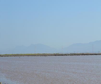
Don Edwards San Francisco Bay National Wildlife Refuge
Bay Area · 5.6 km away

Avalon Mountain View
White Mountains · 11.6 km away
Foothills park
Bay Area · 15.9 km away
Redwood Regional Park
Bay Area · 34.3 km away
Rose Peak, California
Bay Area · 34.7 km away

Glen Canyon park
Bay Area · 38.9 km away
Hiking near Victoria
105 trails to explore ~1218 km away
We work hard to provide the most up-to-date and error-free data possible. If something seems incorrect, let us know! Your contribution helps the whole community.
Hikers' opinions
Be the first to review!
No hiker has shared their experience yet. Share your impressions and help other hikers!