

Ready to explore O'Neill Regional Park? Here's everything you need to know before you go!
Discover the trail
Photos: Pacific Southwest Region USFWS from Sacramento, US — Domaine public (Wikimedia Commons)
Trail description
O'Neill Regional Park is one of Orange County's most accessible and rewarding natural escapes. Tucked into the foothills of the Santa Ana Mountains, this regional park offers a genuine taste of Southern California's inland wilderness — oak woodlands, riparian corridors, open chaparral, and the kind of quiet that's hard to find this close to a major metro area. Whether you're looking for a casual walk with the family or a longer day out on the trail, O'Neill delivers without a lot of fuss.
The Setting
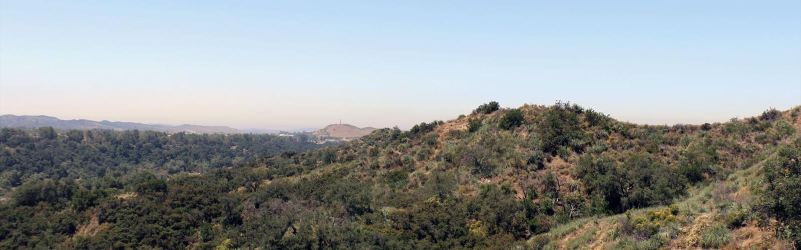
The park sits along Trabuco Creek, and that riparian corridor is really the heart of the place. Mature sycamores and willows line the creek bottom, providing shade and a noticeably cooler microclimate compared to the exposed ridgelines above. As you move away from the creek, the terrain transitions into classic Southern California chaparral — dense scrub, rocky slopes, and open views across the canyon. The contrast between these two environments is part of what makes O'Neill interesting to explore.
The Santa Ana Mountains form the backdrop, and on clear days the views from the higher sections of the trail network are genuinely impressive. This is foothill terrain — not flat, but not brutally steep either. The landscape has a rugged, sun-baked character that feels distinctly different from the coastal parks nearby.
The Trail Network
O'Neill Regional Park has a solid network of trails that connect to the broader Trabuco District trail system, including links toward the Cleveland National Forest. This connectivity is one of the park's biggest assets — it's not just a loop-and-done kind of place. Hikers who want to extend their day have real options.
Within the park itself, trails range from easy creek-side walks to more demanding climbs up into the chaparral. The terrain underfoot is typical of the region: packed dirt, loose rock on the steeper sections, and occasional creek crossings that can be wet in winter and early spring. Trail junctions are generally well-marked, but carrying a map or downloading the trail data before you go is always a good call.
The park also accommodates equestrians on many of its trails, so expect to share the path with horses on busier weekends. Mountain bikers are permitted on designated trails as well, so it's worth checking current trail use designations before heading out.
Wildlife and Nature
The mix of habitats at O'Neill makes it a genuinely good spot for wildlife watching. The riparian zone along Trabuco Creek attracts a wide variety of birds year-round, and the oak woodland sections are particularly active in the morning hours. Mule deer are commonly spotted, especially in the quieter corners of the park early in the day. The chaparral supports its own cast of residents — lizards, rabbits, and the occasional coyote moving through the scrub.
The oak woodland component of the park is worth paying attention to. Coast live oaks provide canopy cover in several sections, and the acorn-dependent food web they support brings in woodpeckers, scrub jays, and other species that depend on that resource. It's the kind of ecosystem that rewards slow, attentive hiking over covering ground quickly.
Practical Information
O'Neill Regional Park is a developed regional park with real infrastructure. There's a campground on-site, which makes it a viable base for multi-day exploration of the surrounding trail network. Day-use facilities include picnic areas, restrooms, and a parking area. A day-use fee applies for vehicle entry — it's worth confirming the current rate with Orange County Parks before your visit, as fees are subject to change.
- Dogs: Leashed dogs are generally permitted in the park, but trail-specific rules can vary — check with Orange County Parks for current policies on specific trails.
- Horses: Equestrian use is permitted on designated trails throughout the park.
- Bikes: Mountain bikes are allowed on designated trails only.
- Camping: The park has a developed campground with sites available for reservation.
- Restrooms: Available at the main day-use area.
- Fees: A vehicle day-use fee is charged at entry. Confirm current pricing with Orange County Parks.
Getting There
The park is located in the Trabuco Canyon area of Orange County, California. Access is via Trabuco Canyon Road, which winds up from the flatlands into the foothills. The road itself gives you a preview of the terrain — it's a pleasant drive that leaves the suburban grid behind fairly quickly. Parking is available at the main entrance area. On busy weekends, arriving earlier in the day is a good idea, both for parking and for cooler temperatures on the trail.
Best Times to Visit
Fall and spring are the sweet spots for O'Neill. Temperatures are comfortable, the creek is more likely to be running, and the vegetation is at its most interesting. Winter visits are also worthwhile — the chaparral takes on a greener look after rain, and the park tends to be quieter. Summer hiking is doable but demands an early start; the exposed chaparral sections get hot fast once the sun is up, and there's limited shade on the upper trails.
What Makes O'Neill Worth the Trip
What sets O'Neill apart from other Orange County parks is the combination of genuine trail variety, the riparian corridor along Trabuco Creek, and the connectivity to a much larger trail network in the Santa Ana Mountains. It doesn't feel like a manicured park experience — the terrain is real, the wildlife is present, and the landscape has enough character to hold your attention across multiple visits. For hikers based in the greater Orange County area who want something more substantial than a paved path, O'Neill Regional Park is a reliable and consistently rewarding option.
The Essential Hiking Checklist
Everything you need for your next hike. Bilingual, printable, 1 page.
Get your free hiking checklistRecommended gear for this trail
As an Amazon Associate I earn from qualifying purchases.


Ready to go?
Everything you need to know before you goWhen?
How much?
As an Amazon Associate I earn from qualifying purchases.
Affiliate links — LGPO may earn a commission at no extra cost to you.
- Hiking shoes Essential
- → Salomon Elixir Tour Mid WP · 203.38 $
- Layered clothing Essential
- Rain jacket Essential
- Trekking poles
- → Black Diamond Trail Ergo Cork · 69.99 $
- Headlamp
- → Petzl Actik Core 625 · 103.95 $
FAQ - Frequently asked questions
Everything you need to knowSimilar hikes nearby
Discover other trails you might enjoy

Hiking near Victoria
93 trails to explore ~1710 km away
We work hard to provide the most up-to-date and error-free data possible. If something seems incorrect, let us know! Your contribution helps the whole community.
Hikers' opinions
Be the first to review!
No hiker has shared their experience yet. Share your impressions and help other hikers!