

Ready to explore Mount Stewart, California? Here's everything you need to know before you go!
Discover the trail
Trail description
Mount Stewart is a rugged peak in the Sierra Nevada of California, offering a genuine mountaineering experience for those who want more than a trail walk. This is a climb that rewards preparation and fitness — expect exposed terrain, route-finding, and the kind of summit views that make the effort feel completely worth it.
The Mountain
Mount Stewart sits within the Sierra Nevada range, a region defined by granite walls, high-altitude lakes, and dramatic elevation changes. The peak itself is part of the classic Sierra landscape — think polished rock slabs, talus fields, and ridgelines that stretch as far as you can see. It's the kind of objective that draws climbers and scramblers who are comfortable moving on technical terrain without necessarily roping up for every move, though conditions and your own experience level should always guide that decision.
The approach and the climb itself put you deep into Sierra Nevada wilderness, away from crowded trailheads and day-hiker traffic. That relative solitude is a big part of what makes Mount Stewart worth seeking out.
What to Expect on the Climb
Mount Stewart is not a casual hike. The terrain involves a mix of trail, off-trail travel, and scrambling on rock. Route-finding is a real part of the experience — there's no single obvious path painted on the ground, and the mountain will ask you to read the terrain and make decisions. That's part of the appeal for the right kind of adventurer, but it also means this objective isn't suited for beginners or anyone unfamiliar with moving on loose rock and exposed ridges.
The granite is typical Sierra Nevada — generally solid, but with sections of loose talus and scree that require careful foot placement. Hands come into play on steeper sections. The exposure increases as you gain elevation, and the summit push typically involves the most committing terrain of the day.
Weather in the Sierra Nevada can shift quickly, especially in summer when afternoon thunderstorms are a real concern. An early start is standard practice for any Sierra peak — aim to be off exposed terrain well before midday if storms are in the forecast.
The Summit Experience
Reaching the top of Mount Stewart puts you above the surrounding landscape with views across the Sierra Nevada that are hard to match. The high-alpine environment at the summit is stark and beautiful — granite, sky, and distant peaks in every direction. On a clear day, the scale of the range becomes fully apparent from up here.
The summit itself is the kind of place where you want to sit for a while, take in the panorama, and eat your lunch before the descent. The Sierra Nevada rewards those who slow down and actually look around.
Getting There
Access to Mount Stewart follows the typical Sierra Nevada pattern — a drive to a trailhead, often on roads that require attention and sometimes a high-clearance vehicle depending on the specific approach. Trailhead facilities in this part of the Sierra range from basic to non-existent, so plan accordingly. Bring everything you need: water, food, navigation tools, and layers for the summit.
Permits may be required depending on the time of year and the specific wilderness area you're entering. The Sierra Nevada has a well-established permit system for overnight travel, and even day-use access to certain zones can require advance planning. Check current requirements with the relevant land management agency before your trip.
Gear and Preparation
For a climb like Mount Stewart, your kit should reflect the terrain:
- Footwear: Approach shoes or light hiking boots with solid grip on rock. Trail runners can work for experienced scramblers who know what they're getting into.
- Navigation: A downloaded topo map and GPS device or app. Cell service is unreliable in the Sierra backcountry.
- Layers: Temperatures drop fast at elevation. A wind layer and insulating mid-layer are essential even in summer.
- Sun protection: At Sierra Nevada elevations, UV exposure is intense. Sunscreen, sunglasses, and a hat are non-negotiable.
- Water: Carry enough for the full day. Filtration is an option if you're crossing streams on the approach, but don't count on water sources near the summit.
- Headlamp: Early starts mean pre-dawn departures. A headlamp is always in the pack.
Who This Climb Is For
Mount Stewart is best suited for hikers who have already logged time on Sierra Nevada terrain and are comfortable with the transition from trail to off-trail scrambling. If you've done a few Sierra peaks and felt confident on talus and exposed ridges, this is a natural next step. If you're newer to the mountains, building experience on more straightforward objectives first will make a climb like this significantly more enjoyable — and safer.
Solo climbers should be especially honest with themselves about their comfort level on exposed terrain. Having a partner is always a good idea on a route with real route-finding demands and technical sections.
Leave No Trace
The Sierra Nevada backcountry is a fragile environment. Stay on rock when possible to avoid damaging the sparse alpine vegetation. Pack out everything you bring in. Human waste disposal in the high Sierra requires a WAG bag or proper cathode — check current regulations for the specific area. Campfires are restricted or prohibited at elevation in most Sierra wilderness zones.
The relative quiet and wildness of a place like Mount Stewart exists because people who came before made the effort to leave it that way — that responsibility carries forward with every party that heads up the mountain.
The Essential Hiking Checklist
Everything you need for your next hike. Bilingual, printable, 1 page.
Get your free hiking checklistRecommended gear for this trail
As an Amazon Associate I earn from qualifying purchases.


Ready to go?
Everything you need to know before you goWhen?
How much?
As an Amazon Associate I earn from qualifying purchases.
Affiliate links — LGPO may earn a commission at no extra cost to you.
- Hiking shoes Essential
- → Salomon Elixir Tour Mid WP · 203.38 $
- Layered clothing Essential
- Rain jacket Essential
- Trekking poles
- → Black Diamond Trail Ergo Cork · 69.99 $
- Headlamp
- → Petzl Actik Core 625 · 103.95 $
FAQ - Frequently asked questions
Everything you need to knowSimilar hikes nearby
Discover other trails you might enjoy

Coso Range Wilderness Trail
Sierra Nevada
Bloody Mountain, California
Sierra Nevada
Mount Lyell, California
Sierra Nevada
California Hot Springs
Sierra Nevada
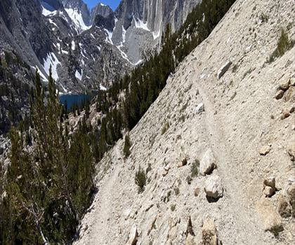
Mount Hopkins, California
Sierra Nevada
Vernal and Nevada Falls (The Mist) Trail
Sierra Nevada
Hiking near Victoria
93 trails to explore ~1375 km away
We work hard to provide the most up-to-date and error-free data possible. If something seems incorrect, let us know! Your contribution helps the whole community.
Hikers' opinions
Be the first to review!
No hiker has shared their experience yet. Share your impressions and help other hikers!