
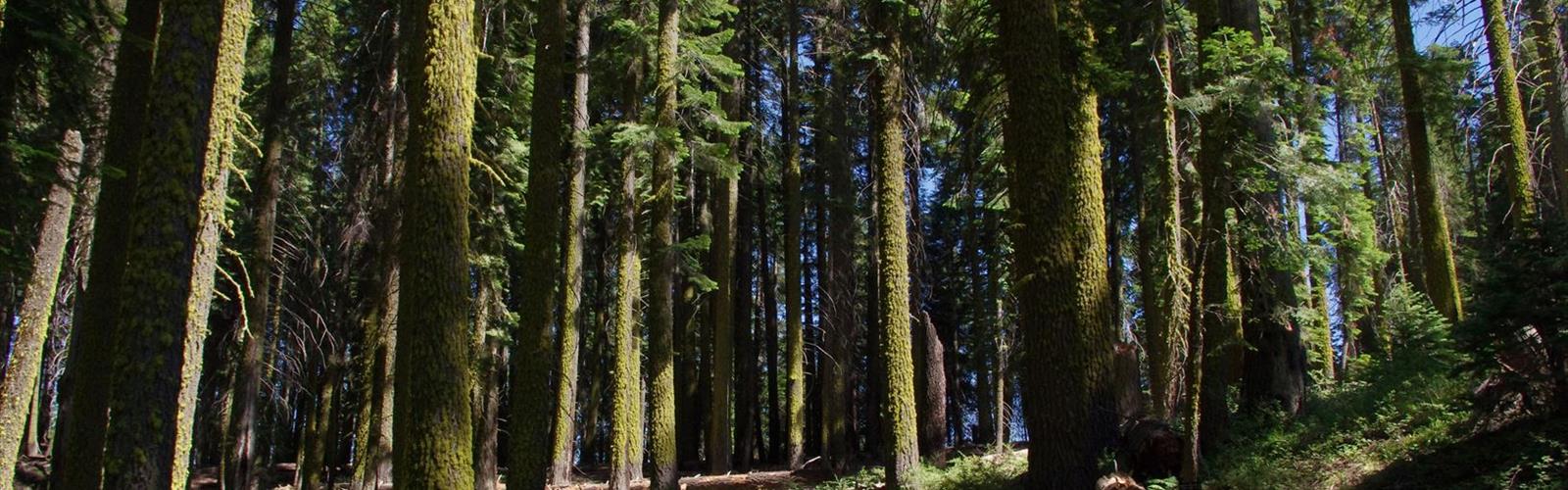

Ready to explore High Sierra Trail? Here's everything you need to know before you go!
Discover the trail
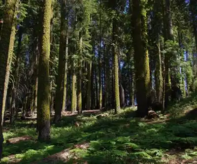
Photos: David Prasad from Welches, OR., United States — CC BY-SA 2.0 (Wikimedia Commons)
Trail description
The High Sierra Trail is one of the most celebrated long-distance routes in the American West. Cutting across the southern Sierra Nevada from Crescent Meadow in Sequoia National Park all the way to Mount Whitney, this trail delivers an experience that serious backpackers put on their bucket list and rarely forget. It's a route that earns its reputation — not through hype, but through sheer scale, solitude, and scenery.
What Kind of Trail Is This?
The High Sierra Trail is a point-to-point backcountry route. It's not a day hike. This is a multi-day backpacking trip that takes most hikers anywhere from six to twelve days to complete, depending on pace and side trips. The terrain is demanding — you're crossing high alpine passes, traversing exposed ridgelines, and navigating granite wilderness far from any road. That said, the trail itself is well-established and well-marked for a backcountry route of this length.
The western trailhead starts at Crescent Meadow, deep inside Sequoia National Park, where giant sequoias frame the beginning of the journey. From there, the trail heads east through a series of dramatic canyon systems, river crossings, and open granite basins before climbing toward the crest of the Sierra Nevada. The eastern terminus connects to the Mount Whitney Trail, finishing at Whitney Portal.
The Terrain Along the Way
What makes the High Sierra Trail stand out from other long routes in California is the variety of landscapes it moves through. You start in dense conifer forest surrounded by some of the largest trees on Earth. Within the first day or two, the trail drops into the canyon of the Middle Fork of the Kaweah River — a deep, rugged gorge that feels remote and wild. The river section involves significant elevation change as you descend and then climb back out.
As you push east, the forest thins and the granite takes over. The trail crosses through the Kern River drainage, one of the longest north-south river valleys in the Sierra, before the final push toward the Whitney massif. The upper sections of the route are classic high Sierra — open, rocky, windswept, and stunning. Exposure to weather increases significantly above treeline, and afternoon thunderstorms are a real consideration during summer months.
The trail passes through several iconic locations that hikers talk about long after the trip is done:
- Crescent Meadow — the lush, sequoia-ringed starting point on the western end
- Hamilton Lakes — a pair of high alpine lakes tucked beneath dramatic granite walls, often cited as one of the most beautiful campsites on the entire route
- Precipice Lake — a stark, high-elevation tarn sitting below the sheer face of Eagle Scout Peak
- Kern River Canyon — a long, deep valley that offers a different, more arid character than the rest of the route
- Guitar Lake — the classic high camp before the final summit push to Mount Whitney
Permits and Access
Getting on the High Sierra Trail requires advance planning. The route travels through Sequoia National Park and the John Muir Wilderness, both of which require wilderness permits for overnight travel. Permits are competitive and typically need to be reserved well in advance through the recreation.gov system. The Crescent Meadow trailhead quota fills up quickly, especially for summer departures.
There is an entrance fee to access Sequoia National Park. If you're finishing at Whitney Portal on the eastern end, you'll need to arrange a vehicle shuttle or coordinate transportation, since this is a point-to-point route with trailheads roughly 60 miles apart by road.
Bear canisters are required throughout the route. This isn't optional — rangers enforce it, and for good reason. The bear activity in Sequoia and the surrounding wilderness is significant, and proper food storage is essential for both your safety and the health of the wildlife.
Who This Trail Is For
The High Sierra Trail is best suited for experienced backpackers who are comfortable with multi-day wilderness travel, navigation, and self-sufficiency. The elevation gain is substantial, particularly on the final approach to Mount Whitney, and altitude sickness is a genuine concern for hikers coming from lower elevations. Spending a night or two acclimatizing before starting is a smart move.
That said, the trail doesn't require technical climbing skills. It's a hiking route, not a mountaineering objective — though the optional summit of Mount Whitney at the end adds a serious physical challenge for those who want it. The summit sits at 14,505 feet, making it the highest point in the contiguous United States.
Hikers who thrive on this route tend to be those who are comfortable being far from help, who enjoy the rhythm of long days on trail, and who can handle unpredictable mountain weather. It rewards patience and preparation more than raw fitness.
Practical Notes for Planning
- Water sources are generally reliable along the route, but all water should be filtered or treated.
- Resupply is not available along the trail — you carry everything you need, or arrange a resupply cache at specific points if doing a longer trip.
- Cell service is essentially nonexistent for the majority of the route. A satellite communicator is strongly recommended.
- Snow can linger on the higher passes well into summer. Checking current conditions before departure is important, especially for early-season trips.
- Leave No Trace principles are strictly expected throughout the route, including proper waste disposal in the backcountry.
Why Hikers Keep Coming Back
The High Sierra Trail has been drawing backpackers for generations, and the reason is straightforward: it delivers a genuine wilderness experience through some of the most spectacular mountain terrain in North America. The route is long enough to feel like a real journey, varied enough to stay interesting from start to finish, and challenging enough that finishing it means something. The combination of ancient sequoia forest, deep river canyons, high alpine lakes, and the final climb to the roof of the contiguous United States makes it a route unlike anything else in California's Gold Country region or beyond.
The Essential Hiking Checklist
Everything you need for your next hike. Bilingual, printable, 1 page.
Get your free hiking checklistRecommended gear for this trail
As an Amazon Associate I earn from qualifying purchases.


Ready to go?
Everything you need to know before you goWhen?
How much?
As an Amazon Associate I earn from qualifying purchases.
Affiliate links — LGPO may earn a commission at no extra cost to you.
- Hiking shoes Essential
- → Salomon Elixir Tour Mid WP · 203.38 $
- Layered clothing Essential
- Rain jacket Essential
- Trekking poles
- → Black Diamond Trail Ergo Cork · 69.99 $
- Headlamp
- → Petzl Actik Core 625 · 103.95 $
FAQ - Frequently asked questions
Everything you need to knowSimilar hikes nearby
Discover other trails you might enjoy

Coso Range Wilderness Trail
Sierra Nevada
Bloody Mountain, California
Sierra Nevada
Mount Lyell, California
Sierra Nevada
California Hot Springs
Sierra Nevada
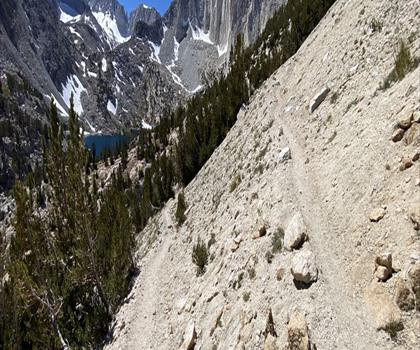
Mount Hopkins, California
Sierra Nevada
Vernal and Nevada Falls (The Mist) Trail
Sierra Nevada
Hiking near Victoria
93 trails to explore ~1384 km away
We work hard to provide the most up-to-date and error-free data possible. If something seems incorrect, let us know! Your contribution helps the whole community.
Hikers' opinions
Be the first to review!
No hiker has shared their experience yet. Share your impressions and help other hikers!