


Ready to explore otis trail? Here's everything you need to know before you go!
Discover the trail
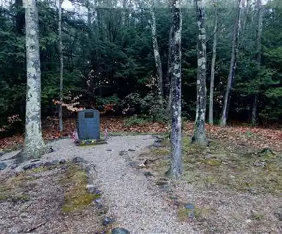
Trail description
The Otis Trail on Cape Cod, Massachusetts, is one of those quiet, unhurried walks that reminds you why people fall in love with the Cape beyond its beaches. Tucked away from the summer crowds and the salt-sprayed shoreline, this trail moves through the kind of interior Cape landscape that most visitors never bother to find — and that's exactly what makes it worth seeking out.
The Landscape
Cape Cod's inland terrain is often underestimated. People picture sand dunes and ocean views, but the Otis Trail takes you through a different side of the Cape entirely. The landscape here is shaped by glacial history — kettle ponds, sandy soils, pitch pine and scrub oak forest that stretches in every direction with a low, dense canopy. It's not dramatic in the way mountain trails are dramatic, but it has its own character: open sky filtering through gnarled pines, soft sandy footing underfoot, and a stillness that's hard to find elsewhere on the Cape during peak season.
The pitch pine and scrub oak barrens that dominate this part of Massachusetts are a globally rare ecosystem, and the Otis area sits within a broader landscape that supports this habitat. Walking through it, you get a real sense of the Cape's ecological identity — not the postcard version, but the actual living landscape that's been here long before the summer cottages.
What to Expect on the Trail
The Otis Trail is a relatively accessible route that suits a wide range of hikers. The terrain is flat to gently rolling, consistent with the glacially flattened topography of the mid-Cape region. The sandy soil makes for soft footing, though it can slow your pace slightly compared to packed dirt or gravel paths. There are no significant climbs or technical sections — this is a trail where you can actually look around and take things in rather than watching your feet the whole time.
The path moves through forested sections where the tree canopy closes in and the light goes golden and dappled, then opens into more exposed scrubby areas where you can see further and the wind picks up. That alternation between enclosed and open keeps the walk feeling varied even without dramatic elevation changes.
Wildlife is present throughout, though often subtle. The pitch pine barrens are known habitat for species adapted to this specific environment, and patient walkers are rewarded with bird activity, particularly during migration seasons. The quiet of the interior forest makes it easier to notice what's moving around you.
The Otis Connection
The trail's name ties it to the broader Otis area of Cape Cod, a part of the mid-Cape that carries both natural and historical significance. The region around Joint Base Cape Cod — formerly Otis Air National Guard Base — encompasses a large protected land area that has helped preserve significant stretches of the Cape's interior from development. This context matters when you're walking the trail: the open space you're moving through exists in part because of the military land buffer that kept development at bay for decades. It's an unusual conservation story, and it's left behind a landscape that feels genuinely wild by Cape Cod standards.
Practical Information
The Otis Trail is located in the Cape Cod region of Massachusetts. A few things worth knowing before you head out:
- Terrain: Flat to gently rolling, sandy underfoot — manageable for most fitness levels and suitable for older kids comfortable on natural surfaces.
- Footing: Sandy soil throughout; trail runners or light hiking shoes work well. No need for heavy boots.
- Navigation: Pay attention to trail markers, especially in areas where the scrub oak and pine forest looks similar in multiple directions. The flat terrain means you won't have elevation cues to orient yourself.
- Sun exposure: Sections of the trail pass through open scrubland with limited shade. Bring sun protection, especially in summer.
- Water: No water sources on trail. Bring everything you need.
- Dogs: Check current regulations for the specific access point you're using, as rules can vary depending on which land management area the trail passes through.
- Ticks: The scrub oak and low brush habitat is prime tick territory. Do a thorough check after your hike, particularly from spring through fall.
Best Times to Visit
Spring and fall are the strongest seasons for this trail. Spring brings wildflowers and active bird migration through the pitch pine barrens, while fall turns the scrub oak a warm russet and the crowds that define Cape Cod summers have largely cleared out. Summer works too — the interior forest provides more shade than you'd expect — but the Cape's peak season traffic can complicate parking and access depending on where you're starting from.
Winter hiking on the Otis Trail is genuinely underrated. The bare scrub oak opens up long sight lines through the forest, the sandy soil doesn't turn to mud the way clay-based trails do, and you'll almost certainly have the place to yourself. Dress for wind exposure in the open sections and you'll find it a surprisingly pleasant off-season option.
Who This Trail Is For
The Otis Trail is a good fit for hikers who want to get off the Cape's well-worn tourist path and spend time in a landscape that feels genuinely different from the shoreline experience. It's not a trail that's going to challenge experienced hikers looking for elevation or technical terrain — but that's not the point. The point is the pitch pine forest, the quiet, the ecological rarity of the barrens habitat, and the chance to see a side of Cape Cod that most people drive right past on their way to the beach.
Families with kids who are comfortable on natural surfaces will find it accessible, and anyone interested in the Cape's natural history will find the landscape itself worth the trip.
The Essential Hiking Checklist
Everything you need for your next hike. Bilingual, printable, 1 page.
Get your free hiking checklistRecommended gear for this trail
As an Amazon Associate I earn from qualifying purchases.


Ready to go?
Everything you need to know before you goWhen?
How much?
As an Amazon Associate I earn from qualifying purchases.
Affiliate links — LGPO may earn a commission at no extra cost to you.
- Hiking shoes Essential
- → Salomon Elixir Tour Mid WP · 203.38 $
- Layered clothing Essential
- Rain jacket Essential
- Trekking poles
- → Black Diamond Trail Ergo Cork · 69.99 $
- Headlamp
- → Petzl Actik Core 625 · 103.95 $
FAQ - Frequently asked questions
Everything you need to knowSimilar hikes nearby
Discover other trails you might enjoy
Fort Hill Trail
Cape Cod
Dune Shacks Trail
Cape Cod

Hatches Harbor Trail
Cape Cod

Great Island Trail
Cape Cod
Cape Cod Rail Trail
Cape Cod
Cape Cod National Seashore
Cape Cod
Hiking near Providence
0 trails to explore ~73 km away
We work hard to provide the most up-to-date and error-free data possible. If something seems incorrect, let us know! Your contribution helps the whole community.
Hikers' opinions
Be the first to review!
No hiker has shared their experience yet. Share your impressions and help other hikers!