

Ready to explore Virginia Peak, Nevada? Here's everything you need to know before you go!
Discover the trail
Trail description
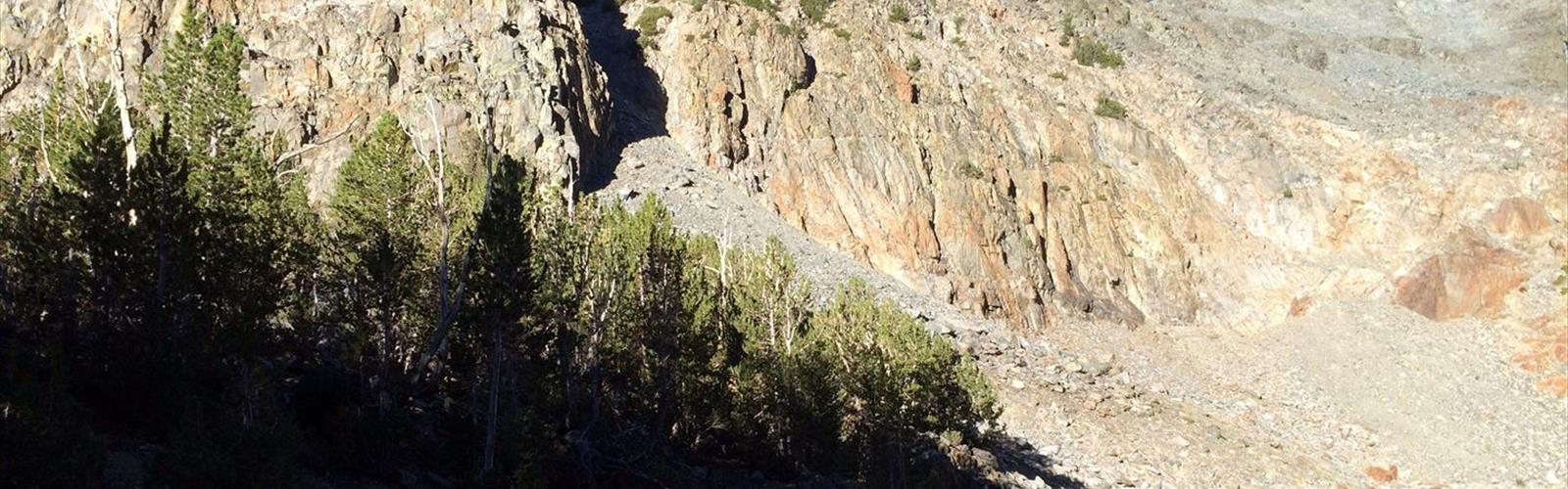
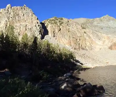
Virginia Peak is a rugged summit in the Virginia Range, located in the Reno-Tahoe area of Nevada. This is a climb that rewards those who are comfortable with off-trail travel and some scrambling — it's not a manicured trail experience, but rather the kind of objective that draws peak baggers and scramblers who want something a little more raw and honest than a groomed path to a viewpoint.
The Terrain
The Virginia Range is high desert country — open, exposed, and dramatic in its own understated way. The landscape here is defined by sagebrush flats, rocky ridgelines, and the kind of wide-open Nevada sky that makes you feel like you can see halfway across the Great Basin. Virginia Peak sits as one of the more prominent points in this range, and the approach reflects the character of the land: dry, direct, and unforgiving if you're underprepared.
Expect loose rock on the upper sections, steep grassy slopes in places, and terrain that requires you to pick your own line. There's no single worn path leading to the summit — route-finding is part of the experience here. If you're the type who prefers clear trail markers every hundred meters, this probably isn't your mountain. But if you enjoy reading the land and making decisions on the go, Virginia Peak delivers exactly that kind of engagement.
What to Expect on the Climb
The climbing on Virginia Peak is best described as a scramble rather than technical mountaineering. You'll use your hands on the steeper sections near the top, but you won't need ropes or specialized gear under normal conditions. That said, the exposure and loose footing demand solid footwear — trail runners can work for experienced scramblers, but sturdy hiking boots with ankle support are the smarter call for most people.
The approach involves navigating open terrain before the ridge steepens. Pay attention to your footing throughout — the combination of dry grass, scree, and crumbly volcanic rock means you need to stay deliberate with every step, especially on the descent. Coming down is where most people have trouble on objectives like this, so take your time.
The summit itself offers a genuine sense of accomplishment and a panoramic perspective over the Virginia Range and the broader Nevada landscape. On a clear day, the views stretch far across the basin and range topography that defines this part of the state.
Getting There
Virginia Peak is accessed from the Reno-Tahoe region of Nevada. The area is within reasonable driving distance of Reno, making it a viable day objective for locals and visitors based in the city. Road conditions on the approach can vary — a high-clearance vehicle is worth considering depending on the specific access route and recent weather. Check current conditions before heading out, particularly after rain or snow, as desert roads can become impassable quickly.
Practical Considerations
- Water: There is no reliable water source on this route. Carry everything you need from the trailhead. In Nevada's high desert, dehydration is a real and fast-moving risk, especially in warmer months.
- Sun exposure: The Virginia Range offers almost no shade. A hat, sunscreen, and sun-protective clothing are not optional — they're essential.
- Navigation: Bring a downloaded map or GPS track. Cell service in this area is unreliable, and the lack of formal trail markings means you need to be confident in your navigation before you start.
- Weather: Nevada weather can shift quickly. Afternoon thunderstorms are a real concern in summer, and being on an exposed ridgeline or summit when lightning rolls in is dangerous. Start early and be willing to turn around.
- Footwear: Sturdy boots with good grip are strongly recommended given the loose and rocky terrain on the upper mountain.
- Leave No Trace: This is open desert terrain — pack out everything you bring in, and stay on rock or established paths where possible to minimize impact on the fragile high desert ecosystem.
Who This Is For
Virginia Peak is best suited for hikers and scramblers who already have experience with off-trail travel and aren't rattled by a bit of exposure. It's not a beginner objective — not because it requires technical skills, but because the combination of route-finding, loose terrain, desert conditions, and physical demand adds up quickly for those without a solid base of experience.
For experienced hikers looking to tick off Nevada peaks or explore the Virginia Range beyond the more popular destinations near Reno, this is a satisfying and legitimate summit with real character. It's the kind of place that feels earned when you get to the top.
The Virginia Range Context
The Virginia Range has historical significance in Nevada — this is the same range that gave rise to the Comstock Lode mining boom in the 19th century, and the landscape still carries traces of that era. Virginia City sits in this range, and the surrounding hills were heavily worked during the silver and gold rush years. Hiking and climbing here puts you in terrain that has a deep human history layered beneath its wild surface, which adds a dimension to the experience that goes beyond the physical challenge of the climb itself.
The range also supports typical Great Basin wildlife — mule deer, coyotes, various raptors, and the ever-present ravens that seem to follow scramblers across Nevada's high country. The sagebrush ecosystem, while it might look sparse to the uninitiated, is a functioning and ecologically important landscape worth treating with respect.
Seasonal Notes
Spring and fall are generally the most comfortable seasons for climbing in the Virginia Range — temperatures are moderate, and the desert shows its best colors. Summer is doable but demands an early start to beat the heat and avoid afternoon storms. Winter conditions can bring snow and ice to the upper terrain, which changes the character of the climb significantly and requires appropriate gear and experience.
The Essential Hiking Checklist
Everything you need for your next hike. Bilingual, printable, 1 page.
Get your free hiking checklistRecommended gear for this trail
As an Amazon Associate I earn from qualifying purchases.


Ready to go?
Everything you need to know before you goWhen?
How much?
As an Amazon Associate I earn from qualifying purchases.
Affiliate links — LGPO may earn a commission at no extra cost to you.
- Hiking shoes Essential
- → Salomon Elixir Tour Mid WP · 203.38 $
- Layered clothing Essential
- Rain jacket Essential
- Trekking poles
- → Black Diamond Trail Ergo Cork · 69.99 $
- Headlamp
- → Petzl Actik Core 625 · 103.95 $
FAQ - Frequently asked questions
Everything you need to knowSimilar hikes nearby
Discover other trails you might enjoy

Hiking near Victoria
93 trails to explore ~1013 km away
We work hard to provide the most up-to-date and error-free data possible. If something seems incorrect, let us know! Your contribution helps the whole community.
Hikers' opinions
Be the first to review!
No hiker has shared their experience yet. Share your impressions and help other hikers!