

Ready to explore Mount Rose, Nevada? Here's everything you need to know before you go!
Discover the trail
Trail description
Mount Rose is one of the most rewarding summit hikes in the Reno-Tahoe region. Standing as one of the highest peaks in the area, it draws hikers who want a genuine alpine experience without having to travel far from the city. The trail to the top is a classic Nevada high-country route — exposed ridgelines, sweeping basin views, and the kind of elevation gain that earns the summit.
The Terrain
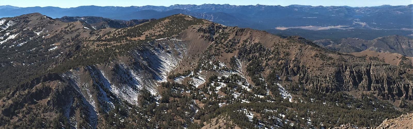
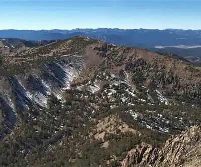
The climb to Mount Rose moves through several distinct zones as you gain elevation. Lower sections of the trail pass through open meadows and scattered conifers, where the landscape still feels approachable. As you push higher, the trees thin out and the terrain opens up dramatically. The upper mountain is exposed and rocky, with loose scree in places that demands attention underfoot. Wind is a constant factor near the summit — even on calm days in the valley, conditions up top can shift quickly.
The trail itself is well-defined for most of the route, but the final push to the summit involves some route-finding on rocky ground. Trekking poles are genuinely useful here, especially on the descent when tired legs meet loose rock.
What You'll See
The views from the summit of Mount Rose are the main event. On a clear day, you get a full panorama that takes in Lake Tahoe to the southwest, the Reno valley to the east, and a sprawling network of Nevada and California peaks in every direction. It's the kind of 360-degree payoff that makes the effort feel completely worth it.
The alpine wildflowers along the trail during the warmer months add color to the rocky landscape. Marmots are common in the boulder fields near the upper mountain, and you'll often hear them before you see them. Raptors ride the thermals above the ridgeline regularly.
Who This Hike Is For
Mount Rose is not a beginner hike. The elevation gain is significant, and the altitude itself adds a layer of challenge — hikers coming from lower elevations should plan for the effects of thinner air. That said, it's a very achievable objective for anyone with a solid base of hiking fitness and some experience on mountain terrain. You don't need technical climbing skills or specialized gear, but you do need to be honest about your conditioning before you head out.
Experienced hikers will find the route straightforward and can move efficiently. For those newer to alpine hiking, building up with some lower-elevation trails in the region first is a smart move before committing to this one.
Practical Considerations
The Mount Rose trailhead sits at high elevation, which means the hiking season is compressed compared to lower trails in the region. Snow can linger well into late spring and return early in the fall. Checking current conditions before you go is essential — what looks like a clear trail on a map can be a very different story after a late-season storm.
Start early. Afternoon thunderstorms are a real hazard on exposed alpine terrain, and the summit of Mount Rose leaves you with nowhere to shelter if weather moves in fast. Getting to the top and back down before early afternoon is the standard approach for a reason.
- Start early to avoid afternoon thunderstorms on the exposed upper mountain
- Bring layers — summit temperatures can be significantly colder than the trailhead
- Carry plenty of water — the upper mountain is dry and the exertion is real
- Watch the weather — conditions change fast at elevation
- Trekking poles are helpful on the rocky descent
- Check snow conditions before heading out in spring or early fall
Getting There
The Mount Rose trailhead is accessible from the Mount Rose Highway (Nevada State Route 431), which connects the Reno area to the north shore of Lake Tahoe. The trailhead has a parking area, and it fills up on weekends during peak season — arriving early solves this problem and also gets you on the trail before the heat and afternoon weather build.
Why Mount Rose Stands Out
What makes Mount Rose a standout in the Reno-Tahoe area is the combination of accessibility and genuine alpine character. You're not driving hours to reach a remote trailhead — the mountain is right there, visible from the city, reachable on a day off. But once you're on the upper mountain, it feels like real high-country terrain. The exposure, the views, the physical demand — it all adds up to an experience that punches well above its logistical weight.
For locals, it's a benchmark hike — the kind of route people come back to year after year to measure their fitness, share with visiting friends, or simply reconnect with what makes this corner of Nevada worth living in.
The Essential Hiking Checklist
Everything you need for your next hike. Bilingual, printable, 1 page.
Get your free hiking checklistRecommended gear for this trail
As an Amazon Associate I earn from qualifying purchases.


Ready to go?
Everything you need to know before you goWhen?
How much?
As an Amazon Associate I earn from qualifying purchases.
Affiliate links — LGPO may earn a commission at no extra cost to you.
- Hiking shoes Essential
- → Salomon Elixir Tour Mid WP · 203.38 $
- Layered clothing Essential
- Rain jacket Essential
- Trekking poles
- → Black Diamond Trail Ergo Cork · 69.99 $
- Headlamp
- → Petzl Actik Core 625 · 103.95 $
FAQ - Frequently asked questions
Everything you need to knowSimilar hikes nearby
Discover other trails you might enjoy

Hiking near Victoria
93 trails to explore ~1046 km away
We work hard to provide the most up-to-date and error-free data possible. If something seems incorrect, let us know! Your contribution helps the whole community.
Hikers' opinions
Be the first to review!
No hiker has shared their experience yet. Share your impressions and help other hikers!