

Ready to explore Slide Mountain, Nevada? Here's everything you need to know before you go!
Discover the trail
Trail description
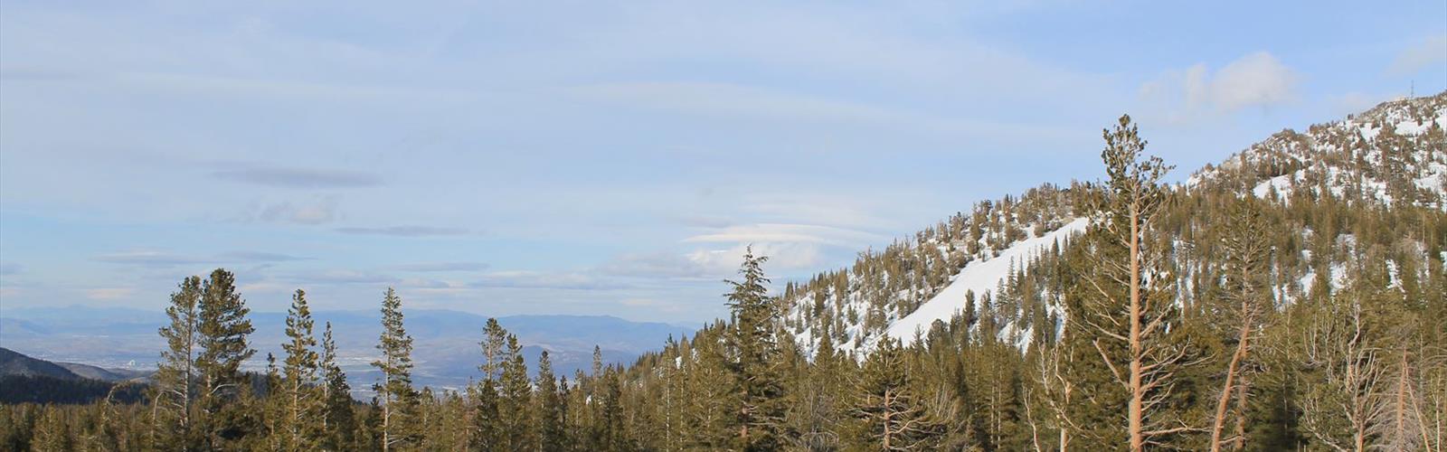
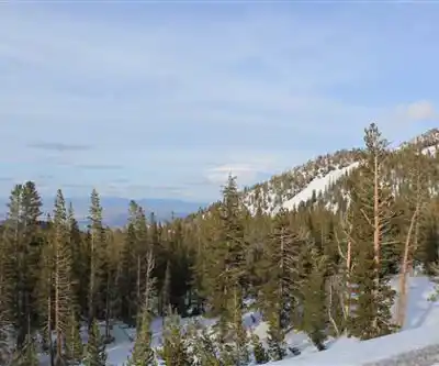
Slide Mountain in Nevada's Reno-Tahoe region is one of the more rewarding summit objectives in the greater Reno area. Rising above the Mount Rose Highway corridor on the eastern flank of the Sierra Nevada, it offers a genuine alpine climbing experience without requiring you to drive hours into California. For hikers and scramblers based in Reno or visiting the Tahoe basin, this is a solid day objective that delivers real elevation, open ridgelines, and sweeping views across the Great Basin and toward Lake Tahoe.
The Mountain
Slide Mountain sits in Washoe County, Nevada, and is the highest point in the immediate Reno-area mountains. The name itself comes from a massive debris avalanche that reshaped the mountain's western face — the scar is still visible and gives the peak its distinctive profile when viewed from the valley. The terrain is a mix of open talus, rocky slopes, and exposed ridgeline, making this more of a scramble than a standard trail hike on the upper sections. That said, the approach is well-established and the route is manageable for hikers comfortable with off-trail movement and some hands-on scrambling near the top.
The mountain is located adjacent to Slide Mountain Ski Area (now operating as a smaller winter recreation area), and the trailhead access is tied to the Mount Rose area, one of the most accessible alpine zones from downtown Reno. You're looking at roughly a 45-minute drive from the city, which makes this a realistic before-work or after-work objective in the longer days of summer.
The Route and Terrain
The climbing route on Slide Mountain follows a general line up the mountain's slopes, gaining elevation steadily through open terrain. The lower sections move through subalpine meadows and scattered conifers before the vegetation thins out and the route transitions to talus and loose rock. The upper mountain is exposed, and route-finding requires some attention — there's no single marked trail to the summit, so hikers should be comfortable navigating by terrain features.
The summit scramble involves moving over blocky rock and requires the use of hands in places. It's not technical climbing — no ropes or gear needed — but it's a step above a standard hiking trail. Solid footwear with ankle support and good grip is important here. The rock can be loose in sections, so watch your footing and be mindful of anyone below you on the slope.
Views from the summit are the payoff. On a clear day you can see across the Reno valley, out into the Nevada desert, and west toward the Lake Tahoe basin. The contrast between the Sierra Nevada's granite and the high desert stretching east is one of the more striking panoramas you'll get from any peak in this region.
What to Know Before You Go
- Trailhead access: The area is reached via the Mount Rose Highway (Nevada State Route 431). Check current road and trailhead conditions before heading out, especially in shoulder seasons.
- Season: The best window is typically late spring through early fall, once snow has cleared the upper slopes. Snow can linger well into June at elevation, and early-season conditions can make the upper scramble significantly more committing.
- Weather: Afternoon thunderstorms are a real concern in summer. Start early and plan to be off the exposed upper mountain before midday. The summit offers no shelter.
- Footwear: Hiking boots with good ankle support and traction are strongly recommended. Trail runners can work for experienced scramblers, but the talus and loose rock reward a stiffer sole.
- Water: Carry all the water you need. Sources on the route are unreliable, particularly later in the season.
- Navigation: The upper route is not formally marked. A map, GPS, or solid familiarity with the terrain is useful, particularly in low visibility or if you're new to the area.
Who This Is For
Slide Mountain is a good fit for hikers who are ready to move beyond maintained trails and want a taste of real mountain terrain without committing to a technical climb. If you've done the standard trails around Mount Rose and want something with more bite — more elevation gain, more exposure, more route-finding — this is a natural next step. It's also a legitimate objective for scramblers and peak-baggers working through the Nevada and Sierra Nevada high points.
Less experienced hikers or those uncomfortable with loose rock and off-trail movement should build up on more established routes in the area before tackling the upper mountain on Slide Mountain.
Getting There
From Reno, take Mount Rose Highway (NV-431) toward the Mount Rose Summit. The approach to Slide Mountain is accessed from this corridor. Parking in the area can fill up on weekends during peak season, so an early start is worthwhile both for the weather and for securing a spot.
Slide Mountain is the kind of objective that rewards preparation — get an early start, check the forecast, bring layers, and you'll have one of the better summit days the Reno-Tahoe region has to offer.
The Essential Hiking Checklist
Everything you need for your next hike. Bilingual, printable, 1 page.
Get your free hiking checklistRecommended gear for this trail
As an Amazon Associate I earn from qualifying purchases.


Ready to go?
Everything you need to know before you goWhen?
How much?
As an Amazon Associate I earn from qualifying purchases.
Affiliate links — LGPO may earn a commission at no extra cost to you.
- Hiking shoes Essential
- → Salomon Elixir Tour Mid WP · 203.38 $
- Layered clothing Essential
- Rain jacket Essential
- Trekking poles
- → Black Diamond Trail Ergo Cork · 69.99 $
- Headlamp
- → Petzl Actik Core 625 · 103.95 $
FAQ - Frequently asked questions
Everything you need to knowSimilar hikes nearby
Discover other trails you might enjoy

Hiking near Victoria
93 trails to explore ~1050 km away
We work hard to provide the most up-to-date and error-free data possible. If something seems incorrect, let us know! Your contribution helps the whole community.
Hikers' opinions
Be the first to review!
No hiker has shared their experience yet. Share your impressions and help other hikers!