


Ready to explore Tar River? Here's everything you need to know before you go!
Discover the trail
Oh no! We don't have any photos 😢
This trail hasn't been captured yet. Be the first to share your adventure!Trail description
The Tar River corridor in North Carolina's coastal region offers a quieter, more understated outdoor experience than the state's more famous trails — and that's exactly what makes it worth seeking out. This is a place where the pace slows down, the landscape opens up along the water, and you get a genuine feel for the flatlands and riparian ecosystems that define eastern North Carolina.
The River and Its Surroundings
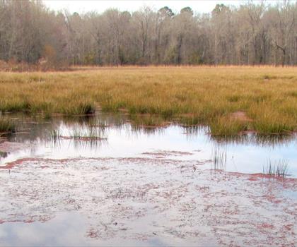
The Tar River is one of the longest rivers entirely within North Carolina, and its lower stretches — as it winds toward the Pamlico Sound — pass through a landscape shaped by water. Expect wide, slow-moving water flanked by bottomland hardwood forests, wetland edges, and stretches of floodplain that support a dense mix of wildlife. The terrain here is flat, which is typical of the coastal plain, and the trails and access points along the river reflect that — this isn't a place you come to for elevation gain or ridge views. You come for the water, the birds, and the stillness.
The vegetation along the Tar River corridor is characteristic of eastern North Carolina's coastal plain: tupelo, bald cypress, river birch, and various oaks dominate the bottomland areas, while open water edges attract a wide range of waterfowl and wading birds. The transition between upland and wetland habitat happens gradually here, and that gradient is part of what makes the area ecologically interesting.
What to Expect on the Trail
Hiking along the Tar River is a low-key, nature-focused experience. The terrain is flat and the pace is relaxed, making it accessible to a wide range of hikers — families, beginners, and anyone looking for a calm outing rather than a physical challenge. The paths tend to follow the river closely, giving you consistent views of the water and the vegetation along its banks.
Because this is a coastal plain environment, conditions underfoot can vary depending on recent rainfall. Some sections may be soft or muddy after wet weather, so waterproof footwear is a practical choice, especially in spring or after heavy rain. The flat terrain means there's no real scrambling or technical footing involved — just steady walking through a quiet, green landscape.
Wildlife and Nature
The Tar River corridor is genuinely good birding territory. The mix of open water, wooded banks, and wetland edges creates habitat for a solid variety of species throughout the year. Great blue herons are a common sight along the water, and wood ducks, kingfishers, and various warblers are regularly spotted depending on the season. The river itself supports fish populations that in turn attract osprey and other raptors.
Beyond birds, the area is home to the kind of wildlife you'd expect in a healthy riparian corridor — river otters, turtles basking on logs, and a range of amphibians that thrive in the wet, sheltered environment along the banks. If you move quietly and take your time, you're likely to see more than you would on a busier, more trafficked trail.
The Broader Landscape Context
Understanding the Tar River means understanding the coastal plain it flows through. This part of North Carolina sits well inland from the Outer Banks but is still very much shaped by its proximity to the coast — the land is low, the water table is high, and the ecosystems are defined by that relationship between land and water. The Tar River eventually becomes the Pamlico River as it widens toward the sound, and the whole system is ecologically connected to the broader Albemarle-Pamlico watershed, one of the largest estuarine systems on the East Coast.
That context matters when you're out on the trail. You're not just walking along a river — you're moving through a landscape that's part of a much larger ecological network, one that supports migratory birds, anadromous fish, and a range of species that depend on the connection between freshwater and coastal environments.
Practical Information
- Terrain: Flat, typical of the North Carolina coastal plain. No significant elevation change.
- Footing: Can be soft or muddy in wet conditions — waterproof footwear recommended.
- Best for: Nature walks, birding, quiet riverside hiking, family outings.
- Accessibility: The flat terrain makes this suitable for hikers of most fitness levels.
- Wildlife viewing: Best in early morning or late afternoon when activity along the water is highest.
- Insects: Mosquitoes and biting insects can be significant in warmer months given the wetland environment — bring repellent.
Getting the Most Out of Your Visit
The Tar River rewards patience. This isn't a trail where you push hard and rack up miles — it's a place where slowing down pays off. Bring binoculars if you have them, move quietly along the water's edge, and give yourself time to actually watch the river rather than just walk past it. The wildlife here is present and active; you just have to give it a chance to show itself.
Early morning visits are particularly worthwhile. The light on the water is better, the birds are more active, and the corridor tends to be quieter before the day heats up. In summer, the combination of humidity and insects makes midday visits less comfortable, so planning your timing around the cooler parts of the day makes a real difference in how much you enjoy the experience.
The Tar River corridor is the kind of place that doesn't announce itself loudly — it's not dramatic, it's not famous, and it doesn't need to be. What it offers is a genuine, unhurried connection to one of eastern North Carolina's most important natural systems, and that's worth the trip on its own terms.
The Essential Hiking Checklist
Everything you need for your next hike. Bilingual, printable, 1 page.
Get your free hiking checklistRecommended gear for this trail
As an Amazon Associate I earn from qualifying purchases.


Ready to go?
Everything you need to know before you goWhen?
How much?
As an Amazon Associate I earn from qualifying purchases.
Affiliate links — LGPO may earn a commission at no extra cost to you.
- Hiking shoes Essential
- → Salomon Elixir Tour Mid WP · 203.38 $
- Layered clothing Essential
- Rain jacket Essential
- Trekking poles
- → Black Diamond Trail Ergo Cork · 69.99 $
- Headlamp
- → Petzl Actik Core 625 · 103.95 $
FAQ - Frequently asked questions
Everything you need to knowSimilar hikes nearby
Discover other trails you might enjoy

Hiking near Philadelphia
0 trails to explore ~513 km away
We work hard to provide the most up-to-date and error-free data possible. If something seems incorrect, let us know! Your contribution helps the whole community.
Hikers' opinions
Be the first to review!
No hiker has shared their experience yet. Share your impressions and help other hikers!