

Ready to explore Plott Balsam Mountain, North Carolina? Here's everything you need to know before you go!
Discover the trail
Oh no! We don't have any photos 😢
This trail hasn't been captured yet. Be the first to share your adventure!Trail description
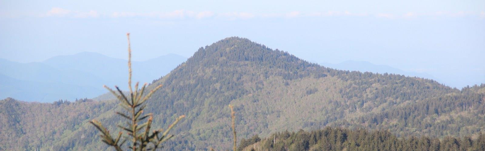
Plott Balsam Mountain rises as one of the most striking and underappreciated high-elevation destinations in western North Carolina. Tucked within the southern Appalachians, this mountain offers a genuine backcountry feel without the crowds that tend to pile up at more well-known peaks in the region. If you're looking for a place where the forest feels old, the air feels different, and the views actually reward the effort, Plott Balsam delivers.
The Terrain
The Plott Balsam range is part of the larger Balsam Mountains, a subrange of the Blue Ridge that runs through Jackson and Haywood counties in North Carolina. The terrain here is classic southern Appalachian high country — steep ridgelines, dense spruce-fir forest near the upper elevations, and a rugged character that reminds you these mountains are serious even if they don't get the same press as the Smokies next door.
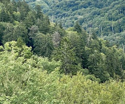
As you gain elevation, the forest transitions noticeably. Lower slopes are dominated by hardwoods — oaks, maples, yellow birch — before giving way to the dense, mossy spruce-fir ecosystem that defines the highest reaches of the Balsams. That upper zone has a distinctly northern feel, almost boreal, with thick lichen-covered trunks and a quiet that's hard to find elsewhere in the Southeast.
The ridgeline itself is narrow and exposed in places, which means wind can be a real factor, especially in shoulder seasons. The footing can get rocky and rooty as you push higher, so solid footwear matters here.
What Makes This Place Stand Out
The Plott Balsam range sits right along the Eastern Continental Divide, which means water falling on one side eventually drains toward the Atlantic, while water on the other side heads toward the Gulf of Mexico. It's one of those geographic details that adds a layer of meaning to an already compelling landscape.
The spruce-fir forest at the summit zone is also ecologically significant. These high-elevation forests are considered globally rare and are home to species found almost nowhere else at this latitude. The red spruce and Fraser fir that dominate the upper canopy are the same species you'd find much farther north — they survived here as climate refugia after the last ice age. That context makes the hike feel like more than just a workout.
Wildlife is present throughout the range. Black bears are common in this part of North Carolina, and the dense forest provides excellent habitat. You're also likely to encounter a variety of songbirds, particularly during migration, and the high-elevation forest supports species like the red-breasted nuthatch and dark-eyed junco that aren't typical at lower elevations.
The Experience on the Trail
Hiking on Plott Balsam Mountain tends to be a quieter experience than what you'd find in Great Smoky Mountains National Park, which sits just to the west. That relative solitude is one of the main draws. You're not fighting for parking or navigating around tour groups — you're just out in the mountains.
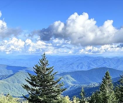
The climb is genuine. The Balsams don't ease you in gently; the elevation gain is real and the trail demands attention. But that's part of what makes reaching the upper ridgeline satisfying. The views from exposed sections of the ridge open up across the surrounding mountains, with layers of blue ridgelines stretching in multiple directions on a clear day.
The forest floor throughout the hike is lush and varied. Ferns, wildflowers, and mosses carpet the ground, and small streams cross the trail in places, adding to the sensory experience. In spring, the wildflower display in the lower hardwood sections can be impressive. In fall, the color change moves down from the summit, and the high-elevation trees often turn earlier than what you'd see in the valleys below.
Practical Information
Access to Plott Balsam Mountain is primarily via the Blue Ridge Parkway, which runs along the crest of the Balsam range in this area. The Parkway provides some of the most direct access to high-elevation trailheads in western North Carolina, and the Plott Balsam area is no exception. Parking is available at pullouts and designated areas along the Parkway.
- Location: Western North Carolina, within the Balsam Mountains subrange of the Blue Ridge
- Access road: Blue Ridge Parkway
- Elevation zone: High-elevation spruce-fir forest near the summit
- Wildlife: Black bears, migratory songbirds, high-elevation bird species
- Forest type: Hardwood at lower elevations transitioning to spruce-fir near the top
Cell service is limited or nonexistent in much of this area, which is standard for the high Appalachians. Download your maps offline before you go and let someone know your plan. Weather can change quickly at elevation, and afternoon thunderstorms are a real possibility in summer — an early start is always a smart move in these mountains.
Who This Hike Is For
Plott Balsam Mountain is best suited for hikers who are comfortable with sustained elevation gain and uneven terrain. It's not a casual stroll, but it's also not technical — no scrambling or route-finding required. Hikers who appreciate ecological diversity, old-growth character, and a quieter backcountry atmosphere will find this mountain particularly rewarding.
If you've already done the popular peaks in the Smokies and want to explore what the surrounding ranges have to offer, the Plott Balsams are a natural next step. The landscape is just as compelling, the forest is just as rich, and the experience feels more personal.
Nearby Context
The town of Waynesville sits to the north of the Plott Balsam range and serves as a practical base for exploring this part of western North Carolina. It's a small mountain town with enough services — food, lodging, gear — to support a multi-day visit to the area. The Blue Ridge Parkway connects the Plott Balsam area to a broader network of high-elevation destinations throughout the southern Appalachians, making it easy to combine this hike with others in the region.
The Plott Balsam range also carries local historical significance — the range is named after the Plott family, early European settlers in the area who developed the Plott Hound, North Carolina's official state dog, originally bred for hunting bear in these very mountains.
The Essential Hiking Checklist
Everything you need for your next hike. Bilingual, printable, 1 page.
Get your free hiking checklistRecommended gear for this trail
As an Amazon Associate I earn from qualifying purchases.


Ready to go?
Everything you need to know before you goWhen?
How much?
As an Amazon Associate I earn from qualifying purchases.
Affiliate links — LGPO may earn a commission at no extra cost to you.
- Hiking shoes Essential
- → Salomon Elixir Tour Mid WP · 203.38 $
- Layered clothing Essential
- Rain jacket Essential
- Trekking poles
- → Black Diamond Trail Ergo Cork · 69.99 $
- Headlamp
- → Petzl Actik Core 625 · 103.95 $
FAQ - Frequently asked questions
Everything you need to knowSimilar hikes nearby
Discover other trails you might enjoy

Hiking near Pittsburgh
0 trails to explore ~614 km away
We work hard to provide the most up-to-date and error-free data possible. If something seems incorrect, let us know! Your contribution helps the whole community.
Hikers' opinions
Be the first to review!
No hiker has shared their experience yet. Share your impressions and help other hikers!