


Ready to explore Tennessee Divide? Here's everything you need to know before you go!
Discover the trail
Oh no! We don't have any photos 😢
This trail hasn't been captured yet. Be the first to share your adventure!Trail description
The Tennessee Valley Divide is the boundary of the drainage basin of the Tennessee River and its tributaries.
The Tennessee River drainage basin begins with its tributaries in southwestern Virginia and flows generally west to the confluence of the Tennessee with the Ohio River at Paducah, Kentucky. The Tennessee Valley Divide forms a loop surrounding the drainage basin, beginning and ending at the river's mouth in Paducah. Following the Divide in a clockwise direction, it leads east and southeast through western Kentucky through the Land Between the Lakes, a narrow area between the Tennessee and Kentucky rivers, then passes into Tennessee, where it continues southeast, passing south of the Nashville Basin on top of Duck River Ridge. Turning more to the east, the Divide climbs onto the low plateau of The Barrens, and then onto the higher Cumberland Plateau. The Divide turns northeast along the crest of the Cumberland Plateau, then follows the ridgecrest of Cumberland Mountain northeast to Cumberland Gap, at the junction of Tennessee, Kentucky, and Virginia. The Divide continues northeast along the Kentucky-Virginia border, first following Cumberland Mountain, then Little Black and Black Mountain, after which it turns east into Virginia. The Divide follows the crest of Sandy Ridge northeast until it briefly touches the West Virginia border, then turn southeast near Tazewell, Virginia. From there, the divide follows an irregular line towards the south. In this area of southwestern Virginia, the divide forms the boundary between the drainage of the Tennessee River and the New River, which also flows to the Ohio River.
Near Blowing Rock, North Carolina, the divide meets the Eastern Continental Divide in the Blue Ridge Mountains. This point forms a triple point between the streams draining west to the Tennessee, north to the New River, and east to the coastal rivers of North Carolina.
From Blowing Rock, the Tennessee Valley Divide coincides with the Eastern Continental Divide, to another triple point in northern Georgia, from which point streams flow northwards towards the Tennessee River, eastwards to the Atlantic coast of Georgia, and southwards towards the Gulf of Mexico.
From there, the Tennessee Valley Divide trends generally westward, dividing the Tennessee Valley in Alabama from the generally southward-flowing rivers of Alabama and Mississippi. Some of those rivers, such as the Tombigbee River, have their headwaters remarkably close to the Tennessee River. The divide then turns north and ends at the foot of Broadway in downtown Paducah, Kentucky, which also marks Mile 0 of the Tennessee River at its confluence with the Ohio.
The divide passes through or touches the states of West Virginia, Virginia, North Carolina, South Carolina, Georgia, Alabama, Mississippi, Tennessee and Kentucky.
Free
1 pages
The Essential Hiking Checklist
Everything you need for your next hike. Bilingual, printable, 1 page.
Get your free hiking checklistRecommended gear for this trail
As an Amazon Associate I earn from qualifying purchases.
LGPO Pick

Salomon
Elixir Tour Mid WP
Waterproof mid-height boot ideal for rocky terrain
203.38 $


Affiliate links — LGPO may earn a commission at no extra cost to you.
Ready to go?
Everything you need to know before you goWhen?
Opening hours
No information
Varies by season
Best season
Fall
Spectacular colors
Best time
Early morning
Less crowded
Weather (next days)
Loading
How much?
Entry fees
Adult
Not available
Child
—
What to bring?
As an Amazon Associate I earn from qualifying purchases.
Affiliate links — LGPO may earn a commission at no extra cost to you.
Gear
- Hiking shoes Essential
- → Salomon Elixir Tour Mid WP · 203.38 $
- Layered clothing Essential
- Rain jacket Essential
- Trekking poles
- → Black Diamond Trail Ergo Cork · 69.99 $
- Headlamp
- → Petzl Actik Core 625 · 103.95 $
Water & food
2L minimum
No water point on the trail
Bring energy snacks for a 4h+ hike
Good to know
Safety
Download the GPX before you go
Limited cellular coverage on the trail
Slippery after rain
Be careful on rocky sections
In an emergency
Emergency
911
Parking GPS
34.6983, 34.6983
Center
Not available
FAQ - Frequently asked questions
Everything you need to knowTennessee Divide is rated hard.
The elevation gain of Tennessee Divide is 610 m.
The summit of Tennessee Divide is at 2,469 m.
Allow about 3h00 for Tennessee Divide (6.4 km).
No, Tennessee Divide has no visitor centre on site.
Didn't find your answer?
Similar hikes nearby
Discover other trails you might enjoy

Hinch Mountain, Tennessee
East Tennessee
929 M
Beginner
Alexander Knob, Tennessee
East Tennessee
13.5 KM
5h30
1060 M
Advanced
Mount Chapman, North Carolina_Tennessee
East Tennessee
1.4 KM
30 min
42 M
Beginner
Cosby Knob, North Carolina_Tennessee
East Tennessee
10 KM
1h50
18 M
Beginner
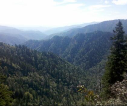
Tricorner Knob, Tennessee_North Carolina
East Tennessee
1865 M
Beginner
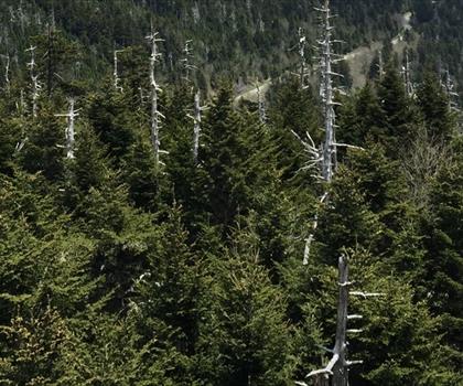
Mount Collins, North Carolina_Tennessee
East Tennessee
1886 M
Beginner
Top 10 best hiking in East Tennessee
Our ranking based on hiker reviews
Hiking near Sydney
22 trails to explore ~7666 km away
Did you spot an error?
We work hard to provide the most up-to-date and error-free data possible. If something seems incorrect, let us know! Your contribution helps the whole community.
Hikers' opinions
Be the first to review!
No hiker has shared their experience yet. Share your impressions and help other hikers!