
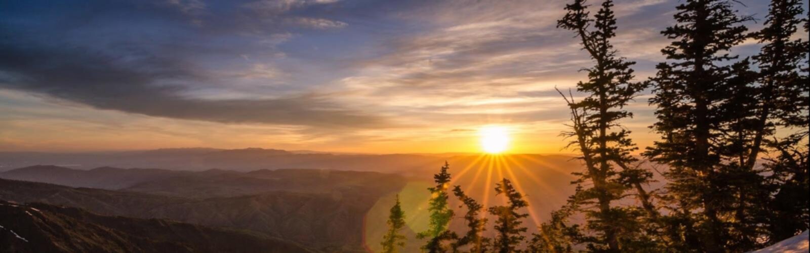

Ready to explore Ben Lomond, Utah? Here's everything you need to know before you go!
Discover the trail


Trail description
Ben Lomond stands as one of northern Utah's most prominent and challenging peaks, rising dramatically above the Wasatch Range to offer some of the most rewarding mountain experiences in the region. This imposing summit attracts serious hikers and mountaineers who come for its steep terrain, expansive views, and the genuine sense of accomplishment that comes with reaching its lofty heights.
The Mountain Experience
Ben Lomond presents a formidable challenge that demands respect and preparation. The mountain's steep slopes and significant elevation gain make this a serious undertaking that typically requires a full day commitment. The trail winds through diverse terrain, starting in lower elevation foothills and climbing steadily through changing ecosystems as you gain altitude.
The ascent takes you through varied landscapes, from scrub oak and mountain mahogany in the lower sections to aspen groves and eventually into higher alpine environments. Each elevation zone brings its own character and challenges, with the terrain becoming increasingly rugged as you approach the summit.
Summit Views and Rewards
The panoramic views from Ben Lomond's summit are truly spectacular, offering sweeping vistas across northern Utah's diverse landscape. From the top, you can see across the Great Salt Lake, with its distinctive shoreline and islands creating a unique backdrop that's unlike anywhere else in the mountain west. The Wasatch Range stretches out in both directions, revealing the dramatic topography that defines this region.
On clear days, the visibility extends for miles in every direction, encompassing urban areas, agricultural valleys, and endless mountain ridges. The contrast between the developed valleys below and the wild mountain terrain creates a striking visual reminder of Utah's diverse geography.
Trail Conditions and Terrain
The route to Ben Lomond's summit involves sustained climbing over varied terrain that can be quite demanding. Rocky sections, loose scree, and steep grades are all part of the experience. The trail conditions can change significantly with weather and season, so checking current conditions before heading out is essential.
Water sources along the route are limited or non-existent during certain times of year, making it crucial to carry adequate supplies for the entire journey. The exposed nature of much of the upper route means weather can change quickly, and afternoon thunderstorms are a real consideration during summer months.
Wildlife and Natural Environment
The diverse elevation zones on Ben Lomond support varied wildlife populations. In the lower elevations, you might encounter deer, various bird species, and smaller mammals. As you climb higher, the ecosystem changes, and you may spot different species adapted to the alpine environment.
The changing vegetation zones provide interesting botanical diversity, from drought-adapted shrubs at lower elevations to hardy alpine plants near the summit. This ecological variety adds another dimension to the hiking experience beyond just the physical challenge.
Planning Your Adventure
Ben Lomond demands thorough preparation and planning. The significant elevation gain and challenging terrain mean this isn't a casual day hike. Starting early is essential, both to avoid afternoon weather and to ensure adequate daylight for the descent.
Weather conditions can change rapidly at elevation, so bringing layers and being prepared for various conditions is crucial. Even on warm valley days, temperatures at the summit can be significantly cooler, and wind exposure adds another factor to consider.
Access and Approach
The approach to Ben Lomond typically begins from trailheads accessible by vehicle, though the exact route and access points may vary. The initial sections often involve hiking through more moderate terrain before the serious climbing begins. Understanding the route and having proper navigation tools is important, as the upper sections can be less clearly defined than typical maintained trails.
Parking areas near the trailhead can fill up during peak hiking season, particularly on weekends, so arriving early serves multiple purposes. The popularity of this peak among serious hikers means you're likely to encounter others, especially on the main route during favorable weather periods.
Seasonal Considerations
Ben Lomond's high elevation means seasonal conditions play a major role in accessibility and safety. Snow can persist well into late spring and return early in fall, significantly affecting route conditions and difficulty. Summer offers the most reliable access, but also brings the highest temperatures in the lower elevations and the greatest risk of afternoon thunderstorms.
Winter conditions transform Ben Lomond into an entirely different challenge, requiring specialized equipment and mountaineering skills. The mountain's exposure and steep terrain make winter ascents serious undertakings that should only be attempted by experienced mountaineers with proper gear and knowledge.
What Makes Ben Lomond Special
Ben Lomond stands out in northern Utah's hiking landscape for its combination of accessibility and genuine mountain challenge. While not requiring technical climbing skills, it offers a taste of serious mountaineering that's hard to find elsewhere in the region. The mountain's prominence and the quality of summit views make it a worthy objective for hikers looking to push their limits and experience Utah's high country at its finest.
The Essential Hiking Checklist
Everything you need for your next hike. Bilingual, printable, 1 page.
Get your free hiking checklistRecommended gear for this trail
As an Amazon Associate I earn from qualifying purchases.


Ready to go?
Everything you need to know before you goWhen?
How much?
As an Amazon Associate I earn from qualifying purchases.
Affiliate links — LGPO may earn a commission at no extra cost to you.
- Hiking shoes Essential
- → Salomon Elixir Tour Mid WP · 203.38 $
- Layered clothing Essential
- Rain jacket Essential
- Trekking poles
- → Black Diamond Trail Ergo Cork · 69.99 $
- Headlamp
- → Petzl Actik Core 625 · 103.95 $
FAQ - Frequently asked questions
Everything you need to knowSimilar hikes nearby
Discover other trails you might enjoy

Powder Mountain
Northern Utah

Deer Valley Resort
Northern Utah

Sugarloaf Mountain, Utah
Northern Utah
Mormon Pioneer Trail
Northern Utah

Weber River
Northern Utah
Blacksmith Fork
Northern Utah
Hiking near Calgary
120 trails to explore ~1088 km away
We work hard to provide the most up-to-date and error-free data possible. If something seems incorrect, let us know! Your contribution helps the whole community.
Hikers' opinions
Be the first to review!
No hiker has shared their experience yet. Share your impressions and help other hikers!