
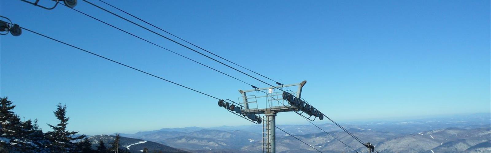
Ready to explore Killington Ski Area? Here's everything you need to know before you go!
Discover the trail
Available trails
| TrailTrails | Dist.Distance | GainElevation | Est. timeEstimated time | Difficulty | GPX |
|---|---|---|---|---|---|
|
|
1.8 km | 500 m | ≈ 1h30 | ||
|
|
1.9 km | 85 m | ≈ 33min | ||
|
|
1.9 km | 67 m | ≈ 32min | ||
|
|
0.3 km | 61 m | ≈ 15min | ||
|
|
1.1 km | 88 m | ≈ 23min | ||
|
|
0.6 km | — | |||
|
Beginner
|
2.1 km | 177 m | ≈ 44min | Beginner | |
|
Beginner
|
1.1 km | 6 m | ≈ 15min | Beginner | |
|
Intermediate
|
3.2 km | 500 m | ≈ 1h30 | Intermediate | |
|
Intermediate
|
3.5 km | 500 m | ≈ 1h30 | Intermediate |
Trail description
Killington Resort, which it calls “The Beast,” offers mountain biking in summer along with a network of hiking trails: forest paths, grassy ski trails and work roads. Several trails start from the base of the mountain, and several lead to the summit of Killington Peak.
The ten trails
The resort labels each trail with a letter. Lengths and vertical gain come from its summer hiking guide, which gives them in miles and feet; the km and m values are conversions.
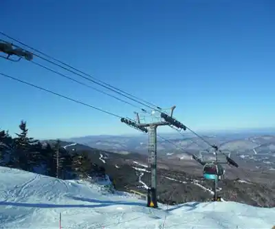
- A – Flume: 1.1 mi (1.8 km), 1,640 ft (500 m) of vertical. The most direct route to Killington Peak, following the K-1 Gondola up the Flume and Cascade ski trails. The resort describes it as steep and rugged.
- B – Canyon Loop: 1.2 mi (1.9 km), 280 ft (85 m). An easier loop from the K-1 Lodge through the Canyons area and past the headwaters of Roaring Brook, on work roads, grassy ski trails and wooded stretches.
- C – Warbler: 2.0 mi (3.2 km), 1,640 ft (500 m). Moderately difficult. It crosses the Snowdon Peak ski trails, then joins the loop to Killington Peak, on a wide work road shared with mountain bikers and work vehicles.
- E – Wildlands: 2.2 mi (3.5 km), 1,640 ft (500 m). Moderate, on varied terrain, from the K-1 Lodge across many ski trails to Killington Peak.
- F – Alpine: 1.2 mi (1.9 km), 220 ft (67 m). An alternate from the upper section of the E Trail: it follows ski trails to the top of Skye Peak, then loops back to the E Trail for the final climb to Killington Peak.
- H – Moraine: 1.3 mi (2.1 km), 580 ft (177 m). Starts at the Grand Hotel or the bottom of the Snowshed Express Quad and runs through forest and fields. The resort calls it gentle. It connects to the S Trail, which drops to the base of the Superstar Express Quad, or to the E Trail.
- I – Pond Loop: 0.7 mi (1.1 km), 20 ft (6 m). A loop around Snowshed Pond with several walking bridges and very little climbing.
- J – Summit: 0.2 mi (0.3 km), 200 ft (61 m). Stairs from the top of the K-1 Gondola lead to the summit at 4,241 ft, where the resort lists views of the Adirondack, Taconic, Green and White Mountain ranges.
- K – Idler: 0.7 mi (1.1 km), 290 ft (88 m). The most direct route from the Snowshed base area to the K-1, next to the road. Wide and well maintained, it also serves as an access road for maintenance ATVs.
- S: 0.38 mi (0.6 km), no vertical. A connector between the H Trail and the base of the K-1.
Climbing Killington Peak
The A, C and E trails lead to Killington Peak, at 4,241 ft (1,293 m). The E Trail, which the resort describes as moderate, links the K-1 Lodge to the summit: 2.2 mi (3.5 km) and 1,640 ft (500 m) of vertical. To come down from the A Trail, the resort recommends the more winding C or E trails; it also offers download-only gondola tickets on days the gondola is running. The Peak Lodge at the top welcomes gondola riders year-round; check the resort's Mountain Report for its hours.
The K-1 Gondola in summer
The K-1 Gondola climbs 1.25 miles to the summit of Killington Peak. In summer 2026 it ran from 10 a.m. to 5 p.m.: Friday to Sunday from July 3 to August 30, Friday to Monday from September 4 to 7, then daily from September 11 to October 12. The resort plans to close it for most of summer 2027 while its control system is replaced. The trails can also be hiked on foot, without the gondola.
Before you go
- Season: according to the resort, Killington operates as a summer destination from late May to mid-October. Operating hours and trail closures are posted in the Mountain Report.
- Parking: free at all Killington Resort base lodges.
- Dogs: the resort says dogs are welcome in outdoor areas and on select pet-friendly trails during the non-ski season. They must be on a leash, in a carrier or held, and under control. They are not allowed in base lodges, indoor public facilities, outdoor seating areas or food venues, or anywhere skiing, snowboarding or mountain biking takes place during operating hours. They may not swim in Snowshed Pond. No animals, service animals included, are allowed on gondolas or chairlifts.
- Mountain bikes: many trails are shared with bikers. At crossings, the resort asks hikers to look both ways and stay to the side of the trail when possible.
- Plants and insects: wild parsnip, poison ivy and giant hogweed are common on the mountain. The resort recommends bug spray, sunblock, sturdy footwear and, on longer hikes, water.
- Hiking alone: the resort suggests telling friends or family where you are going. Its trail map page also links to black bear safety tips.
Services and amenities
Everything you need for your next hike. Bilingual, printable, 1 page.
Get your free hiking checklistRecommended gear for this trail
As an Amazon Associate I earn from qualifying purchases.


Ready to go?
Everything you need to know before you goStarting Point
The trails start from several points around the base area: the K-1 Lodge (B and E trails), the Grand Hotel or the bottom of the Snowshed Express Quad (H Trail) and the Snowshed base area (K Trail). The J Trail starts at the top of the K-1 Gondola. The K-1 Gondola address is 4563 Killington Rd, Killington, VT 05751.
When?
As an Amazon Associate I earn from qualifying purchases.
Affiliate links — LGPO may earn a commission at no extra cost to you.
- Hiking shoes Essential
- → Salomon Elixir Tour Mid WP · 203.38 $
- Layered clothing Essential
- Rain jacket Essential
- Trekking poles
- → Black Diamond Trail Ergo Cork · 69.99 $
- Headlamp
- → Petzl Actik Core 625 · 103.95 $
FAQ - Frequently asked questions
Everything you need to knowOutings near Killington Ski Area
Discover other trails you might enjoy

Rams Head, Vermont
Green Mountains · 2.1 km away
Snowdon Peak, Vermont
Green Mountains · 2.2 km away
Killington Peak
Green Mountains · 3.1 km away

Pico Peak, Vermont
Green Mountains · 3.5 km away

Little Killington, Vermont
Green Mountains · 4.5 km away
Deer Leap Trail
Green Mountains · 5.1 km away
Hiking near Montpelier
220 trails to explore ~73 km away
We work hard to provide the most up-to-date and error-free data possible. If something seems incorrect, let us know! Your contribution helps the whole community.
Hikers' opinions
Be the first to review!
No hiker has shared their experience yet. Share your impressions and help other hikers!