

Ready to explore Mount Independence? Here's everything you need to know before you go!
Discover the trail
Oh no! We don't have any photos 😢
This trail hasn't been captured yet. Be the first to share your adventure!Trail description
Description
Mount Independence sits on the western shore of Lake Champlain in Vermont, directly across the water from Fort Ticonderoga in New York. This isn't your typical hiking destination — it's a place where history and trail walking genuinely intersect. The site preserves one of the most significant American Revolutionary War fortifications in the country, and the trail network here lets you explore that history on foot, at your own pace, through a landscape that has changed remarkably little since the 1770s.
What Makes This Place Different
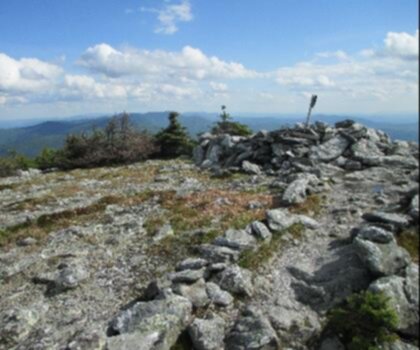
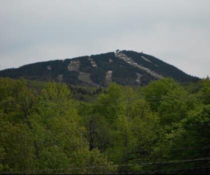
Most people come to Mount Independence for the history, but they stay for the trails. The peninsula juts out into Lake Champlain, which means you get water views from multiple angles as you walk. The combination of open meadows, forested ridgelines, and lakeside bluffs creates a varied landscape that keeps the hiking interesting even if you're not particularly drawn to the historical side of things.
That said, the history here is genuinely compelling. During the winter of 1776–1777, this site held one of the largest concentrations of American troops in the entire war — a fortified camp that worked in coordination with Fort Ticonderoga across the lake. Walking the trails, you'll pass the remains of earthworks, building foundations, and other features that have been preserved in place. The site is managed as a state historic site, and that management focus means the landscape is carefully maintained rather than heavily developed.
The Trail Network
Mount Independence has a well-established loop trail system that covers the main areas of the historic site. The trails are color-coded and well-marked, making navigation straightforward even for first-time visitors. You can choose shorter loops that focus on the core fortification area, or combine segments to cover more of the peninsula and get deeper into the wooded sections.
The terrain is generally moderate — there are some elevation changes as you move between the lakeside bluffs and the interior of the site, but nothing that requires technical skill or specialized gear. The footing is mostly packed earth and grass, with some rocky sections near the water's edge. Trails can get muddy after rain, particularly in the wooded areas.
Key stops along the trail network include:
- The Orange Trail — covers the core of the fortification area, passing major earthworks and the site of the main American camp
- The Blue Trail — runs along the western shore of the peninsula with direct views across Lake Champlain toward Fort Ticonderoga
- The Red Trail — takes you through the more forested northern section of the site, where you'll find additional building foundations and quieter terrain
- The Black Trail — a shorter connector that links the main loop sections and passes the site of the blockhouse
The on-site museum and visitor center serves as a natural starting point. It's worth spending time there before you head out — the exhibits give you enough context to recognize what you're looking at when you encounter earthworks or foundation remnants on the trail.
The Views
The lakeside sections of the trail deliver some of the best views on the property. From the western bluffs, you're looking directly across a narrow stretch of Lake Champlain at Fort Ticonderoga — it's one of the few places where you can visually grasp the strategic relationship between the two fortifications. The lake views are open and unobstructed in several spots, and the combination of water, distant hills, and the old fort across the way makes for a genuinely striking scene.
The interior sections of the trail are more enclosed, moving through second-growth forest with occasional clearings where the original camp structures once stood. These areas feel quieter and more contemplative, especially on weekdays when visitor numbers are lower.
Practical Information
Mount Independence State Historic Site is a managed property with a staffed visitor center. There is an admission fee to access the site — fees apply to adults, with reduced rates for children and Vermont residents. The site is typically open from late spring through mid-fall; it is not maintained for winter access, so check current operating dates before planning a visit.
Parking is available in a designated lot near the visitor center. The access road to the site is a gravel road that is passable for standard vehicles.
- Dogs: Dogs are permitted on the trails but must be kept on leash at all times
- Bikes: Bicycles are not permitted on the trail network
- Admission: Fee-based entry; check the Vermont Division for Historic Preservation for current rates and hours
- Facilities: Restrooms and a museum are available at the visitor center
Who This Trail Suits
Mount Independence works well for a wide range of hikers. Families with kids who have some interest in history will find the combination of walking and tangible historical features more engaging than a typical nature trail. Hikers looking for a half-day outing with meaningful content — rather than just mileage — will appreciate the depth of what's here. It's also a solid option for anyone visiting the Lake Champlain region who wants to get outside and cover some ground without committing to a full mountain day.
The trails are not particularly challenging from a fitness standpoint, which makes the site accessible to a broad range of ability levels. The main limitation is the seasonal operating window — this is not a year-round destination in the way that a public forest trail would be.
Getting There
Mount Independence is located in Orwell, Vermont, on the western shore of Lake Champlain. The site is reached via a marked access road off Vermont Route 73. Signage from the main road directs visitors to the parking area. The nearest larger town is Brandon, Vermont, to the east. If you're combining a visit with Fort Ticonderoga across the lake, note that there is no direct water crossing for vehicles — you'll need to drive around via the bridge at Chimney Point to the south.
Recommended gear for this trail


Ready to go?
Everything you need to know before you goStarting Point
The mount independence trails are located in Orwell, Vermont. To get to the start of the trails, take exit 9 off of I-89 and head east on Route 74. The trailhead will be on your left.
When?
How much?
- Hiking shoes Essential
- → Salomon Elixir Tour Mid WP · 203.38 $
- Layered clothing Essential
- Rain jacket Essential
- Trekking poles
- → Black Diamond Trail Ergo Cork · 69.99 $
- Headlamp
- → Petzl Actik Core 625 · 103.95 $
FAQ - Frequently asked questions
Everything you need to knowThe Essential Hiking Checklist
Everything you need for your next hike. Bilingual, printable, 1 page.
Download the free checklistSimilar hikes nearby
Discover other trails you might enjoy
Mount Abraham, Vermont
Green Mountains
Snowdon Peak, Vermont
Green Mountains

Slate Valley Trails
Green Mountains
Flatlander Farm
Green Mountains
Bristol Tripadvisor #1, Vermont Bed and Breakfast at Russell Young Farm
Green Mountains
Deer Leap Trail
Green Mountains
Hiking near Lake Placid
0 trails to explore ~70 km away
We work hard to provide the most up-to-date and error-free data possible. If something seems incorrect, let us know! Your contribution helps the whole community.
Hikers' opinions
Be the first to review!
No hiker has shared their experience yet. Share your impressions and help other hikers!