
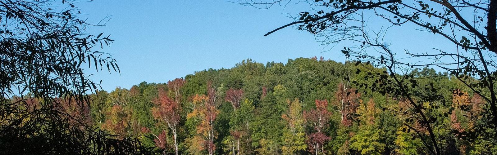
Ready to explore Kerr Lake? Here's everything you need to know before you go!
Discover the trail
Available trails
| TrailTrails | Dist.Distance | GainElevation | Difficulty | GPX |
|---|---|---|---|---|
|
Beginner
|
1.1 km | — | Beginner | |
|
Beginner
|
1.1 km | — | Beginner | |
|
Intermediate
|
6.8 km | — | Intermediate | |
|
Intermediate
|
0.8 km | — | Intermediate | |
|
Intermediate
|
0.3 km | — | Intermediate | |
|
Intermediate
|
11.6 km | — | Intermediate | |
|
Intermediate
|
1.3 km | — | Intermediate | |
|
Intermediate
|
0.6 km | — | Intermediate |
Trail description
Where Kerr Lake is
The John H. Kerr Reservoir straddles Virginia and North Carolina. According to Wikipedia, it is often called Kerr Lake in North Carolina and Bugg's Island Lake in Virginia. The DCR gives Buggs Island Lake (Kerr Reservoir) 48,000 acres. According to Wikipedia, its shoreline totals 850 miles (1,370 km). John H. Kerr Dam, on the Roanoke River, was built from 1947 to 1952; the U.S. Army Corps of Engineers operates the facility.
Kerr Lake State Recreation Area is on the North Carolina side. This page covers the Virginia side: Occoneechee State Park, 2,698 acres, at 1192 Occoneechee Park Road in Clarksville. The Virginia Department of Conservation and Recreation (DCR) places the park on the John H. Kerr Reservoir, better known as Buggs Island Lake. It adds that the Occoneechi lived on an island near the present park until 1676.
The trails
The DCR trail guide lists eight trails, from the shortest, Ironbow Connection (0.2 mi, 0.3 km), to the longest, Panhandle (7.2 mi, 11.6 km). Beaver Pond (4.2 mi, 6.8 km) and Panhandle are the park's two multi-use trails; Old Plantation and Tutelo Birding are self-guided interpretive trails, according to the DCR.
The guide rates Mossey Creek and Old Plantation "easy" and the other six "moderate"; none is rated "difficult". Trail blazes: Panhandle white, Beaver Pond green, Mossey Creek blue, Old Plantation and Tutelo Birding red, Big Oak and Ironbow Connection yellow, Warrior's Path orange.
The DCR gives 20 miles of trails in one section of its page and 22 miles in another. The trail guide table adds up to 14.7 mi (23.7 km). The trail distances on this page come from that table; the guide's map can be downloaded from the DCR website.
Rules and safety
- Dogs on a leash no longer than 6 ft (1.8 m), attended at all times; clean up after your dog. Dogs are prohibited on designated swimming beaches.
- There is no designated swimming area in the park. The trail guide warns that swimming or wading in unguarded areas may be hazardous: swift currents, sudden drop-offs, unseen obstructions.
- Drones and other remote-control aircraft may not be flown in Virginia state parks (4VAC5-30-400).
- Fires only in grills, camp stoves or designated fire rings; a fire must be attended at all times and extinguished when you leave.
- For an emergency, dial 911.
Hours, parking and fees
The park is open for day use from 8 a.m. to dusk daily; the visitor center is open 8 a.m. to 4 p.m. The DCR lists $7 for parking a passenger vehicle at Occoneechee State Park, at both the standard rate and the April to October weekend rate. The trail guide says a parking fee is charged year-round at Virginia state parks and that self-pay parking information is available at the contact station.
Camping and lodging
Campsites are open from the first Friday in March to the first Monday in December. The park also has 11 equestrian campsites, cabins, two lodges, three yurts and a bunkhouse. Both campgrounds have bathhouses with hot showers and flush toilets; restrooms are also near the Splash Park and the picnic shelters. To reserve: 800-933-PARK (virginiastateparks.gov). The park can be reached at 434-374-2210.
Services and amenities
Everything you need for your next hike. Bilingual, printable, 1 page.
Get your free hiking checklistRecommended gear for this trail
As an Amazon Associate I earn from qualifying purchases.


Ready to go?
Everything you need to know before you goStarting Point
Occoneechee State Park, 1192 Occoneechee Park Road, Clarksville, Virginia. The contact station, the parking areas and the eight trails are shown on the map in the DCR trail guide.
When?
8 a.m. to dusk daily.
As an Amazon Associate I earn from qualifying purchases.
Affiliate links — LGPO may earn a commission at no extra cost to you.
- Hiking shoes Essential
- → Salomon Elixir Tour Mid WP · 203.38 $
- Layered clothing Essential
- Rain jacket Essential
- Trekking poles
- → Black Diamond Trail Ergo Cork · 69.99 $
- Headlamp
- → Petzl Actik Core 625 · 103.95 $
FAQ - Frequently asked questions
Everything you need to knowOutings near Kerr Lake
Discover other trails you might enjoy

Hiking near Pittsburgh
3 trails to explore ~442 km away
We work hard to provide the most up-to-date and error-free data possible. If something seems incorrect, let us know! Your contribution helps the whole community.
Hikers' opinions
Be the first to review!
No hiker has shared their experience yet. Share your impressions and help other hikers!