
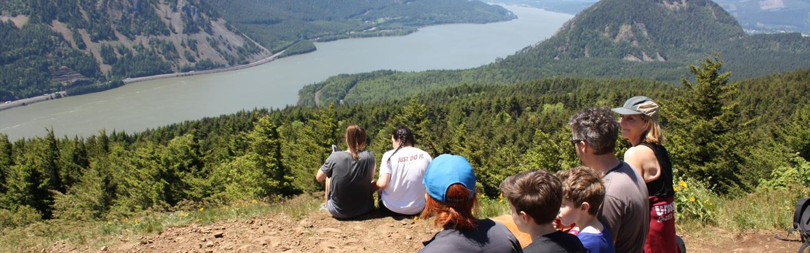

Ready to explore Triangle Pass? Here's everything you need to know before you go!
Discover the trail
Photos: U.S. Forest Service- Pacific Northwest Region — Domaine public (Wikimedia Commons)
Trail description
Triangle Pass is a backcountry route tucked into the Columbia Plateau region of Washington State. It's the kind of destination that rewards hikers who are willing to do a little homework before heading out — the terrain here is distinctly different from the lush, forested trails that dominate western Washington, and that contrast is exactly what makes it worth the trip.
The Landscape
The Columbia Plateau is one of Washington's most geologically dramatic regions. Shaped by massive basalt lava flows and later carved by the catastrophic Missoula Floods at the end of the last ice age, the landscape here is open, rugged, and surprisingly raw. Expect wide skies, exposed ridgelines, and terrain that feels genuinely remote even when you're not that far from a road.
Triangle Pass sits within this broader plateau environment, where the land tends to roll and break in ways that catch hikers off guard. The vegetation shifts noticeably depending on elevation and aspect — you'll move through sagebrush steppe, bunch grasses, and scattered shrubs rather than the dense conifer forests most Pacific Northwest hikers are used to. That openness means long sightlines and a real sense of space, but it also means less shade and more exposure to wind and sun.
What to Expect on the Trail
The route to Triangle Pass follows terrain typical of the Columbia Plateau — relatively dry underfoot in summer, potentially muddy or icy depending on the season. The "pass" itself is a geographic feature that marks a transition point in the landscape, where the topography shifts and views open up in multiple directions. It's the kind of spot where you naturally stop, take stock of where you've come from, and get a feel for what lies ahead.
The trail surface varies. Some sections are well-defined and easy to follow; others may require more attention to route-finding, especially if you're visiting outside of peak season when foot traffic is lighter and trail markers can be harder to spot. Bringing a map — not just a phone with GPS — is a smart call out here.
Because the Columbia Plateau sits in the rain shadow of the Cascades, conditions here are drier and sunnier than much of western Washington. That's a genuine advantage for hikers who are tired of muddy boots and overcast skies, but it also means you need to manage sun exposure and carry more water than you might on a shaded forest trail.
Wildlife and Nature
The open shrub-steppe habitat of the Columbia Plateau supports a distinct community of wildlife that you won't encounter on most Washington trails. Raptors are a consistent presence — red-tailed hawks, ferruginous hawks, and prairie falcons all hunt these open landscapes. Ground squirrels and jackrabbits are common, and if you're moving quietly, mule deer are a regular sighting.
Reptiles are more active here than in wetter parts of the state. Rattlesnakes are present in the Columbia Plateau region, so it's worth watching where you step and where you put your hands, especially around rocky outcrops and in warm weather. This isn't a reason to avoid the trail — it's just part of hiking in this ecosystem, and a little awareness goes a long way.
Wildflower season on the plateau can be genuinely impressive. Balsamroot, lupine, and phlox are among the species that bloom across the open slopes, typically peaking in spring before the summer heat sets in.
Planning Your Visit
The Columbia Plateau region is best visited in spring and fall. Spring brings cooler temperatures, wildflowers, and active wildlife. Fall offers comfortable hiking conditions and dramatic light across the open landscape. Summer is doable but demands early starts and serious attention to hydration — midday heat on exposed terrain can be intense. Winter access depends on conditions; snow and ice can make some routes challenging or impassable.
Before heading out, check current trail conditions and any access restrictions. Land management in the Columbia Plateau involves multiple agencies depending on the specific area, so it's worth confirming who manages the Triangle Pass route and whether any permits or fees apply to your visit.
Getting There
Access to trails in the Columbia Plateau region typically involves driving through small agricultural communities and onto roads that range from well-maintained pavement to rougher gravel. Depending on recent weather and the specific access road for Triangle Pass, a vehicle with decent clearance may be an advantage. Check road conditions before you go, particularly in early spring when runoff can affect unpaved surfaces.
Cell service is limited to nonexistent in much of this region. Download offline maps before you leave, let someone know your plans, and carry the ten essentials. The Columbia Plateau rewards self-sufficient hikers who come prepared.
Who This Trail Is For
Triangle Pass appeals to hikers who are drawn to wide-open landscapes and a quieter, less-trafficked experience. If you're used to the busy trails of the Cascades or the Olympics, the Columbia Plateau feels like a different world — and that's the point. You're unlikely to share the trail with crowds here, which makes it a solid choice for anyone looking to get away from the weekend rush.
The exposed, semi-arid terrain also makes this a good destination for hikers who want to build experience in environments that demand more self-reliance. Navigation, water management, and weather awareness all matter more here than on a well-signed, heavily trafficked trail — and that's part of what makes reaching Triangle Pass feel genuinely earned.
The Essential Hiking Checklist
Everything you need for your next hike. Bilingual, printable, 1 page.
Get your free hiking checklistRecommended gear for this trail
As an Amazon Associate I earn from qualifying purchases.


Ready to go?
Everything you need to know before you goWhen?
How much?
As an Amazon Associate I earn from qualifying purchases.
Affiliate links — LGPO may earn a commission at no extra cost to you.
- Hiking shoes Essential
- → Salomon Elixir Tour Mid WP · 203.38 $
- Layered clothing Essential
- Rain jacket Essential
- Trekking poles
- → Black Diamond Trail Ergo Cork · 69.99 $
- Headlamp
- → Petzl Actik Core 625 · 103.95 $
FAQ - Frequently asked questions
Everything you need to knowHiking near Victoria
93 trails to explore ~321 km away
We work hard to provide the most up-to-date and error-free data possible. If something seems incorrect, let us know! Your contribution helps the whole community.
Hikers' opinions
Be the first to review!
No hiker has shared their experience yet. Share your impressions and help other hikers!