


Ready to explore Fortress Mtn? Here's everything you need to know before you go!
Discover the trail
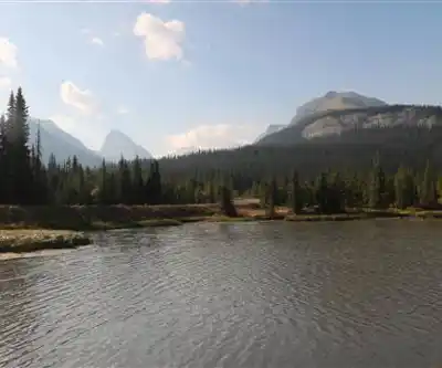
Photos: Thank you for visiting my page from Canada — CC BY 2.0 (Wikimedia Commons)
Trail description
Fortress Mountain sits in the Kananaskis foothills of Alberta, and if you've spent any time exploring that part of the province, you already know the area delivers some of the most rewarding terrain in the Canadian Rockies' eastern ranges. The mountain itself is a recognizable landmark — a broad, fortress-like summit that gives the area its name and serves as a natural anchor point for anyone heading into this corner of the foothills.
The Terrain
The landscape around Fortress Mountain is classic Alberta foothills transitioning into full alpine. You move through subalpine forest — mostly spruce and fir — before the treeline opens up and the views start doing the talking. The upper terrain is rocky and open, with the kind of wide-angle sightlines that remind you why people make the drive out here in the first place. The surrounding ridgelines and valleys are part of the larger Kananaskis Country network, so the sense of space is real — you're not hemmed in.
The mountain sits within a landscape shaped by glaciation, and that shows in the terrain underfoot: exposed rock, talus slopes on the upper sections, and meadow pockets where the grade eases off. It's the kind of place where the geology is right there in front of you, not buried under dense vegetation.
What to Expect on the Trail
Fortress Mountain is a destination that rewards hikers who are comfortable on open, rocky terrain. The lower sections follow more defined trail, but as you gain elevation, the route becomes more about reading the landscape and picking your line across open ground. Cairns help in places, but this isn't a manicured path — it's a mountain, and it asks you to pay attention.
The exposure increases as you climb. Wind is a real factor on the upper mountain, especially once you're above treeline, so layering up even on a warm day is just good practice. The views from the upper reaches extend across the Kananaskis valley system and toward the main ranges of the Rockies to the west — on a clear day, the panorama is genuinely impressive.
Wildlife is part of the picture in this area. The foothills and alpine zones around Fortress Mountain are habitat for species common to the Kananaskis region, so keeping your eyes open and your distance is standard operating procedure. Bears are present in the broader area — carrying bear spray and knowing how to use it is not optional here.
Getting There
Fortress Mountain is accessible via the Kananaskis Trail (Highway 40), which is the main artery through Kananaskis Country. The area is well-signed, and the Fortress Mountain area has been a known destination for outdoor users for decades — originally developed as a ski area, the mountain and its surroundings have since become a year-round destination for hikers, scramblers, and backcountry users.
Parking is available in the area, and the access road off Highway 40 is straightforward. Note that Highway 40 south of the Kananaskis Lakes Trail junction is closed seasonally — typically from December 1 to June 15 — so timing your visit matters if you're coming from that direction.
Practical Information
- Kananaskis Conservation Pass: Required for all vehicles parking in Kananaskis Country. Make sure you have one before you go — enforcement is active.
- Season: The upper mountain is typically accessible from mid-summer through early fall, once snowpack has cleared. Early season and late season conditions can change fast — check current conditions before heading out.
- Bear safety: Bear spray is strongly recommended. Travel in groups when possible and make noise on the trail.
- Weather: Mountain weather in this part of Alberta can shift quickly. Afternoon thunderstorms are common in summer — plan to be off exposed terrain by early afternoon.
- Footwear: Sturdy hiking boots with ankle support are the right call for the rocky upper terrain. Trail runners work on the lower sections but become limiting higher up.
- Water: Carry enough water for your full outing. There may be water sources in the area, but treating any backcountry water before drinking is standard practice.
Who This Is For
Fortress Mountain is best suited to hikers and scramblers who are comfortable with elevation gain, open rocky terrain, and route-finding on unmarked ground. It's not a beginner destination — the upper mountain asks for a baseline of fitness and some experience reading mountain terrain. That said, it's not a technical climb, and hikers with solid experience on Alberta trails will find it well within reach.
If you're introducing someone to alpine hiking in Kananaskis, there are gentler options nearby to build up to this one. But if you've got a few Kananaskis summits under your belt and you're looking for a route with real character and a strong payoff at the top, Fortress Mountain delivers exactly that.
The Bigger Picture
Fortress Mountain sits within Kananaskis Country, a provincially managed recreation area that covers a significant stretch of the eastern slopes of the Rockies in Alberta. The area is managed to balance recreation with conservation, and the trail network — formal and informal — is extensive. Fortress Mountain is one of the more prominent features in the southern Kananaskis, and it connects visually and geographically to the broader landscape of peaks, ridges, and valleys that make this one of Alberta's most-used backcountry destinations.
The mountain's history as a ski area adds an interesting layer to the place — infrastructure from that era is still visible in parts of the area, giving it a slightly different character than a purely wilderness summit. That history doesn't detract from the experience; if anything, it's a reminder of how long people have been drawn to this particular piece of terrain.
Recommended gear for this trail
As an Amazon Associate I earn from qualifying purchases.


Ready to go?
Everything you need to know before you goWhen?
How much?
As an Amazon Associate I earn from qualifying purchases.
Affiliate links — LGPO may earn a commission at no extra cost to you.
- Hiking shoes Essential
- → Salomon Elixir Tour Mid WP · 203.38 $
- Layered clothing Essential
- Rain jacket Essential
- Trekking poles
- → Black Diamond Trail Ergo Cork · 69.99 $
- Headlamp
- → Petzl Actik Core 625 · 103.95 $
FAQ - Frequently asked questions
Everything you need to know
25 hikes under 2 hours from Montreal
Distance, elevation, parking and season for each one. The ones we go back to ourselves.
Get the guideSimilar hikes nearby
Discover other trails you might enjoy
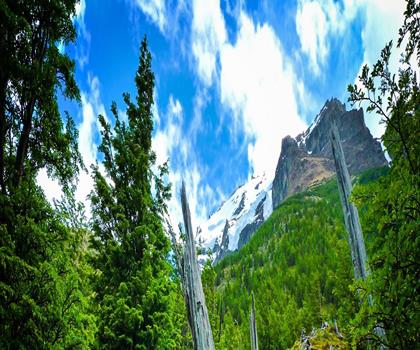
Fossil Mountain
Canadian Rockies

Snake Indian Mountain
Canadian Rockies
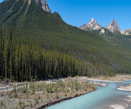
Mushroom Peak
Canadian Rockies
Mount Woolley
Canadian Rockies
Stutfield Peak
Canadian Rockies
Mount Sarbach
Canadian Rockies
Hiking near Canmore
200 trails to explore ~33 km away
We work hard to provide the most up-to-date and error-free data possible. If something seems incorrect, let us know! Your contribution helps the whole community.
Hikers' opinions
Be the first to review!
No hiker has shared their experience yet. Share your impressions and help other hikers!