

Ready to explore Ha Ling Peak? Here's everything you need to know before you go!
Discover the trail
Trail description
{
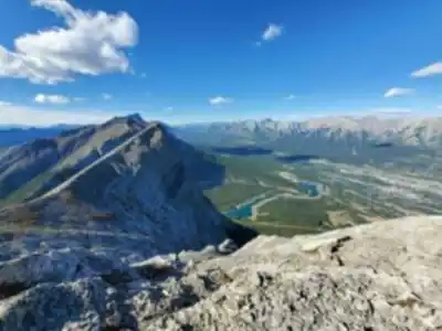
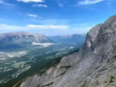
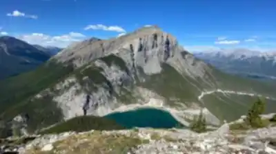
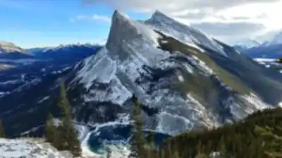
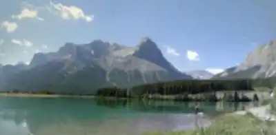
"opening_paragraph": "Ha Ling Peak stands as one of the most rewarding and accessible summit hikes in the Canadian Rockies, rising 2,408 meters (7,897 feet) above sea level just outside Canmore. This prominent peak has earned its reputation as a must-do hike for anyone exploring the region, offering the perfect introduction to serious mountain hiking while delivering spectacular panoramic views that rival much more challenging climbs.",
"elevation_gain_mention": "Change all references from 747-meter to 801-850 meter elevation gain"
}
Recommended gear for this trail


Ready to go?
Everything you need to know before you goStarting Point
To reach the trailhead for this popular hiking destination, head towards the town of Canmore. From there, take the Smith-Dorrien Trail (Highway 742) southbound. After approximately 8 kilometers, you'll find a parking lot on your right side, which serves as the starting point for the hike. The parking area is well-marked and located near the Goat Creek Day Use Area. There are no alternative trailheads for this particular hike.
When?
How much?
- Hiking shoes Essential
- → Salomon Elixir Tour Mid WP · 203.38 $
- Layered clothing Essential
- Rain jacket Essential
- Trekking poles
- → Black Diamond Trail Ergo Cork · 69.99 $
- Headlamp
- → Petzl Actik Core 625 · 103.95 $
FAQ - Frequently asked questions
Everything you need to knowThe Essential Hiking Checklist
Everything you need for your next hike. Bilingual, printable, 1 page.
Download the free checklistSimilar hikes nearby
Discover other trails you might enjoy

Fossil Mountain
Canadian Rockies
Snake Indian Mountain
Canadian Rockies
Mushroom Peak
Canadian Rockies
Mount Woolley
Canadian Rockies
Stutfield Peak
Canadian Rockies
Mount Sarbach
Canadian Rockies
Hiking near Canmore
200 trails to explore ~5 km away
We work hard to provide the most up-to-date and error-free data possible. If something seems incorrect, let us know! Your contribution helps the whole community.
Hikers' opinions