


Ready to explore Mount Kidd? Here's everything you need to know before you go!
Discover the trail
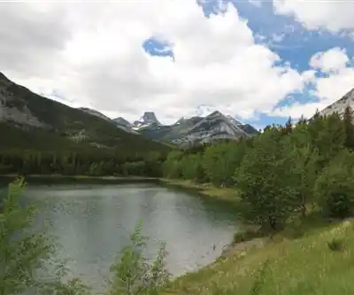
Photos: Thank you for visiting my page from Canada — CC BY 2.0 (Wikimedia Commons)
Trail description
Mount Kidd is one of the most recognizable peaks in the Kananaskis region of the Canadian Rockies, rising sharply above the surrounding valleys south of Calgary. Its distinctive silhouette is hard to miss as you drive through Kananaskis Country, and the trails on its slopes deliver a genuine Rocky Mountain experience — the kind that reminds you why people keep coming back to this corner of Alberta.
With a 6.5 km route, 1,200 m of elevation gain, and an estimated 6.5 hours on trail, this is a full day out. The moderate difficulty rating reflects a hike that's accessible to fit, experienced hikers who are comfortable on rocky terrain — not a casual stroll, but not a technical mountaineering objective either. Come prepared, pace yourself, and the mountain rewards you generously.
What the Trail Is Actually Like
The route starts in classic montane forest — dense stands of lodgepole pine and spruce that block the wind and give you a chance to warm up your legs before things get serious. The forest section is pleasant and relatively straightforward, but don't let it lull you into a false sense of ease. The elevation gain comes steadily, and the terrain shifts as you climb.
As you move higher, the trees thin out and the trail becomes rockier. Footing demands more attention here — loose scree and exposed limestone slabs require you to pick your line carefully and move deliberately. This is where trekking poles earn their keep. The scrambling sections aren't extreme, but they do require confidence on uneven ground and a willingness to use your hands in places.
The payoff for all that effort is a panoramic view across the Kananaskis Valley and the surrounding peaks. On a clear day, the scale of the landscape is genuinely humbling — ridge after ridge of Rocky Mountain terrain stretching in every direction. It's the kind of view that makes the burning quads feel entirely worth it.
Terrain and Ecosystems Along the Way
One of the things that makes Mount Kidd interesting as a hiking destination is the variety of terrain you move through on a single route. The lower elevation forest gives way to open rocky slopes, which in turn open up to alpine-adjacent terrain near the upper sections of the trail. Each zone has its own character and its own wildlife.
The meadow areas — particularly in the mid-elevation sections — are worth slowing down for. Wildflowers push through the rocky soil during summer, and the open sight lines make these spots ideal for spotting wildlife. Marmots are a near-constant presence in the rocky zones, announcing your arrival with their sharp whistles. Deer are commonly seen in the lower meadows, especially in the early morning and evening hours. Keep your eyes on the ridgelines and you may catch raptors riding thermals above the peaks.
The limestone geology throughout the area is striking — the grey rock faces and cliffs that define Mount Kidd's profile are the same ancient seabed material that makes up much of the Canadian Rockies. It's a landscape shaped over millions of years, and the exposed rock faces make that history visible in a way that's hard to ignore.
Practical Information for Your Visit
With 1,200 m of elevation gain packed into 6.5 km, this trail climbs hard. Budget the full 6.5 hours and don't plan anything strenuous for the following day. The descent on rocky terrain is slower than people expect, and rushing it is how ankles get twisted.
Gear worth bringing on this route:
- Sturdy hiking boots with solid ankle support — trail runners are marginal on the rockier upper sections
- Trekking poles — helpful on the ascent, essential on the descent
- More water than you think you need — the elevation gain and dry mountain air will dehydrate you faster than expected
- Layers — temperatures at the upper sections can drop significantly even on warm valley days, and afternoon thunderstorms are common in summer
- Snacks and a real lunch — this is a long day with serious caloric demands
Mountain weather in the Canadian Rockies moves fast. Check the forecast before you leave, but understand that conditions can change dramatically between the trailhead and the upper mountain. If you see storm clouds building over the peaks in the early afternoon, take them seriously and start your descent.
The Kananaskis region requires a Kananaskis Conservation Pass for vehicles parked at trailheads — make sure you have one sorted before you arrive. It's a straightforward online purchase and avoids an unnecessary fine at the start of what should be a great day out.
When to Go
The main hiking season on Mount Kidd runs from late June through September, once the upper trail has cleared of snow. July and August offer the most reliable conditions and the best wildflower displays in the meadow sections. September brings cooler temperatures, fewer people on trail, and the golden larch season that makes the Kananaskis region particularly spectacular in autumn.
Early starts are always a good idea in the Rockies — parking fills up on weekends during peak season, and getting on trail by 7 or 8 a.m. puts you ahead of both the crowds and the afternoon weather window.
Recommended gear for this trail
As an Amazon Associate I earn from qualifying purchases.


Ready to go?
Everything you need to know before you goStarting Point
The mount kidd trails are located in Kananaskis Country, Alberta. To get to the start of the trails, take Highway 40 south from Calgary to the Kananaskis Village turnoff. Follow the signs to the village and then continue on the Smith Dorrien Trail (Highway 742) until you reach the mount kidd parking lot.
When?
How much?
As an Amazon Associate I earn from qualifying purchases.
Affiliate links — LGPO may earn a commission at no extra cost to you.
- Hiking shoes Essential
- → Salomon Elixir Tour Mid WP · 203.38 $
- Layered clothing Essential
- Rain jacket Essential
- Trekking poles
- → Black Diamond Trail Ergo Cork · 69.99 $
- Headlamp
- → Petzl Actik Core 625 · 103.95 $
FAQ - Frequently asked questions
Everything you need to know
25 hikes under 2 hours from Montreal
Distance, elevation, parking and season for each one. The ones we go back to ourselves.
Get the guideSimilar hikes nearby
Discover other trails you might enjoy
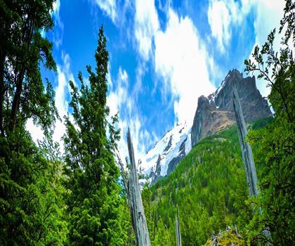
Fossil Mountain
Canadian Rockies

Snake Indian Mountain
Canadian Rockies
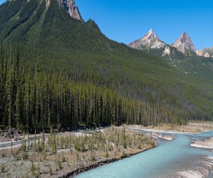
Mushroom Peak
Canadian Rockies
Mount Woolley
Canadian Rockies
Stutfield Peak
Canadian Rockies
Mount Sarbach
Canadian Rockies
Hiking near Canmore
200 trails to explore ~24 km away
We work hard to provide the most up-to-date and error-free data possible. If something seems incorrect, let us know! Your contribution helps the whole community.
Hikers' opinions
Be the first to review!
No hiker has shared their experience yet. Share your impressions and help other hikers!