

Ready to explore Peyto Lake? Here's everything you need to know before you go!
Discover the trail
Trail description
The Trail
The hike to the Peyto Lake viewpoint follows the Bow Summit Lookout trail, starting from the Bow Summit parking area — the highest point on the Icefields Parkway. The trail covers 1.4 km with an elevation gain of 93 meters, rated easy, and most people complete the round trip in about 45 minutes. It's genuinely accessible: families with kids, older hikers, and first-timers all do this trail comfortably.
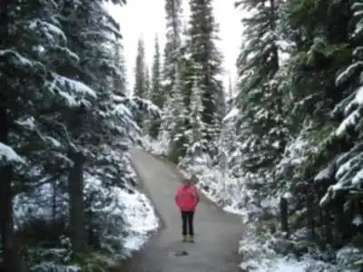
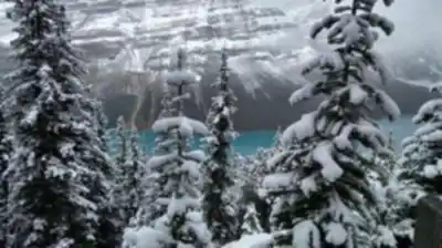
The path is wide and well-maintained, winding through subalpine forest — mostly Engelmann spruce and subalpine fir — before opening up as you approach the viewpoint. The elevation gain is gradual enough that it never feels like a slog, but you do feel it in your legs just enough to make the payoff feel earned. Interpretive signs along the way give context on the area's geology, ecology, and wildlife, which adds something to the experience if you take a moment to read them.
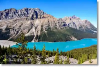
The main viewpoint is where everything comes together. The elevated perspective lets you take in not just the lake itself but the full sweep of the valley — Mount Patterson and Pyramid Mountain framing the scene, the forest dropping away below, and that turquoise water sitting at the center of it all. It's a genuinely spectacular vantage point.
Recommended gear for this trail


Ready to go?
Everything you need to know before you goStarting Point
To access the hiking trails, head to the Icefields Parkway (Highway 93 North). The main trailhead is located at the peyto lake Viewpoint parking lot. From Lake Louise, drive approximately 40 kilometers north on the Icefields Parkway until you reach the clearly marked turnoff for the viewpoint. There are no alternative trailheads for this location.
When?
How much?
- Hiking shoes Essential
- → Salomon Elixir Tour Mid WP · 203.38 $
- Layered clothing Essential
- Rain jacket Essential
- Trekking poles
- → Black Diamond Trail Ergo Cork · 69.99 $
- Headlamp
- → Petzl Actik Core 625 · 103.95 $
FAQ - Frequently asked questions
Everything you need to knowThe Essential Hiking Checklist
Everything you need for your next hike. Bilingual, printable, 1 page.
Download the free checklistSimilar hikes nearby
Discover other trails you might enjoy

Fossil Mountain
Canadian Rockies
Snake Indian Mountain
Canadian Rockies
Mushroom Peak
Canadian Rockies
Mount Woolley
Canadian Rockies
Stutfield Peak
Canadian Rockies
Mount Sarbach
Canadian Rockies
Hiking near Banff
187 trails to explore ~90 km away
We work hard to provide the most up-to-date and error-free data possible. If something seems incorrect, let us know! Your contribution helps the whole community.
Hikers' opinions