

Ready to explore Ruby Lake? Here's everything you need to know before you go!
Discover the trail
Trail description
Description
Ruby Lake is a fantastic short hike in the Rock Creek area of the Eastern Sierra, located in one of California's most beautiful regions. The hike itself is 4 miles round trip with 900 feet of elevation gain. While that might not seem like a lot on paper, the altitude and steady climbing make this a rewarding alpine experience for day hikers and backpackers alike.
The Hiking Experience
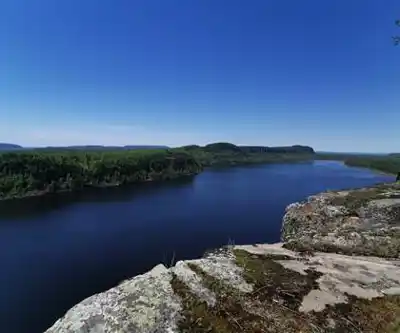
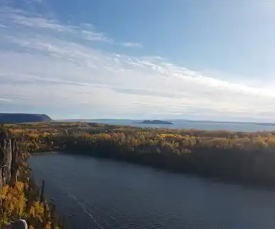
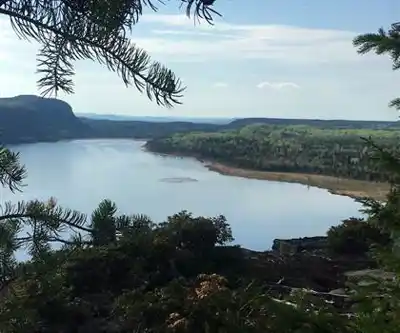
The trail begins at the Mosquito Flats parking area at the end of Rock Creek Road and heads south into the woods, climbing slowly above the nearby Rock Creek stream before entering more open terrain. As you quickly gain elevation on the way up to Ruby Lake at over 11,000 feet, the views south into Little Lakes Valley and distant peaks like Bear Creek Spire make for a memorable sight. Mt. Abbott dominates on the right side of the view.
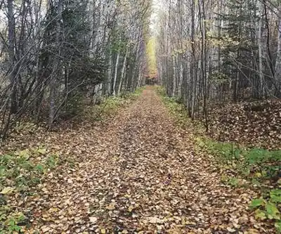
The trail is well-defined for most of the route, though topographic maps and navigation tools are always recommended in alpine terrain. Sturdy hiking boots with good ankle support are essential for the rocky terrain and loose scree near the lake.
What Makes Ruby Lake Worth It
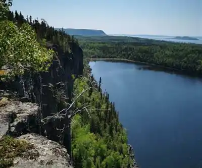
Ruby Lake sits tucked into the high alpine landscape, its waters fed by snowmelt and underground springs, keeping them remarkably clear throughout the hiking season. The rocky shoreline gives you plenty of room to rest your legs and take in the views without feeling crowded. The water stays cold enough that swimming is more of a quick dip than a leisurely soak, but it's perfect for cooling off tired feet after the climb.
The surrounding alpine environment is spectacular, with jagged peaks framing the lake and pristine wilderness stretching in all directions.
Wildlife and Natural Environment
The area around Ruby Lake supports a healthy alpine ecosystem. Mountain goats are commonly spotted on the rocky slopes above the lake, and marmots are a near-constant presence on the boulder fields near the shoreline — you'll likely hear their sharp warning whistles before you see them. During peak summer, hardy alpine wildflowers push through the rocky ground around the lake, making the most of the short growing season. The intense UV exposure at this elevation means sunscreen and sunglasses matter even when it's overcast.
Trail Conditions and Weather
Conditions on this trail can shift quickly. Afternoon thunderstorms are a regular feature of summer in the Eastern Sierra, and temperatures can drop sharply even on days that start warm and clear. Layering is the only reliable strategy — pack a waterproof shell and an insulating mid-layer regardless of the forecast.
Snow patches can linger well into summer, particularly in shaded areas and north-facing slopes at higher elevations. Early season hikers should be prepared for swollen stream crossings from snowmelt runoff. Late season — typically late September into early October — brings clear skies and cooler temperatures ideal for hiking.
Planning and Logistics
Ruby Lake is accessible as a rewarding day hike or an overnight backpacking trip. The 4-mile round trip with 900 feet of elevation gain typically takes 4-5 hours depending on your pace and acclimatization to the altitude. Camping is allowed in the John Muir Wilderness area, with options for campsites and dispersed camping.
Water is available at the lake, but always treat or filter backcountry water before drinking. Bring enough food and water for your full trip, a first aid kit, navigation tools, and sun protection. The remote location means help is not immediately available if something goes wrong.
- Distance: 4 miles round trip
- Elevation gain: 900 feet
- Estimated time: 4-5 hours
- Difficulty: Moderate to Hard
- Elevation at lake: Over 11,000 feet
- Location: John Muir Wilderness, Eastern Sierra, California
- Trailhead: Mosquito Flats parking area at end of Rock Creek Road
- Recommended footwear: Sturdy hiking boots with ankle support
- Navigation: Topographic map and compass or GPS recommended
- Water: Available at the lake — bring a filtration system
- Camping: Allowed in John Muir Wilderness
Best Season
The hiking season at Ruby Lake is generally limited to summer and early fall, once snow has cleared from the higher elevations. July through September is typically the most reliable period. Check current trail conditions before heading out, especially early and late in the season.
Getting There
On Highway 395, turn onto Rock Creek Road at Tom's Place (23 miles north of Bishop or 15 miles south of the Mammoth Lakes turnoff on Highway 203). Follow Rock Creek Road past Rock Creek Lake to the end of the road at the Mosquito Flats parking area.
Recommended gear for this trail


Ready to go?
Everything you need to know before you goStarting Point
To access the hiking trails, you can start from several trailheads. One common starting point is the parking lot located at the end of Emerald Lake Road, which is accessible via Highway 1. Another option is to begin your hike from the trailhead near the Yoho National Park Visitor Centre, situated along Trans-Canada Highway 1 in Field, British Columbia. Both locations provide convenient access to the trails leading to your destination.
When?
How much?
- Hiking shoes Essential
- → Salomon Elixir Tour Mid WP · 203.38 $
- Layered clothing Essential
- Rain jacket Essential
- Trekking poles
- → Black Diamond Trail Ergo Cork · 69.99 $
- Headlamp
- → Petzl Actik Core 625 · 103.95 $
FAQ - Frequently asked questions
Everything you need to knowThe Essential Hiking Checklist
Everything you need for your next hike. Bilingual, printable, 1 page.
Download the free checklistSimilar hikes nearby
Discover other trails you might enjoy

Fossil Mountain
Canadian Rockies
Snake Indian Mountain
Canadian Rockies
Mushroom Peak
Canadian Rockies
Mount Woolley
Canadian Rockies
Stutfield Peak
Canadian Rockies
Mount Sarbach
Canadian Rockies
Hiking near Calgary
120 trails to explore ~217 km away
We work hard to provide the most up-to-date and error-free data possible. If something seems incorrect, let us know! Your contribution helps the whole community.
Hikers' opinions