
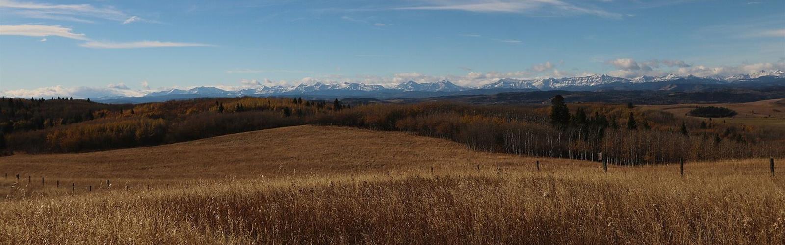
Ready to explore Ann & Sandy Cross Conservation Area? Here's everything you need to know before you go!
Discover the trail
Available trails
| TrailTrails | Dist.Distance | GainElevation | Difficulty | GPX |
|---|---|---|---|---|
|
|
4.9 km | — | ||
|
|
4.77 km | — | ||
|
|
1.2 km | — | ||
|
|
8 km | — | ||
|
|
3.57 km | — |
Trail description
The place
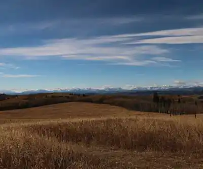
The Ann & Sandy Cross Conservation Area is a habitat conservation area protected under the Alberta Wildlife Act, and not a park. According to the operator, it covers 4,800 acres southwest of Calgary, off Highway 22X, and has about 20 km of interpretive trails. It is managed as a private charitable organization.
The operator's priority is conserving habitat for native wildlife. A series of guidelines governs visits, and entry is by registration at the Welcome Kiosk.
The routes
The operator's trail map names five routes:
- Mountain Lookout: 1.2 km.
- Rancher's Loop: 3.57 km.
- Fescue Loop: 4.77 km.
- Aspen Loop: 4.9 km.
- Paradise Loop: 8 km.
On the map, these routes share sections, so their lengths do not add up. The underlying trails are named Fescue Trail, Aspen Trail, Rancher's Trail, Mountain Trail and Paradise Trail. Time, elevation gain and difficulty per route: not published.
The map also marks four lookouts (Sandy's Lookout, Mountain Lookout, Pine Creek Lookout and West Side Lookout), along with benches, picnic tables, shelters and outhouses. The terrain is hilly and the trails are remote; the operator says the area is not maintained as a park.
Construction and trail access
According to the operator's notice dated August 25, 2026, construction is under way: the trail east of the lower parking lot is closed, and the road past the kiosk gives access to all trails. The path connecting Belvedere House, the education centre, is open. Check the operator's Trail Map page before you go.
Before you go
- Hours: daily from 4:00 a.m. to 11:00 p.m., year-round. The area is closed from 11 p.m. to 4 a.m.
- Registration: all visitors, including parking pass holders, must sign the register at the Welcome Kiosk, under the large trail map.
- Groups: groups of 10 or more must book online in advance.
- Parking: paid, $10 a day without an annual pass. Pay in cash, in an envelope placed in the brown donation box near the kiosk, or by card online. Display the tear-off slip on your dashboard; if you pay by card, display a paper showing your name, the date and "paid by card". Vehicles without proof of payment may get a notice, and vehicles repeatedly parked without paying are subject to towing.
- Access: from the lower parking lot only. The operator invites people who are only visiting the building to park for free in the upper lot.
- Washrooms: outhouses are shown on the map, and there is an exterior washroom attached to Belvedere House. The inside of the house may not be accessible during educational programs.
- Garbage: there are no garbage cans on the trails; pack out what you bring in.
What is not allowed
The operator does not allow dogs or other pets, horses, bicycles, cars and other vehicles, drones, camping, fires, smoking, hunting or firearms. Cross-country skiing is not permitted; snowshoeing is. Stay on the trails and keep a respectful distance from wildlife.
Wildlife and safety
According to the operator, bears and cougars are present. It recommends keeping your distance, making your presence known on the trails and, during the months when wildlife is more active, hiking with others and considering carrying bear spray. Wildlife sightings are posted at the kiosk when you sign in.
The operator also lists other hazards: cattle (on the property twice a year), fallen trees, fencing, holes, mud, ice, water, and stinging plants and insects. Visitors use the area at their own risk. The map notes limited cellular coverage and, in an emergency, says to call 911 first, then (403) 455-2095.
A little history
According to the operator, Ann and Sandy Cross donated nearly 2,000 acres to the Province of Alberta in 1987, at the time the largest private land donation in Canadian history. In 1996 they donated another 2,800 acres, for a total of 4,800 acres. Funds were raised in 1991 to build the education centre, Belvedere House.
Services and amenities
According to the operator: outhouses, picnic tables, benches and shelters along the trails, and an exterior washroom attached to Belvedere House. No garbage cans on the trails.
Everything you need for your next hike. Bilingual, printable, 1 page.
Get your free hiking checklistRecommended gear for this trail
As an Amazon Associate I earn from qualifying purchases.


Ready to go?
Everything you need to know before you goStarting Point
Lower parking lot (access to the trails). Organization's address: 20-194001 160 Street West, Foothills, Alberta T1S 4K9. Sign in at the Welcome Kiosk, under the large trail map. Access to the trails is from the lower parking lot only.
When?
Daily from 4:00 a.m. to 11:00 p.m., year-round. The area is closed from 11 p.m. to 4 a.m.
As an Amazon Associate I earn from qualifying purchases.
Affiliate links — LGPO may earn a commission at no extra cost to you.
- Hiking shoes Essential
- → Salomon Elixir Tour Mid WP · 203.38 $
- Layered clothing Essential
- Rain jacket Essential
- Trekking poles
- → Black Diamond Trail Ergo Cork · 69.99 $
- Headlamp
- → Petzl Actik Core 625 · 103.95 $
FAQ - Frequently asked questions
Everything you need to knowSimilar hikes nearby
Discover other trails you might enjoy
Mount Yamnuska
Foothills
Bluerock Wildland Provincial Park
Foothills
Frank Lake
Foothills
Bragg Creek Provincial Park
Foothills
Brown - Lowery Provincial Park
Foothills
Powderface Creek Trail
Foothills
Hiking near Calgary
127 trails to explore ~22 km away
We work hard to provide the most up-to-date and error-free data possible. If something seems incorrect, let us know! Your contribution helps the whole community.
Hikers' opinions
Be the first to review!
No hiker has shared their experience yet. Share your impressions and help other hikers!