

Ready to explore Restigouche River? Here's everything you need to know before you go!
Discover the trail
Trail description
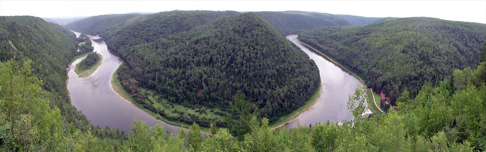
The Restigouche River is one of those places that quietly earns its reputation. Flowing through a landscape shaped by geology, time, and a whole lot of water, this river corridor offers a hiking experience that feels genuinely wild without demanding technical expertise. Whether you're following the riverbank or pushing into the surrounding terrain, the Restigouche has a way of holding your attention.
The River and Its Setting
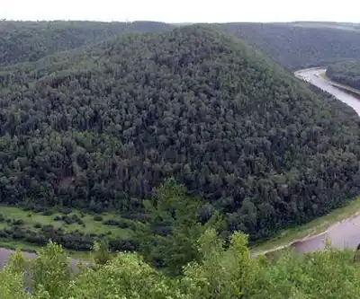
The Restigouche River flows through New Brunswick and Quebec's Eastern Townships, carving through a valley that feels remote even when you're not far from a road. The river itself is wide and powerful in stretches, calm and reflective in others. The surrounding landscape is heavily forested — a mix of softwoods and hardwoods that changes character depending on the season and the elevation you're hiking at.
The valley walls rise on both sides, giving the terrain a sense of depth that flat-country hikers will immediately notice. You're rarely walking on completely level ground here. The trail system follows the natural contours of the land, which means short climbs, root-covered descents, and the occasional muddy stretch after rain.
What the Hiking Is Actually Like
Trails in the Restigouche River area tend to reward patience. This isn't a destination where you tick off a summit and head home. The experience is more about moving through a living landscape — listening to the river, watching the light shift through the canopy, and occasionally spotting wildlife that hasn't noticed you yet.
The footing varies. Some sections are well-packed and easy to navigate, while others require a bit more attention, especially where the trail dips close to the water or crosses wet ground. Waterproof footwear is a practical choice rather than an optional one.
The river itself is a constant presence. In some spots you're right on the bank, close enough to hear the current clearly. In others, the trail pulls back into the forest and the river becomes something you sense more than see. That rhythm — river, forest, river again — is part of what makes hiking here feel different from a purely inland trail.
Wildlife and Natural Environment
The Restigouche River corridor is well known among anglers for its Atlantic salmon runs, and that reputation points to something important about the ecosystem: the water quality here is genuinely high, and the habitat supports a wide range of species. Hikers regularly encounter signs of beaver activity along the banks, and the forest is home to the usual mix of northeastern wildlife — white-tailed deer, black bear, moose in wetter areas, and a strong bird population throughout the warmer months.
The riparian zone along the river supports plant communities you won't find further inland. Fiddleheads push up through the leaf litter in spring. Wildflowers appear in clearings and along the water's edge. The forest floor is dense with ferns in summer, and the whole valley takes on a different character in fall when the hardwoods turn.
Practical Information
The Restigouche River area is accessible, but it's worth doing a bit of planning before you show up. Road conditions on access routes can vary, and some trailheads are easier to reach with a higher-clearance vehicle. Check conditions before heading out, especially in spring when roads can be soft and water levels are high.
- Footwear: Waterproof hiking boots are strongly recommended. The terrain near the river can be wet regardless of recent rainfall.
- Navigation: Bring a map or have an offline version of your route downloaded. Cell coverage in this area is unreliable.
- Water: The river is right there, but treat any water you collect. Carry enough for your planned outing.
- Wildlife awareness: This is bear country. Standard precautions apply — make noise on the trail, store food properly, and know what to do if you have an encounter.
- Insects: Black flies and mosquitoes can be significant in late spring and early summer. Bug repellent and appropriate clothing make a real difference.
Getting There
The Restigouche River runs through New Brunswick and Quebec, and getting there involves some driving on secondary roads. The upside is that once you arrive, the area doesn't feel overrun. Trailhead parking is typically informal — a cleared area off the road rather than a developed lot. Arrive early if you're visiting during peak season, not because it gets crowded in the way popular parks do, but because the best light and the quietest conditions are always in the morning.
Who This Is For
The Restigouche River suits hikers who are comfortable with natural, unmanicured terrain and don't need a lot of infrastructure to have a good time. If you're looking for paved paths, interpretive signs every hundred metres, and a snack bar at the trailhead, this isn't your spot. But if you want a genuine river valley experience in a landscape that hasn't been heavily managed or developed, this delivers.
It works well for solo hikers, pairs, and small groups. Families with older kids who are comfortable on uneven ground will find it manageable. It's not the right call for very young children or anyone who needs a well-marked, maintained trail system.
A Few Things Worth Knowing
- Water levels on the Restigouche can rise quickly after heavy rain. If you're planning to walk close to the bank, check the forecast and be aware of your surroundings.
- The area is used by anglers, particularly during salmon season. You'll likely share the river corridor with people fishing — a heads-up to keep noise reasonable near the water.
- Leave no trace principles apply here. Pack out everything you bring in, and stay on established paths where they exist to protect the riparian vegetation.
- Hunting seasons affect access and safety in some parts of the region. If you're hiking in fall, wear visible colours and be aware of what seasons are open in the area.
The Restigouche River is the kind of place that stays with you — not because it's dramatic or technically challenging, but because it's the real thing: a working river valley in a largely intact landscape, best experienced slowly and on its own terms.
The Essential Hiking Checklist
Everything you need for your next hike. Bilingual, printable, 1 page.
Get your free hiking checklistRecommended gear for this trail
As an Amazon Associate I earn from qualifying purchases.


Ready to go?
Everything you need to know before you goWhen?
How much?
As an Amazon Associate I earn from qualifying purchases.
Affiliate links — LGPO may earn a commission at no extra cost to you.
- Hiking shoes Essential
- → Salomon Elixir Tour Mid WP · 203.38 $
- Layered clothing Essential
- Rain jacket Essential
- Trekking poles
- → Black Diamond Trail Ergo Cork · 69.99 $
- Headlamp
- → Petzl Actik Core 625 · 103.95 $
FAQ - Frequently asked questions
Everything you need to knowSimilar hikes nearby
Discover other trails you might enjoy

Mount Brome (Bromont)
Eastern Townships
Mont Pinacle
Eastern Townships
Sutton Natural Environment Park
Eastern Townships

Parc De La Gorge De Coaticook
Eastern Townships

Mount Orford National Park
Eastern Townships

Parc national de Frontenac
Eastern Townships
Hiking near Sydney
22 trails to explore ~7477 km away
We work hard to provide the most up-to-date and error-free data possible. If something seems incorrect, let us know! Your contribution helps the whole community.
Hikers' opinions
Be the first to review!
No hiker has shared their experience yet. Share your impressions and help other hikers!