

Ready to explore Parc National Du Mont-Mégantic? Here's everything you need to know before you go!
Discover the trail
Available trails
| Trails | Distance | Elevation | Duration | Difficulty | GPX |
|---|---|---|---|---|---|
| 1.02 km | 70 m | 20min | Beginner | GPX | |
| 1.5 km | 20min | Beginner | |||
| 2.5 km | 33min | Beginner | |||
| 6 km | 1h30 | Intermediate | |||
| 3.9 km | 52min | Intermediate | |||
| 2.2 km | 60 m | 35min | Intermediate | ||
| 5.1 km | 390 m | 2h | Intermediate | ||
| 4.5 km | 290 m | 1h30 | Advanced | ||
| 5 km | 320 m | 1h30 | Advanced | ||
| 3 km | 480 m | 1h30 | Advanced |
Trail description
Description
Parc national du Mont-Mégantic sits in the Eastern Townships of Quebec, and it's one of those places that genuinely earns its reputation. The park is built around Mont Mégantic, one of the highest summits in southern Quebec, and it draws hikers, stargazers, and nature lovers from across the province and beyond. What makes it stand out isn't just the elevation or the trails — it's the combination of wild subalpine terrain, dense boreal forest, and one of the darkest skies in eastern North America.
The ASTROLab and the Dark Sky Reserve
Parc national du Mont-Mégantic is home to the ASTROLab, an astronomy interpretation centre located at the base of the mountain. The park sits at the heart of the Réserve internationale de ciel étoilé (International Dark Sky Reserve), the first of its kind in the world when it was designated. This isn't just a marketing angle — the lack of light pollution here is real and measurable, and on a clear night, the sky above the summit is genuinely spectacular. The observatory at the top of Mont Mégantic is a working research facility operated in partnership with Université de Montréal and Université Laval, and it's visible from the upper trails.
If you're planning a visit around stargazing, the ASTROLab offers evening programs and guided observatory visits. These fill up, so booking ahead is strongly recommended.
The Terrain
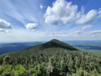
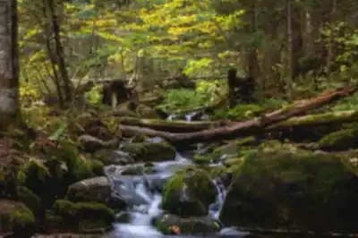
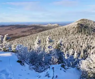
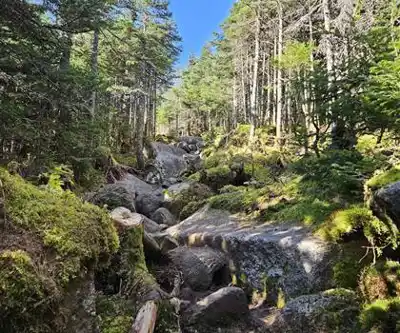
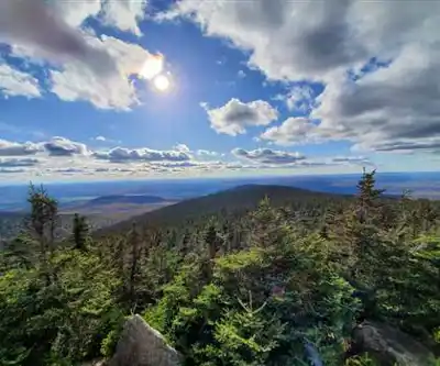
The park covers a landscape shaped by the Appalachian highlands. The lower elevations are dominated by mixed and deciduous forest — sugar maple, yellow birch, beech — while the upper slopes transition into boreal species like balsam fir and white spruce. Near the summit, the vegetation thins out and you get exposed rocky terrain with wide-open views across the Eastern Townships and into the surrounding hills.
The trails range from relatively gentle forest walks to more demanding climbs toward the summit. The upper sections of the mountain involve real elevation gain and can be rocky and rooted underfoot, so proper footwear matters. The summit area itself is above the treeline in places, which means exposure to wind and weather — conditions up top can be significantly different from what you left behind at the trailhead.
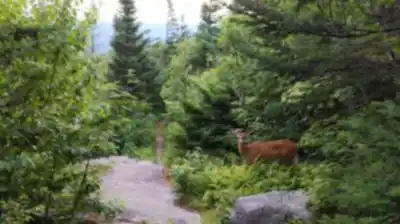
Wildlife and Ecology
The park protects a significant chunk of Appalachian highland ecosystem. White-tailed deer, black bear, moose, and a variety of bird species are present throughout the park. The forest is old enough in places to support species that need interior habitat, and the elevation gradient means you're moving through distinct ecological zones as you climb. Birdwatchers will find the park rewarding, particularly during migration periods.
Trail Network
The park has a developed trail network with routes suited to different ability levels. Some trails lead directly toward the summit of Mont Mégantic, while others explore the lower forest and connect to viewpoints and secondary summits in the area. Mont Saint-Joseph, which sits adjacent to Mont Mégantic and is topped by a chapel and the observatory dome, is accessible via trail and is a key destination within the park.
Trails are generally well-marked and maintained by Sépaq, the organization that manages Quebec's national parks. Signage at trailheads includes maps and difficulty ratings, which helps with planning. Some trails are multi-use, but the park's policies on specific uses — including dogs and cycling — should be confirmed directly with Sépaq or at the park entrance, as these can vary by trail and season.
Facilities and Access
The park has a proper visitor infrastructure. There's a reception and discovery centre near the main entrance, and the ASTROLab serves as a hub for interpretation programming. Camping is available within the park, with both serviced and rustic options, making it easy to base yourself here for a multi-day visit. Picnic areas and washroom facilities are available at key points.
Access to the park requires a daily entry fee, as with all Sépaq-managed parks in Quebec. Fees apply per vehicle or per person depending on the access point and activity. Annual passes for the Sépaq network are valid here. The main access road leads into the heart of the park from the surrounding municipalities in the Estrie region.
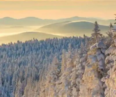
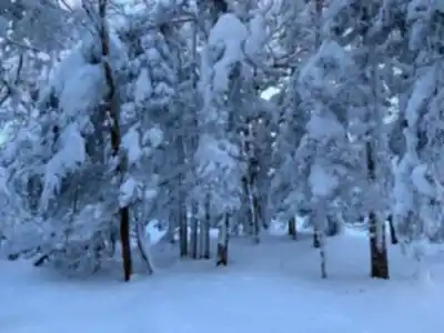
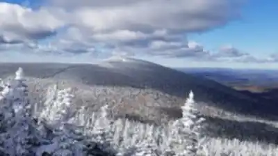
Seasons and Conditions
The park is open year-round, though the experience changes significantly with the seasons. Summer brings full trail access and the busiest visitor numbers. Fall is widely considered the best time to visit for foliage — the elevation and the mix of hardwood and boreal species produces strong colour, and the views from the upper trails are exceptional on a clear October day. Winter transforms the park into a cross-country skiing and snowshoeing destination, with groomed trails and a different kind of quiet. Spring can be muddy and the upper trails may hold snow well into May.
Weather at the summit should always be taken seriously. Even in summer, temperatures at the top can drop quickly and wind is a constant factor. Layers and rain gear are worth carrying regardless of what the forecast says at the trailhead.
What Makes It Worth the Drive
A lot of parks in southern Quebec offer good forest hiking, but Parc national du Mont-Mégantic gives you something harder to find: genuine summit terrain, a functioning astronomical observatory you can actually visit, and night skies that most people living in urban Quebec have never experienced. The combination of a serious hike and a world-class stargazing program in the same location is unusual, and it makes the park a natural choice for a full weekend rather than a day trip.
The Eastern Townships setting also means the surrounding area has plenty to offer — small towns, local food, and a landscape that feels distinctly different from the Laurentians or the Charlevoix. If you're building a longer trip around outdoor time in Quebec, this park fits naturally into that kind of itinerary.
Services and amenities
This information may vary by season.
Recommended gear for this trail


Ready to go?
Everything you need to know before you goStarting Point
To access the hiking trails, you can start at the main trailhead located at 189 Route du Parc, Notre-Dame-des-Bois, QC J0B 2E0. There is a parking lot available at this address. Additionally, another trailhead can be accessed from the Franceville sector, with parking available at 2140 Chemin de Franceville, La Patrie, QC J0B 1Y0. Both locations provide entry points to explore the various trails in the area.
When?
How much?
- Hiking shoes Essential
- → Salomon Elixir Tour Mid WP · 203.38 $
- Layered clothing Essential
- Rain jacket Essential
- Trekking poles
- → Black Diamond Trail Ergo Cork · 69.99 $
- Headlamp
- → Petzl Actik Core 625 · 103.95 $
FAQ - Frequently asked questions
Everything you need to knowThe Essential Hiking Checklist
Everything you need for your next hike. Bilingual, printable, 1 page.
Download the free checklistAlternatives and suggestions
Similar hikes nearby
Discover other trails you might enjoy

Mount Brome (Bromont)
Eastern Townships

Mont Pinacle
Eastern Townships

Sutton Natural Environment Park
Eastern Townships

Parc De La Gorge De Coaticook
Eastern Townships

Mount Orford National Park
Eastern Townships

Parc national de Frontenac
Eastern Townships
Hiking near Sherbrooke
53 trails to explore ~60 km away
We work hard to provide the most up-to-date and error-free data possible. If something seems incorrect, let us know! Your contribution helps the whole community.
Hikers' opinions