
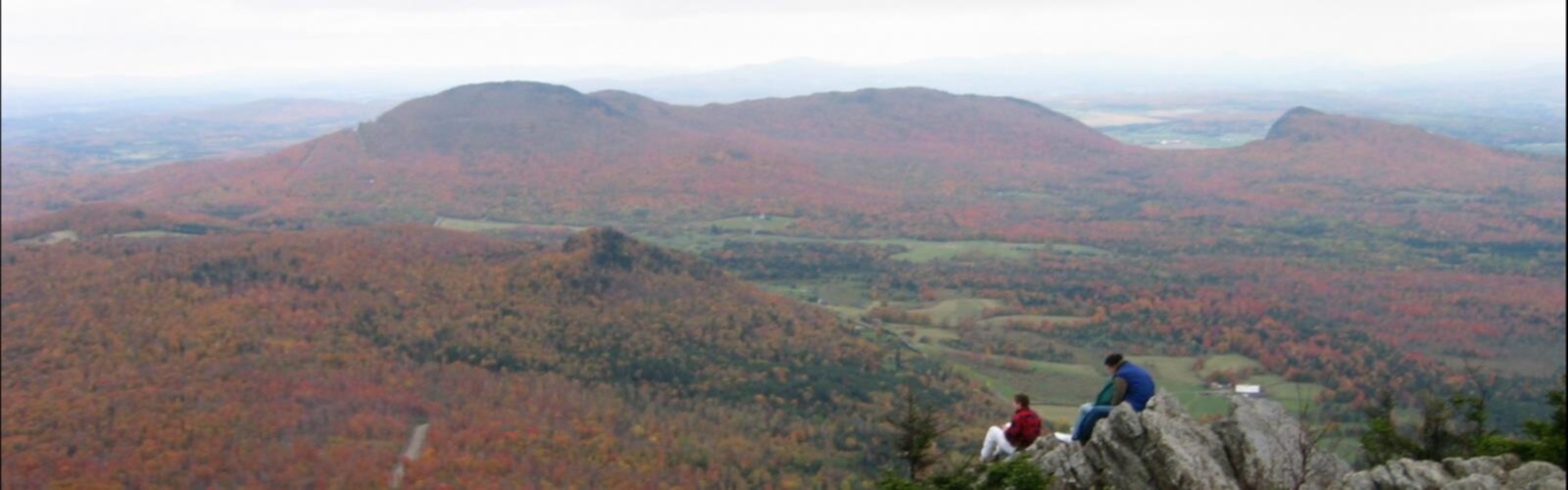

Ready to explore Mont Yapeitso? Here's everything you need to know before you go!
Discover the trail
Oh no! We don't have any photos 😢
This trail hasn't been captured yet. Be the first to share your adventure!Trail description
Mont Yapeitso is one of those summits that rewards the curious hiker willing to venture into the wilder corners of Quebec's Côte-Nord region. Remote, rugged, and largely off the beaten path, this mountain offers an experience that feels genuinely earned — the kind of place where you're more likely to share the trail with a caribou than another hiker.
The Mountain and Its Setting
Mont Yapeitso rises from the boreal landscape of the Côte-Nord, a region defined by vast coniferous forests, granite outcrops, and a sense of space that's hard to find anywhere else in Quebec. The name itself reflects the deep Indigenous heritage of this territory, situated within the ancestral lands of the Innu people who have known and traveled these highlands for generations.
The terrain here is characteristic of the northern Quebec interior: dense black spruce and balsam fir give way to more open, windswept terrain as you gain elevation. The upper reaches of the mountain offer exposed rocky ground where the treeline thins and the sky opens up. On a clear day, the views stretch across an unbroken expanse of boreal wilderness — no roads, no towns, just forest, lakes, and ridgelines rolling toward the horizon.
What to Expect on the Trail
Mont Yapeitso is not a heavily developed hiking destination. This is backcountry Quebec, and the experience reflects that. Trail infrastructure is minimal compared to more popular provincial parks, so hikers should come prepared with solid navigation skills, a detailed topographic map, and a GPS device. Don't rely solely on trail markers or a well-worn path to guide you.
The approach to the summit takes you through classic Côte-Nord boreal forest. The ground can be wet and uneven, with sections of exposed root systems, boggy patches, and rocky scrambles depending on the route and season. Waterproof footwear is a practical choice rather than an optional one out here.
As you climb, the forest gradually opens. The transition zone between closed boreal forest and the more exposed subalpine terrain near the summit is one of the most interesting parts of the hike — the vegetation shifts noticeably, and the wind picks up. The summit itself offers that wide-open, unobstructed feeling that makes the effort worthwhile.
Wildlife and Natural Environment
The Côte-Nord interior is serious wildlife country. Woodland caribou range through these highlands, and their presence is a reminder that you're moving through a functioning boreal ecosystem. Black bear, moose, and a variety of boreal bird species are also part of the landscape. Keep your distance from any wildlife you encounter, store food properly, and make noise on the trail to avoid surprising animals.
The boreal forest surrounding Mont Yapeitso is ecologically significant — old-growth pockets, lichen-covered rock faces, and the network of lakes and rivers that define the Côte-Nord watershed all contribute to a rich and largely undisturbed natural environment. This is the kind of place where the wilderness feels intact.
Getting There
Access to Mont Yapeitso requires planning. The Côte-Nord is a large and sparsely populated region, and getting to remote trailheads often involves long drives on unpaved forestry roads. Check road conditions before you go — these routes can be affected by logging traffic, seasonal closures, and weather. A high-clearance vehicle is strongly recommended.
Fuel up and stock up on supplies before heading into the backcountry. Services are limited once you leave the main highway corridor, and cell coverage is unreliable to nonexistent in much of the interior. Let someone know your itinerary and expected return time before you set out.
Practical Information
- Navigation: Carry a topographic map and GPS. Trail signage may be limited or absent in sections.
- Footwear: Waterproof hiking boots are strongly recommended given the terrain and potential for wet conditions.
- Vehicle: A high-clearance vehicle is advisable for forestry road access.
- Communication: Cell service is unreliable in the Côte-Nord interior. Consider a satellite communicator for backcountry trips.
- Wildlife awareness: Woodland caribou, moose, and black bear are present in the area. Follow standard backcountry wildlife protocols.
- Leave No Trace: This is a sensitive boreal environment. Pack out everything you bring in and stay on established routes where they exist.
- Trip planning: Inform someone of your plans and expected return before heading out.
Best Time to Visit
The hiking season on the Côte-Nord typically runs from late spring through early fall, once snow has cleared from the higher elevations and forestry roads have dried out enough for access. Summer offers the longest days and the most stable conditions. Fall brings dramatic color to the boreal forest and cooler temperatures that make for comfortable hiking — though early snowfall is possible at elevation as the season progresses. Spring can be wet and buggy, but the landscape is alive and the crowds (such as they are) are minimal.
Who This Hike Is For
Mont Yapeitso is best suited to experienced hikers who are comfortable with backcountry travel, self-navigation, and the unpredictability that comes with remote terrain. If you're looking for a well-signed, heavily trafficked trail with facilities at the trailhead, this isn't it. But if you're after a genuine wilderness experience in one of Quebec's most expansive and underexplored regions, Mont Yapeitso delivers exactly that — a summit earned through real effort, in a landscape that still feels wild.
The Essential Hiking Checklist
Everything you need for your next hike. Bilingual, printable, 1 page.
Get your free hiking checklistRecommended gear for this trail
As an Amazon Associate I earn from qualifying purchases.


Ready to go?
Everything you need to know before you goWhen?
How much?
As an Amazon Associate I earn from qualifying purchases.
Affiliate links — LGPO may earn a commission at no extra cost to you.
- Hiking shoes Essential
- → Salomon Elixir Tour Mid WP · 203.38 $
- Layered clothing Essential
- Rain jacket Essential
- Trekking poles
- → Black Diamond Trail Ergo Cork · 69.99 $
- Headlamp
- → Petzl Actik Core 625 · 103.95 $
FAQ - Frequently asked questions
Everything you need to knowSimilar hikes nearby
Discover other trails you might enjoy

Boisé De La Pointe Saint-gilles
North Shore

Parc Nature De Pointe-aux-outardes
North Shore
Réserve faunique de Port-Cartier-Sept-Îles
North Shore

Parc National D'anticosti
North Shore

Centre De Vacances Ferme 5 Étoiles
North Shore

Sentier Pédestre De Portneuf-sur-mer
North Shore
Hiking near Quebec City
40 trails to explore ~615 km away
We work hard to provide the most up-to-date and error-free data possible. If something seems incorrect, let us know! Your contribution helps the whole community.
Hikers' opinions
Be the first to review!
No hiker has shared their experience yet. Share your impressions and help other hikers!