

Ready to explore Parc Des Chutes Dorwin? Here's everything you need to know before you go!
Discover the trail
Available trails
| Trails | Distance | Elevation | Duration | Difficulty | GPX |
|---|---|---|---|---|---|
| 3.07 km | 261 m | 1h | GPX | ||
| 1 km | 0 m | 15min | Beginner | ||
| 0.1 km | 0 m | 15min | Beginner | ||
| 0.1 km | 0 m | 15min | Beginner | ||
| 0.3 km | 0 m | 15min | Beginner | ||
| 0.1 km | 0 m | 15min | Beginner | ||
| 0.4 km | 0 m | 15min | Beginner | ||
| 0.2 km | 0 m | 15min | Beginner | ||
| 0.8 km | 0 m | 15min | Beginner |
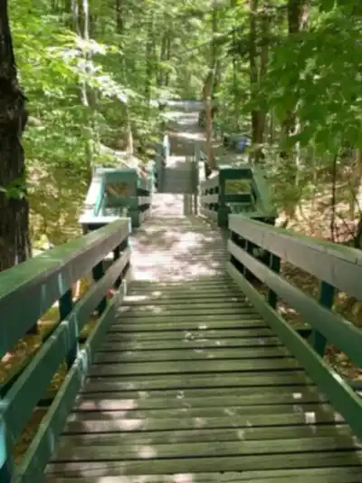
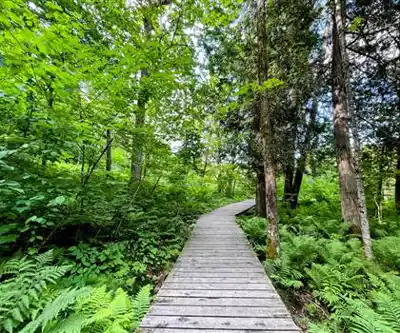
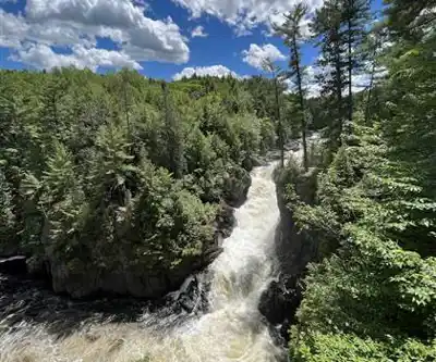
Trail description
{
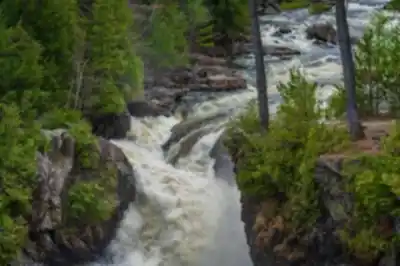
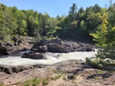
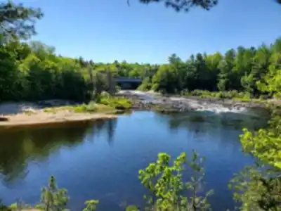
"main_correction": "Replace distance/duration/trail structure content. Change '3-kilometer network' and 'nearly 4 kilometers total' to single consistent reference: '2.4 km main trail' per AllTrails. Change '1 hour and 15 minutes' to '46 minutes average' or 'approximately 45-50 minutes'. Remove descriptions of 'a dozen interconnected paths' and specific named trail segments (Cap Rocheux, Sarsaparilla, Tilleuls, etc.) that cannot be verified. Change elevation from vague '60 meters spread across entire route' to verified '93 meters elevation gain'. Keep accurate information: Ouareau River, 18m waterfall, century-old pine forest, easy difficulty, family-friendly.",
"html_update": "Keep overall structure but revise content to state: '2.4 km main trail with 93 m elevation gain' instead of conflicting 3km/4km claims. State 'approximately 46 minutes' instead of '1 hour 15 minutes'. Remove 'a dozen interconnected paths' language and replace with accurate reference to 'over 3 km of ecological trails' from web source. Remove unverified specific trail names and distances. Keep waterfall viewing, forest character, accessibility, and practical information sections."
}
Services and amenities
This information may vary by season.
Recommended gear for this trail


Ready to go?
Everything you need to know before you goStarting Point
Dorwin Falls Park is located just 2 km from the beach municipal of Rawdon in Lanaudiere. The park regional which houses these falls is located just at the entrance to the village on Route 337. Its address is 3 102 1st Avenue, Route 337, Rawdon, QC J0K 1S0, Quebec.
Some trails remain closed during non-summer months. A parking is located not far from the Cap rocheux trail. This will be an ideal starting point for an exceptional hike in Dorwin Falls Park.
When?
How much?
- Hiking shoes Essential
- → Salomon Elixir Tour Mid WP · 203.38 $
- Layered clothing Essential
- Rain jacket Essential
- Trekking poles
- → Black Diamond Trail Ergo Cork · 69.99 $
- Headlamp
- → Petzl Actik Core 625 · 103.95 $
FAQ - Frequently asked questions
Everything you need to knowThe Essential Hiking Checklist
Everything you need for your next hike. Bilingual, printable, 1 page.
Download the free checklistSimilar hikes nearby
Discover other trails you might enjoy

Mont Sourire
Lanaudière

Parc Régional De La Forêt Ouareau
Lanaudière

Parc des Cascades
Lanaudière

La Montagne Noire
Lanaudière

Mont Ouareau
Lanaudière

Abbaye Val Notre-Dame
Lanaudière
Hiking near Laval
97 trails to explore ~47 km away
We work hard to provide the most up-to-date and error-free data possible. If something seems incorrect, let us know! Your contribution helps the whole community.
Hikers' opinions