
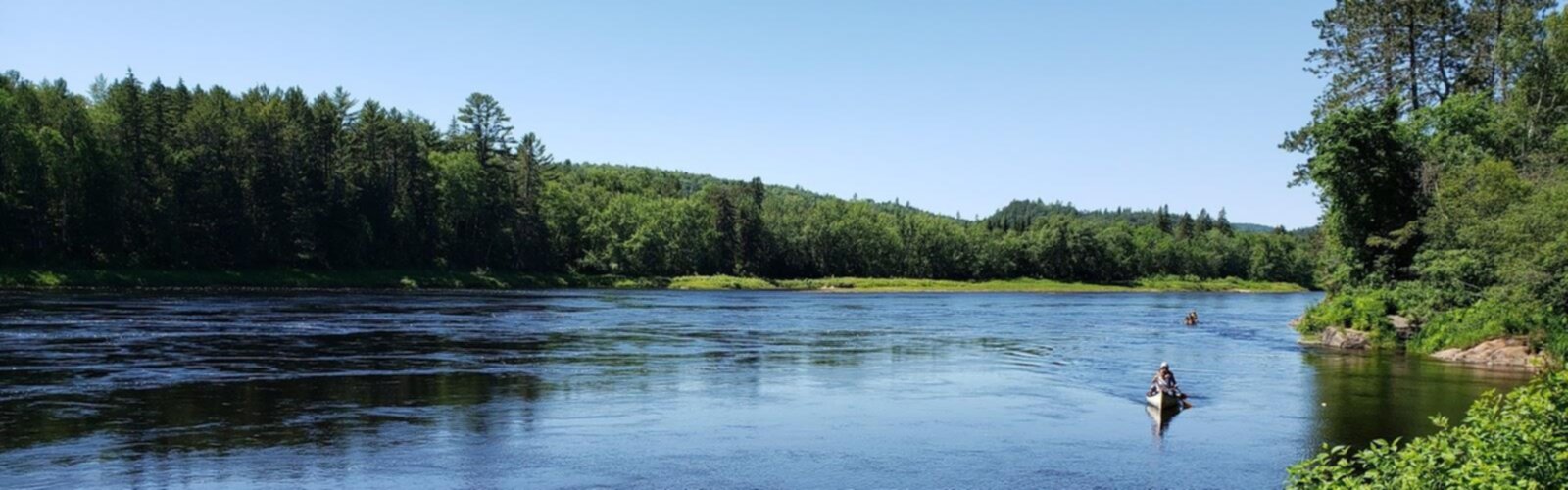

Ready to explore Centre D'aventure Mattawin? Here's everything you need to know before you go!
Discover the trail
Trail description
Centre D'aventure Mattawin sits in the Mauricie region and makes a solid base for anyone who wants to spend a day (or more) outdoors with options that go beyond a single trail. It’s the kind of place where you can start with a hike through forest and along water, then build the rest of your trip around what you feel like doing—quiet exploring, guided outings, or higher-energy river adventures.
Hiking experience at Centre D'aventure Mattawin
The hiking here is built around well-maintained paths that move through a mix of classic Mauricie landscapes: lush forest, peaceful river sections, and climbs that lead to viewpoints. Expect a route that changes as you go—some stretches feel sheltered under trees, others open up as you get closer to lookouts where you can take in the surrounding wilderness.
If you’re planning your day around the hike itself, the main trail information is straightforward: 6.4 km with about 300 m of elevation gain. It’s rated Moderate and typically takes around 2h30, which leaves time to slow down, watch for wildlife, and enjoy the viewpoints rather than treating it like a quick fitness loop.
Terrain and what you’ll see on the trail
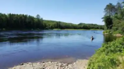
While the exact feel of each section depends on which trail choices you make on-site, the overall experience is a blend of forest walking and riverside scenery with a noticeable climb to reach viewpoints. The forested portions give you that quiet, enclosed feel where you’re walking among dense greenery, and the river sections add a calmer rhythm—more light, more open sightlines, and the chance to pause and listen to water moving nearby.
The viewpoints are a key reason this place stands out. The hike isn’t just about being in the woods; it’s about gaining enough height to change your perspective and get those broader views that make the effort feel worthwhile. If you’re hiking with a group where people have different paces, these natural “milestones” are also good regrouping spots.
Nature, flora, and wildlife to watch for
Centre D'aventure Mattawin is a good place to pay attention to the smaller details as you walk. The trails take you through diverse landscapes that highlight the region’s mix of flora and fauna, and that variety tends to show up in the little changes along the route—different forest pockets, damp areas closer to the river, and transitions as you climb toward the viewpoints.
Wildlife sightings are part of the appeal here. Keep an eye out for deer, beavers, and a variety of bird species. The river environment is especially worth scanning slowly—beavers in particular are easier to spot when you’re patient and quiet, and birds often stand out more when you pause and listen rather than walking continuously.
Who this hike works for
The centre caters to a wide range of comfort levels, from people who hike often to those who are just starting to explore trails. The overall hiking offering is set up so you can pick something that matches your pace and preference, which is useful if you’re traveling with mixed experience levels. With the main hike sitting in the moderate range, it’s approachable for most active visitors while still feeling like a real outing thanks to the elevation gain and the viewpoint payoff.
If you’re newer to hiking, plan to take the 2h30 estimate as an easy-going pace rather than a target. The better approach here is to build in time for photo stops and wildlife watching, especially along river sections where you’ll naturally want to linger.
Beyond hiking: river adventures and guided options
One of the biggest advantages of Centre D'aventure Mattawin is that it’s not limited to hiking. If you want to make the most of being in Mauricie, you can add guided tours and adventure packages to your visit. These include canoeing on the Mattawin River and white-water rafting for a more adrenaline-focused experience.
This mix of land and water activities makes planning easier: you can set up a day where the hike is the steady, scenic anchor and the river time is either a relaxing add-on (canoe) or the main event (rafting). Either way, it’s a practical way to experience the region’s natural character from different angles—quiet forest trails on foot, then the moving water of the river.
On-site support and planning help
The staff at Centre D'aventure Mattawin are described as friendly and genuinely outdoors-focused, and that matters when you’re trying to plan a route that fits your group. They can share tips on trail conditions, recommend routes based on your interests, and help you think through safety for the day. If you’re unsure how the trails will feel underfoot or you’re deciding between hiking-only versus combining it with a guided river activity, that local input is one of the most useful resources you’ll have.
This is especially helpful for visitors who are building a first trip to Mauricie, or anyone who prefers a bit of structure. Guided tours and packaged adventures give you an option to explore without having to plan every detail yourself.
Staying overnight: cabins and camping
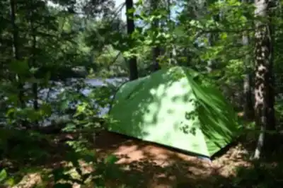
If you want more than a single-day visit, Centre D'aventure Mattawin offers ways to stay on-site so you can slow the pace down and spread activities over more time. Accommodation options include cozy cabins and camping sites under the stars, which makes it easier to turn a hike-and-river day into a longer outdoor stay.
Staying overnight also lets you experience the area in a calmer way. You can hike without feeling rushed, choose a second activity like canoeing or rafting, and still have downtime to enjoy the quiet of the wilderness setting that Mauricie is known for.
The Essential Hiking Checklist
Everything you need for your next hike. Bilingual, printable, 1 page.
Get your free hiking checklistRecommended gear for this trail
As an Amazon Associate I earn from qualifying purchases.


Ready to go?
Everything you need to know before you goStarting Point
To access the hiking trails, head to the main trailhead located at 3911 Route 155, Trois-Rives, QC G0X 2C0. This is the primary starting point for exploring the area.
When?
Tuesday: Closed
Wednesday: Closed
Thursday: Closed
Friday: Closed
Saturday: 9:00 AM – 5:00 PM
Sunday: Closed
How much?
As an Amazon Associate I earn from qualifying purchases.
Affiliate links — LGPO may earn a commission at no extra cost to you.
- Hiking shoes Essential
- → Salomon Elixir Tour Mid WP · 203.38 $
- Layered clothing Essential
- Rain jacket Essential
- Trekking poles
- → Black Diamond Trail Ergo Cork · 69.99 $
- Headlamp
- → Petzl Actik Core 625 · 103.95 $
FAQ - Frequently asked questions
Everything you need to knowSimilar hikes nearby
Discover other trails you might enjoy

Aux berges du lac Castor
Mauricie

Parc De La Rivière Batiscan
Mauricie

Domaine de la forêt perdue
Mauricie

Réserve Faunique Mastigouche
Mauricie

Parc-L'île-Melville
Mauricie

Chute du Diable
Mauricie
Hiking near Quebec City
40 trails to explore ~132 km away
We work hard to provide the most up-to-date and error-free data possible. If something seems incorrect, let us know! Your contribution helps the whole community.
Hikers' opinions
Be the first to review!
No hiker has shared their experience yet. Share your impressions and help other hikers!