
Ready to explore Réserve faunique La Vérendrye? Here's everything you need to know before you go!
Discover the trail
Available trails
| TrailTrails | Dist.Distance | GainElevation | Difficulty | GPX |
|---|---|---|---|---|
|
Beginner
|
2 km | — | Beginner |
Trail description
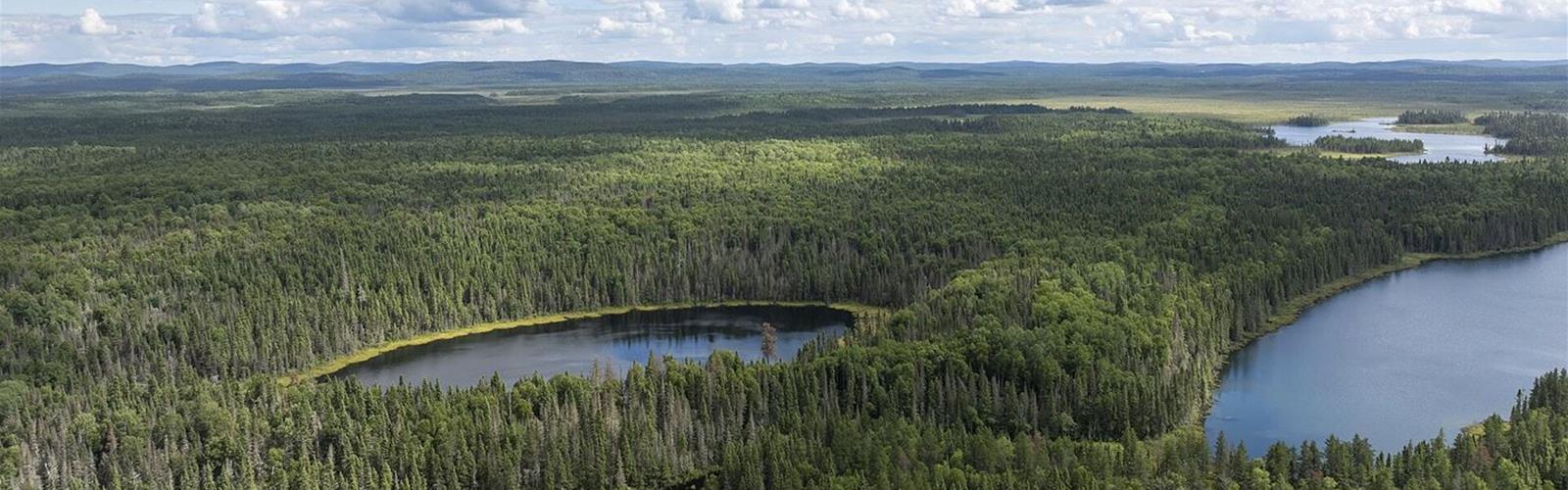
A vast territory of water and forest
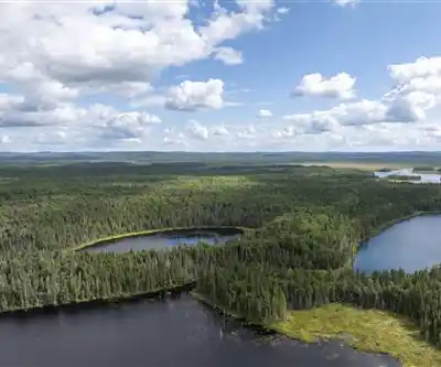
The reserve covers 12,589 km². It has more than 4,000 bodies of water, including two large reservoirs, Cabonga and Dozois, and takes in Grand lac Victoria. The main tree species are black spruce, white spruce, jack pine, white pine, red pine and white birch. Sépaq counts more than 40 mammal species here, including moose, bear and wolf, and 150 bird species.
The territory started out in 1939 as the Route-Mont-Laurier–Senneterre reserve, the year Route 117 was due to be completed to Abitibi. About ten years later it became a park named La Vérendrye, in memory of the explorer who died in 1749, and in 1979 it became a wildlife reserve. Two Algonquin communities, Grand-Lac-Victoria and Lac-Rapide, lie within its boundaries.
Where walking fits in
Sépaq presents canoe-camping (more than 800 km of developed routes, nearly 20 lake circuits and 500 overnight campsites), fishing, camping and hunting. Its activities page presents a single trail for short walks, Les Chutes-du-Lac-Roland.
The trails
- Les Chutes-du-Lac-Roland: 2 km, easy. The trailhead is on Route 117, 40 km from the south entrance. The listed attraction is the falls. Sépaq describes a theme on how animals and plants adapt to their environment, with interpretive panels on the Algonquin nation.
- Baie des Sables (Grand lac Victoria): a marsh trail with a boardwalk linking the Du Till campground to the Baie des Sables campground. Sépaq does not give its length.
Before you go
Getting there. Access is by Route 117. From the south reception, Sépaq gives 287 km to Montréal, 180 km to Ottawa and 523 km to Québec City; the north reception is 57 km from Val-d'Or.
Reception posts. The south, Lac-Rapide and north reception posts open in season: dates and hours are on Sépaq's information page. Opening dates for the trail itself are not specified: check with Sépaq at 819-438-2017.
Fees. No fee is listed for the trail. Sépaq charges for access to the reserve and its activities: see its rates page. To confirm before you go: 819-438-2017.
Dogs. Sépaq admits leashed dogs in its wildlife reserves, but not everywhere. They are not allowed at accommodation sites (except some campsites), on developed shorelines and play areas, inside buildings or on ski trails. Hiking trails are not on that list, but Sépaq does not state the rule for Les Chutes-du-Lac-Roland: see Sépaq's rule for wildlife reserves. A dog weighing 20 kg or more must wear a halter or harness, and the person in charge must pick up its waste.
Hunting. Hunting takes place in the reserve. According to Sépaq, daily small-game hunting runs from October 15, 2026 to January 15, 2027, and bear hunting from mid-May to the end of June. Ask Sépaq (819-438-2017) whether these periods affect the trail.
On site. Forest roads in the reserve are public multi-use roads: Sépaq asks everyone to drive carefully. Recreational drones are not permitted. Depending on the time of summer, raspberries, strawberries, blueberries and mushrooms can be picked free of charge in the reserve (July and August).
Who it suits
A short, easy 2 km walk added to a canoe-camping, fishing or camping stay in the reserve, or a stop along Route 117. Not a full day of hiking: Sépaq describes only one 2 km trail, plus a marsh trail whose length it does not give.
Services and amenities
South, Lac-Rapide and north reception posts (in season): information, shop, access rights and fishing licences. The south reception has a permanent exhibit on fur-bearing animals, fish and birds. At Le Domaine: service station, convenience store, rest area with Wi-Fi and four level 3 charging stations.
Everything you need for your next hike. Bilingual, printable, 1 page.
Get your free hiking checklistRecommended gear for this trail
As an Amazon Associate I earn from qualifying purchases.


Ready to go?
Everything you need to know before you goStarting Point
Les Chutes-du-Lac-Roland: Route 117, 40 km from the reserve's south entrance.
When?
As an Amazon Associate I earn from qualifying purchases.
Affiliate links — LGPO may earn a commission at no extra cost to you.
- Hiking shoes Essential
- → Salomon Elixir Tour Mid WP · 203.38 $
- Layered clothing Essential
- Rain jacket Essential
- Trekking poles
- → Black Diamond Trail Ergo Cork · 69.99 $
- Headlamp
- → Petzl Actik Core 625 · 103.95 $
FAQ - Frequently asked questions
Everything you need to knowOutings near Réserve faunique La Vérendrye
Discover other trails you might enjoy

Mont Sir-Wilfrid
Laurentides · 48.3 km away

Parc régional Montagne du Diable
Laurentides · 50.4 km away
Sentier récréatif des Lacs des Cèdres
Outaouais · 55.9 km away

Centre d'interprétation du cerf de Virginie
Outaouais · 61.3 km away

Sentier écologique « Le Petit Castor »
Laurentides · 79.6 km away

Mont Cayamant
Outaouais · 81.4 km away
Hiking near Gatineau
74 trails to explore ~151 km away
We work hard to provide the most up-to-date and error-free data possible. If something seems incorrect, let us know! Your contribution helps the whole community.
Hikers' opinions
Be the first to review!
No hiker has shared their experience yet. Share your impressions and help other hikers!