

Ready to explore Camp Mercier? Here's everything you need to know before you go!
Discover the trail
Available trails
| Trails | Distance | Elevation | Duration | Difficulty | GPX |
|---|---|---|---|---|---|
| 1.3 km | 0 m | 17min | Beginner | ||
| 2 km | 0 m | 27min | Beginner | ||
| 1.2 km | 0 m | 16min | Beginner | ||
| 4.8 km | 0 m | 1h | Beginner | ||
| 0.8 km | 0 m | 15min | Beginner | ||
| 2.2 km | 50 m | 34min | Beginner | ||
| 2.6 km | 0 m | 35min | Beginner | ||
| 2.6 km | 0 m | 35min | Beginner | ||
| 0.9 km | 0 m | 15min | Intermediate | ||
| 6.4 km | 100 m | 1h30 | Intermediate | ||
| 6.8 km | 0 m | 1h30 | Advanced |
Trail description
Description
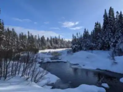
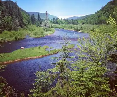
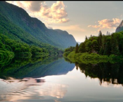
Camp Mercier is a well-established outdoor destination in the Québec City region, tucked into the forested hills of the Laurentian Mountains. It's close enough to the city for a straightforward day trip, but the moment you step onto the trails, the noise and pace of urban life drop away quickly. What you get instead is dense boreal forest, streams running through the landscape, and enough elevation to earn some real views.
Trail network and what the hiking feels like
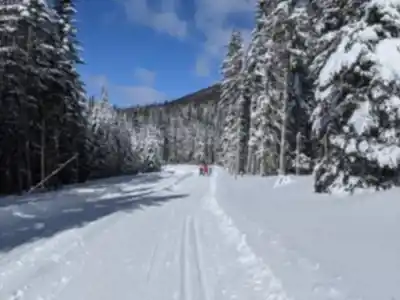
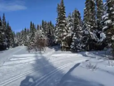
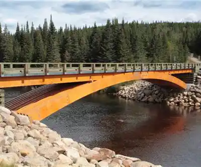
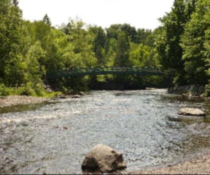
Camp Mercier offers an extensive trail network with genuine variety built into it. You're not walking the same terrain from start to finish. Sections of trail run through sheltered forest where the canopy closes in and the light filters through, and then the landscape opens up as you gain elevation and the surrounding mountains come into view. In between, several routes follow alongside streams, and those stretches tend to be where people naturally slow their pace—the sound of moving water and the scenery make it easy to linger.
The network is set up so that you can shape your day around your energy and experience. Shorter, lower-commitment loops are available if you want a relaxed outing focused on nature and scenery. If you want to push further, the trails connect into broader regional routes, which means you can keep going without needing to double back or return to the car. That connectivity is one of the more practical advantages of hiking here—it gives the day room to grow if you're feeling good.
Sentier des Loups (Wolf Trail)
Among the named routes at Camp Mercier, the Sentier des Loups—the Wolf Trail—stands out for its panoramic views. This is the route to prioritize if you're motivated by wide, open vistas rather than just forest walking. At the viewpoints, you get a real sense of the scale of the Laurentian landscape: mountains layered in the distance, forest stretching out in every direction.
It's worth building some extra time into your plan for this trail. The viewpoints are the kind of spots where you'll want to stop, take it in, and not feel rushed. If you're hiking with someone who's newer to the area, this is also a good route to start with—the payoff at the top makes a strong first impression of what the region looks like from above.
Connecting to longer routes
One of the things that sets Camp Mercier apart from smaller, self-contained trail systems is how well it connects outward. The local network links into other regional trails, so if you arrive with a full day and strong legs, you're not limited to looping back through the same terrain. You can use Camp Mercier as a launching point and extend your route into the surrounding area, combining the Wolf Trail's viewpoints with longer stretches of forest and waterway walking.
This makes it a useful destination for hikers who want to plan a bigger day without having to drive between multiple trailheads.
Four-season use
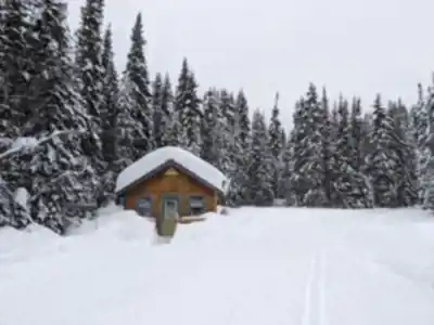
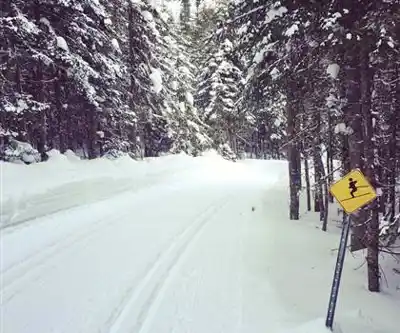
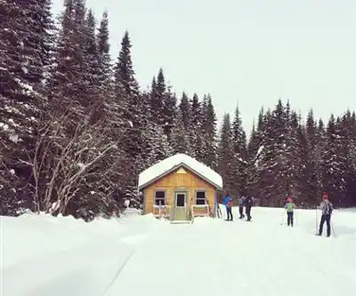
Camp Mercier stays active year-round, and the experience shifts noticeably with the seasons. In winter, the trail system transitions into a well-maintained network for cross-country skiing and snowshoeing. The maintenance matters here—when conditions are cold and the snow is deep, a well-kept trail makes a real difference in how enjoyable the outing is. The winter atmosphere at Camp Mercier is also worth mentioning on its own terms: quiet forest, crisp air, and the same mountain landscape looking completely different under snow.
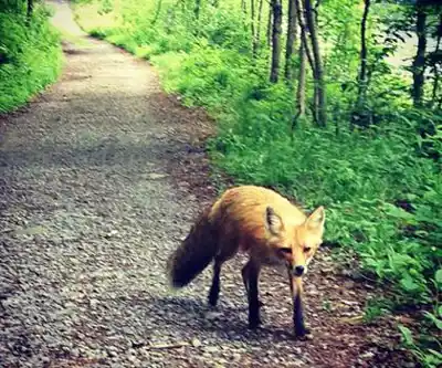
In the warmer months, mountain biking is another active use of the trail system. For those who prefer a slower pace, the area's diverse flora and fauna make it well-suited to birdwatching and general wildlife observation. The mix of forest types and the presence of streams creates a range of small habitats, which tends to support more varied wildlife activity—especially if you're moving quietly and taking your time near forest edges and waterways.
On-site orientation and staff
Arriving at Camp Mercier for the first time is straightforward, partly because the site has staff available to help you get oriented. If you're not sure which trail fits your time or fitness level, or if you want to know what to watch for in terms of wildlife along specific routes, the staff can give you practical, current information. That kind of local knowledge is genuinely useful—especially if you're trying to decide between a shorter loop and a longer connection into the regional network.
Who this hike works for
Camp Mercier covers a wide range of hiking styles and experience levels. Beginners can keep things manageable with shorter forest walks that focus on the scenery and the streamside sections. More experienced hikers can push into the longer regional connections and take on more elevation. Groups with mixed abilities benefit from the network's flexibility—there's enough variety that different people can find a route that suits them without the whole group having to compromise.
It also holds up well for repeat visits. The combination of forest, waterways, and mountain viewpoints means the experience changes depending on which route you take, and the seasonal shifts give the same trails a noticeably different character throughout the year.
Distance, elevation, and time
- Distance: 25 km
- Elevation gain: 800 m
- Estimated duration: 2h30
- Difficulty: Easy
These figures reflect one route within the broader network at Camp Mercier. Because the trail system includes multiple options of varying length and difficulty, your actual outing may differ depending on which route or combination of routes you choose. If panoramic views are your priority, the Sentier des Loups (Wolf Trail) is the route to build your day around.
Services and amenities
This information may vary by season.
Recommended gear for this trail


Ready to go?
Everything you need to know before you goStarting Point
To access the hiking trails, head towards camp mercier in the Laurentides Wildlife Reserve. The main trailhead is located at 2120 Route 175, Stoneham-et-Tewkesbury, QC G3C 2N8. There is a parking lot available at this address for visitors.
When?
Tuesday: 8:30 AM – 4:00 PM
Wednesday: 8:30 AM – 4:00 PM
Thursday: 8:30 AM – 4:00 PM
Friday: 8:30 AM – 4:00 PM
Saturday: 8:30 AM – 4:00 PM
Sunday: 8:30 AM – 4:00 PM
How much?
- Hiking shoes Essential
- → Salomon Elixir Tour Mid WP · 203.38 $
- Layered clothing Essential
- Rain jacket Essential
- Trekking poles
- → Black Diamond Trail Ergo Cork · 69.99 $
- Headlamp
- → Petzl Actik Core 625 · 103.95 $
FAQ - Frequently asked questions
Everything you need to knowTuesday: 8:30 AM – 4:00 PM
Wednesday: 8:30 AM – 4:00 PM
Thursday: 8:30 AM – 4:00 PM
Friday: 8:30 AM – 4:00 PM
Saturday: 8:30 AM – 4:00 PM
Sunday: 8:30 AM – 4:00 PM
The Essential Hiking Checklist
Everything you need for your next hike. Bilingual, printable, 1 page.
Download the free checklistSimilar hikes nearby
Discover other trails you might enjoy
Parc National De La Jacques Cartier
Québec City Region
Parc Chauveau
Québec City Region

Mont Sainte-Anne
Québec City Region

Les Marais Du Nord
Québec City Region

Vallée Bras-du-nord, Coop De Solidarité
Québec City Region

Parc De La Forêt Ancienne Du Mont Wright
Québec City Region
Hiking near Quebec City
40 trails to explore ~46 km away
We work hard to provide the most up-to-date and error-free data possible. If something seems incorrect, let us know! Your contribution helps the whole community.
Hikers' opinions