

Ready to explore Parc National De La Jacques-cartier? Here's everything you need to know before you go!
Discover the trail

Available trails
| Trails | Distance | Elevation | Duration | Difficulty | GPX |
|---|---|---|---|---|---|
| 7.4 km | 1h30 | Beginner | |||
| 7.7 km | 2h | Beginner | |||
| 2.43 km | 167 m | 48min | Beginner | GPX | |
| 1.31 km | 33 m | 21min | Beginner | GPX | |
| 0.89 km | 5 m | 15min | Beginner | GPX | |
| 1.02 km | 120 m | 25min | Beginner | GPX | |
| 0.83 km | 34 m | 15min | Beginner | GPX | |
| 5 km | 1h | Intermediate | |||
| 10.4 km | 2h30 | Intermediate | |||
| 1.54 km | 287 m | 47min | Intermediate | GPX | |
| 3.3 km | 44min | Intermediate | |||
| 2.69 km | 115 m | 46min | Advanced | GPX |
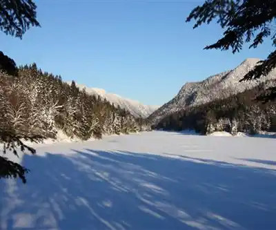
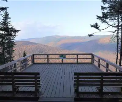
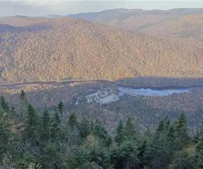
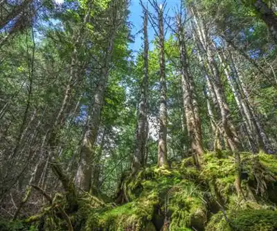
Trail description
{
"canyon_depth_correction": "Change '550 meters deep' to '600 metres deep' (per Authentik Canada source)",
"trail_system_correction": "The description mentions '100 kilometers of hiking trails, plus an additional 30 kilometers for multi-use activities' but web sources indicate '76 km easy trails' as primary reference. Clarify that 76 km is the main trail network.",
"facilities_note": "Remove or rephrase any mention of specific facilities (picnic tables, shelters) that cannot be verified in web sources"
}
Services and amenities
This information may vary by season.
Recommended gear for this trail


Ready to go?
Everything you need to know before you goStarting Point
To access the hiking trails, head to the main entrance of the park. The primary trailhead is located at 103 chemin du Parc-National, Stoneham-et-Tewkesbury, QC G3C 2T5. There are several parking lots available near this location. Follow the signs within the park to reach specific trailheads for different hikes.
When?
How much?
- Hiking shoes Essential
- → Salomon Elixir Tour Mid WP · 203.38 $
- Layered clothing Essential
- Rain jacket Essential
- Trekking poles
- → Black Diamond Trail Ergo Cork · 69.99 $
- Headlamp
- → Petzl Actik Core 625 · 103.95 $
FAQ - Frequently asked questions
Everything you need to knowThe Essential Hiking Checklist
Everything you need for your next hike. Bilingual, printable, 1 page.
Download the free checklistAlternatives and suggestions
Similar hikes nearby
Discover other trails you might enjoy
Camp Mercier
Québec City Region
Parc Chauveau
Québec City Region

Mont Sainte-Anne
Québec City Region

Les Marais Du Nord
Québec City Region

Vallée Bras-du-nord, Coop De Solidarité
Québec City Region

Parc De La Forêt Ancienne Du Mont Wright
Québec City Region
Hiking near Quebec City
40 trails to explore ~42 km away
We work hard to provide the most up-to-date and error-free data possible. If something seems incorrect, let us know! Your contribution helps the whole community.
Hikers' opinions