

Ready to explore Mont Sainte-Anne? Here's everything you need to know before you go!
Discover the trail
Available trails
| Trails | Distance | Elevation | Duration | Difficulty | GPX |
|---|---|---|---|---|---|
| 1.6 km | 0 m | 21min | Beginner | ||
| 0.7 km | 0 m | 15min | Beginner | ||
| 2 km | 0 m | 27min | Beginner | ||
| 1.7 km | 460 m | 1h | Intermediate | ||
| 3.9 km | 610 m | 2h | Intermediate | ||
| 3 km | 610 m | 1h30 | Intermediate | ||
| 3.9 km | 100 m | 1h | Intermediate | ||
| 3.8 km | 590 m | 2h | Advanced | ||
| 2.7 km | 610 m | 1h30 | Advanced | ||
| 8.8 km | 540 m | 3h | Advanced | ||
| 8.88 km | 697 m | 3h | Advanced | GPX |
Trail description
{
"change": "Corriger la phrase de localisation",
"current": "Mont-Saint-Anne sits in the Laurentian highlands northeast of Quebec City",
"corrected": "Mont-Saint-Anne sits in the Laurentian highlands north of Quebec City",
"also_update": "La phrase dans 'Getting There': 'along the Chemin Royal corridor northeast of Quebec City' devrait devenir 'along the Chemin Royal corridor north of Quebec City'",
"html_fix": "
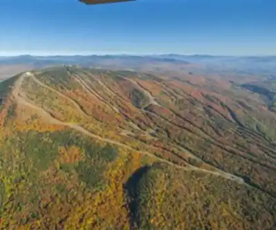
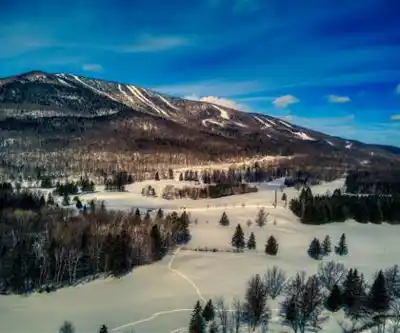
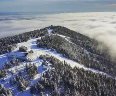
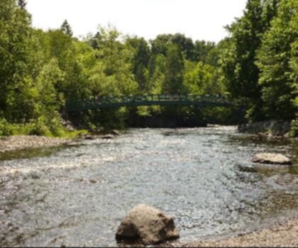
Mont-Saint-Anne sits in the Laurentian highlands north of Quebec City, rising above the St. Lawrence lowlands in a way that makes the summit views feel earned. The mountain is forested with a mix of boreal and mixed-wood species — spruce, fir, birch, and maple — and the trail network winds through this canopy for most of the climb before opening up near the top.
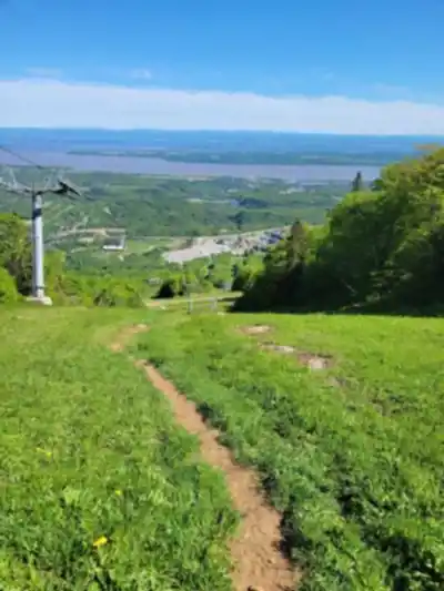
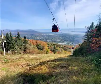
\n\nThe upper sections of the mountain offer exposed ridgeline walking with clear sightlines toward the St. Lawrence River and the surrounding Laurentian landscape. On a clear day, the panorama from the summit area is one of the better viewpoints accessible by foot in this part of Quebec.
\n\n[...section Getting There...]\nMont-Saint-Anne is located in the municipality of Beaupré, along the Chemin Royal corridor north of Quebec City. The access road to the resort base is clearly signed from Route 138, and the drive from Quebec City takes roughly 40 minutes under normal traffic conditions. Parking at the base area is available, though fees may apply depending on the season and resort operations — it's worth confirming current parking policies before your visit.
"}
Services and amenities
This information may vary by season.
Recommended gear for this trail


Ready to go?
Everything you need to know before you goStarting Point
To access the hiking trails, you can start at the main trailhead located at 2000 Boulevard du Beau-Pré, Beaupré, QC G0A 1E0. There is a parking lot available at this address for visitors. Additionally, there are other trailheads in the area that provide access to different sections of the trails. One alternative starting point is at 1000 Chemin des Loisirs, Saint-Ferréol-les-Neiges, QC G0A 3R0. Each location offers convenient access to explore the various hiking routes.
When?
Tuesday: 9:00 AM – 4:00 PM
Wednesday: 9:00 AM – 4:00 PM
Thursday: 9:00 AM – 4:00 PM
Friday: 9:00 AM – 4:00 PM
Saturday: 9:00 AM – 4:00 PM
Sunday: 9:00 AM – 4:00 PM
How much?
- Hiking shoes Essential
- → Salomon Elixir Tour Mid WP · 203.38 $
- Layered clothing Essential
- Rain jacket Essential
- Trekking poles
- → Black Diamond Trail Ergo Cork · 69.99 $
- Headlamp
- → Petzl Actik Core 625 · 103.95 $
FAQ - Frequently asked questions
Everything you need to knowTuesday: 9:00 AM – 4:00 PM
Wednesday: 9:00 AM – 4:00 PM
Thursday: 9:00 AM – 4:00 PM
Friday: 9:00 AM – 4:00 PM
Saturday: 9:00 AM – 4:00 PM
Sunday: 9:00 AM – 4:00 PM
The Essential Hiking Checklist
Everything you need for your next hike. Bilingual, printable, 1 page.
Download the free checklistSimilar hikes nearby
Discover other trails you might enjoy
Parc National De La Jacques Cartier
Québec City Region
Camp Mercier
Québec City Region
Parc Chauveau
Québec City Region

Parc Du Bois-de-coulonge
Québec City Region

Réserve Nationale De Faune Du Cap Tourmente
Québec City Region

Les Marais Du Nord
Québec City Region
Hiking near Quebec City
40 trails to explore ~37 km away
We work hard to provide the most up-to-date and error-free data possible. If something seems incorrect, let us know! Your contribution helps the whole community.
Hikers' opinions