

Ready to explore Vallée Bras-du-nord, Coop De Solidarité? Here's everything you need to know before you go!
Discover the trail
Available trails
| Trails | Distance | Elevation | Duration | Difficulty | GPX |
|---|---|---|---|---|---|
| 2 km | 27min | Beginner | |||
| 0.5 km | 15min | Beginner | |||
| 0.2 km | 15min | Beginner | |||
| 4 km | 20 m | 55min | Intermediate | ||
| 6.6 km | 200 m | 2h | Intermediate | ||
| 3.5 km | 250 m | 1h30 | Intermediate | ||
| 0.3 km | 15min | Intermediate |
Trail description
Description
Vallée Bras du Nord is one of those places that outdoor enthusiasts in the Capitale-Nationale region keep coming back to. Managed by the Coopérative de solidarité Vallée Bras du Nord, this destination has built a strong reputation as a four-season playground that takes its trails seriously — and takes care of them just as seriously.
What Kind of Place Is This?
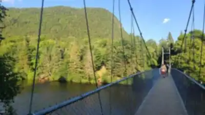
This is a managed outdoor destination run as a solidarity cooperative, which means the community has a real stake in how the land is used and maintained. That model shows in the quality of the infrastructure and the overall experience. You're not just wandering into a patch of Crown land — there's a network of maintained trails, facilities on site, and staff who actually know the terrain.
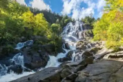
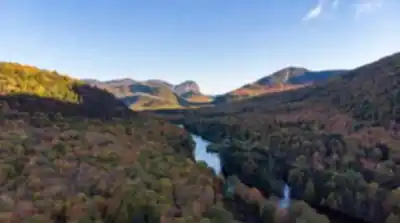
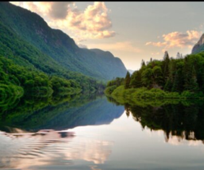
The valley itself is carved by the Bras du Nord River, and the landscape reflects that: steep forested slopes, rocky ridgelines, river crossings, and the kind of mixed boreal terrain that defines this part of Quebec. It's rugged without being inaccessible, and the trail network is designed to offer options for different fitness levels and interests.
The Trail Network
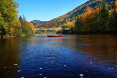
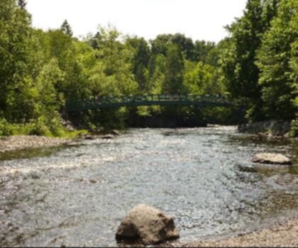
The cooperative manages an extensive network of multi-use trails spread across the valley. Hiking is the main draw, but the trails also accommodate other activities depending on the season. The terrain varies considerably across the network — some sections follow the river at lower elevation, while others climb aggressively toward viewpoints and ridges above the treeline.
What makes the network stand out is the variety packed into a single destination. You can string together a mellow half-day loop along the river, or commit to a full multi-day traverse that takes you deep into the backcountry. The cooperative maintains backcountry shelters and camping infrastructure that make overnight trips genuinely comfortable without requiring you to carry a full expedition kit.
The Terrain and What to Expect
The Bras du Nord valley sits in the Laurentian Highlands, and the geology here is old and unforgiving in the best way. Expect exposed rock, rooty singletrack, and elevation changes that will remind your legs they exist. The river corridor adds a dynamic element — water levels, crossings, and the sound of moving water are constant companions on many of the routes.
The forest cover is predominantly boreal mix: balsam fir, white spruce, yellow birch, and sugar maple at lower elevations. In fall, the hardwood sections put on a serious show. In summer, the canopy keeps things cool even on warm days. The valley's topography creates microclimates, so conditions can shift noticeably as you gain or lose elevation.
Wildlife is present throughout the network. The valley is good habitat for white-tailed deer, black bear, moose, and a range of bird species. Keep your eyes open and your noise level reasonable, especially early morning and at dusk.
Facilities and Access
The cooperative model means there's real infrastructure here. The main access point has parking, a welcome area, and staff who can orient you to current trail conditions. There are fees associated with accessing the trail network — this is not a free public park, and those fees go directly toward trail maintenance and facility upkeep.
Backcountry shelters are available for reservation, which is the recommended approach rather than showing up and hoping for availability. The shelters are spread across the network at logical stopping points for multi-day itineraries. Camping is also available for those who prefer tents.
The cooperative's approach to access and fees is transparent — you know what you're paying for, and the quality of the trails reflects where that money goes. It's a model that works, and it's one reason the destination has developed such a loyal following among hikers from Quebec City and beyond.
Seasons and Conditions
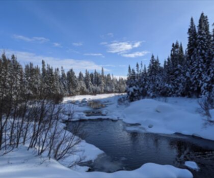
Vallée Bras du Nord operates across multiple seasons, which is part of what makes it worth the drive. Summer hiking is the most popular window, with long days and full trail access. Fall brings exceptional foliage and cooler temperatures that make the climbs more manageable. Winter transforms the network into a cross-country skiing and snowshoeing destination, with groomed trails and the same shelter infrastructure available for cold-weather overnight trips.
Spring shoulder season requires more caution — snowmelt and rain can make certain sections muddy or difficult, and some trails may have restricted access during the most sensitive periods. Checking current conditions with the cooperative before heading out is always a good idea, regardless of season.
Getting There
The valley is located in the Capitale-Nationale region of Quebec, within reasonable driving distance of Quebec City. The access road leads into the valley from the surrounding rural area, and signage from the main routes is generally clear. Parking at the main trailhead is managed by the cooperative as part of the access fee structure.
Who This Place Is For
Vallée Bras du Nord works well for a wide range of hikers, but it rewards those who are willing to commit to more than a quick out-and-back. Day hikers will find plenty of options, but the destination really shines for people who want to spend a night or two in the backcountry without the logistics of a fully self-supported wilderness trip. The shelter network makes that accessible to hikers who might not otherwise attempt an overnight.
- Day hikers: Multiple loop options at varying difficulty levels, with the river corridor offering some of the most scenic and accessible terrain.
- Overnight hikers: Reservable backcountry shelters make multi-day trips straightforward and comfortable.
- Four-season users: The network transitions well across seasons, with winter activities well supported by the cooperative's infrastructure.
- Families with older kids: Some sections of the network are appropriate for younger hikers with solid trail experience, though the more technical terrain is better suited to adults.
Before your visit, check the cooperative's current fee structure, reservation availability for shelters, and any trail closures or seasonal restrictions directly through their official channels — conditions and policies can change, and the cooperative is the best source for up-to-date information.
Services and amenities
This information may vary by season.
Recommended gear for this trail


Ready to go?
Everything you need to know before you goStarting Point
To access the hiking trails, you can start at one of several trailheads. The main parking lot is located at 2180 Rang Saguenay, Saint-Raymond, QC G3L 3G3. Another option is the Shannahan sector, with a parking area at 400 Chemin de la Vallée, Saint-Raymond, QC G3L 2Y4. Both locations provide convenient access to the trail network.
When?
How much?
- Hiking shoes Essential
- → Salomon Elixir Tour Mid WP · 203.38 $
- Layered clothing Essential
- Rain jacket Essential
- Trekking poles
- → Black Diamond Trail Ergo Cork · 69.99 $
- Headlamp
- → Petzl Actik Core 625 · 103.95 $
FAQ - Frequently asked questions
Everything you need to knowThe Essential Hiking Checklist
Everything you need for your next hike. Bilingual, printable, 1 page.
Download the free checklistAlternatives and suggestions
Similar hikes nearby
Discover other trails you might enjoy
Parc National De La Jacques Cartier
Québec City Region
Camp Mercier
Québec City Region
Parc Chauveau
Québec City Region

Mont Sainte-Anne
Québec City Region

Les Marais Du Nord
Québec City Region

Parc De La Forêt Ancienne Du Mont Wright
Québec City Region
Hiking near Quebec City
40 trails to explore ~53 km away
We work hard to provide the most up-to-date and error-free data possible. If something seems incorrect, let us know! Your contribution helps the whole community.
Hikers' opinions