

Ready to explore Chutes Jean Larose? Here's everything you need to know before you go!
Discover the trail
Available trails
| TrailTrails | Dist.Distance | GainElevation | Est. timeEstimated time | Difficulty | GPX |
|---|---|---|---|---|---|
|
Intermediate
|
4 km | — | Intermediate | GPX | |
|
Advanced
|
24.21 km | 643 m | ≈ 6h30 | Advanced | GPX |
|
Advanced
|
13.8 km | 530 m | ≈ 4h | Advanced |
GPX track: © OpenStreetMap contributors — ODbL 1.0
Trail description
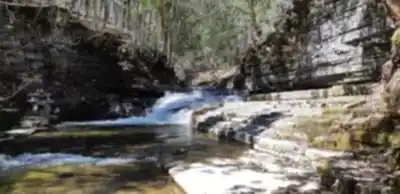
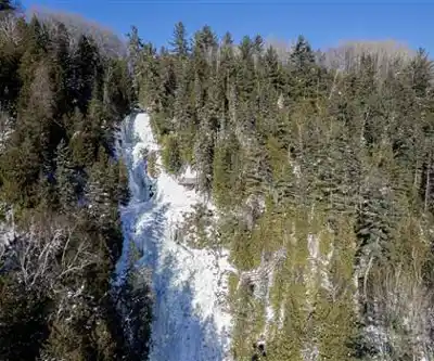
Chutes Jean-Larose are across the street from the Mont-Sainte-Anne station, a few minutes' walk away, according to Québec Cité. Mont-Sainte-Anne's English page describes the “Chemin des chutes” as a trail that runs alongside three cascades of 12, 19 and 41 m. Québec Cité says three successive cascades, the tallest reaching 41 m. Côte-de-Beaupré writes that the falls are only 7 m shorter than Montmorency Falls. None of these sources gives a total height.
The Trails
According to Côte-de-Beaupré, the Jean-Larose loop is 4 km in total and rated “easy intermediate”. From the parking lot, the trail leads to a staircase of about 350 steps that runs alongside the falls and reaches viewpoints. Rest stops break up the climb back. You can also return on a fairly wide trail that climbs gently, which closes the loop. Québec Cité counts more than 350 steps, down and then back up.
From the base of the falls, you can branch off onto the Mestachibo trail. Côte-de-Beaupré describes it as a 13.8 km trail (one way) to the church in Saint-Ferréol-les-Neiges, at an intermediate-to-difficult level and recommended for experienced hikers. The Mestachibo website lists 530 m of positive elevation and 3 to 5 hours for this West segment. You need a return plan: two cars, a taxi booked in advance, or an out-and-back that doubles the distance.
Condition of the Sector: Check Before You Go
The two language versions of Mont-Sainte-Anne's hiking page disagree. The English page lists the Jean-Larose sector among the trails marked “closed”: closed for the summer, with a stair repair project under way and no reopening date. The French page says the path and staircase are accessible again thanks to the stairs rebuilt in autumn 2021. Check with Mont-Sainte-Anne before you go. The Côte-de-Beaupré and Québec Cité pages report no closure.
Access, Fees and Parking
Côte-de-Beaupré lists, for the falls, free access from May 15 to November 30. Mont-Sainte-Anne publishes a hiking rate (adult $17 in 2026, taxes not included) for its mountain trails; its page does not name the Jean-Larose sector, so whether it applies here is unconfirmed. After the Mont-Sainte-Anne traffic light on Route 360, the parking lot is on the right, just past the bridge (Côte-de-Beaupré). Whether parking is free, the sector's opening hours and winter access: unconfirmed.
Dogs and Activities
The rule specific to the falls sector is unconfirmed. Mont-Sainte-Anne allows dogs on a leash on its hiking trails without naming the Jean-Larose sector, and the Mestachibo website says dogs are allowed on a leash. Québec Cité writes that the spot is ideal for canyoning. Swimming, biking, snowshoeing, cross-country skiing and drones: no source mentions them for this site, so they are unconfirmed.
Services and amenities
Everything you need for your next hike. Bilingual, printable, 1 page.
Get your free hiking checklistRecommended gear for this trail
As an Amazon Associate I earn from qualifying purchases.


Ready to go?
Everything you need to know before you goStarting Point
After the Mont-Sainte-Anne traffic light on Route 360, park on the right, just past the bridge. The Jean-Larose loop trail leads from there to the staircase alongside the falls (Côte-de-Beaupré). The listed coordinates are those of the falls, not of the parking lot.
When?
Free access from May 15 to November 30 (Côte-de-Beaupré). Opening hours: unconfirmed.
How much?
As an Amazon Associate I earn from qualifying purchases.
Affiliate links — LGPO may earn a commission at no extra cost to you.
- Hiking shoes Essential
- → Salomon Elixir Tour Mid WP · 203.38 $
- Layered clothing Essential
- Rain jacket Essential
- Trekking poles
- → Black Diamond Trail Ergo Cork · 69.99 $
- Headlamp
- → Petzl Actik Core 625 · 103.95 $
FAQ - Frequently asked questions
Everything you need to knowAlternatives and suggestions
For the mountain itself, see the Mont Sainte-Anne page. For another waterfall in the Quebec City region: Parc de la Chute-Montmorency.
Outings near Chutes Jean Larose
Discover other trails you might enjoy

Canyon Sainte-Anne
Québec City Region · 1.8 km away

Mont Sainte-Anne
Québec City Region · 2.0 km away

Réserve nationale de faune du Cap-Tourmente
Québec City Region · 8.0 km away
Mont Raoul-Blanchard
Charlevoix · 26.8 km away

Parc de la Chute-Montmorency
Québec City Region · 28.0 km away

Sentier du Moulin
Québec City Region · 29.7 km away
Hiking near Quebec City
47 trails to explore ~37 km away
We work hard to provide the most up-to-date and error-free data possible. If something seems incorrect, let us know! Your contribution helps the whole community.
Hikers' opinions
Be the first to review!
No hiker has shared their experience yet. Share your impressions and help other hikers!