

Ready to explore Parc Naturel Régional De Portneuf? Here's everything you need to know before you go!
Discover the trail
Trail description
Description
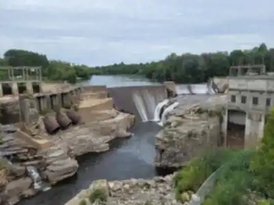
Parc naturel régional de Portneuf is one of those places that earns its reputation quietly. Located in the Quebec City region, it's close enough to the city for a day trip but feels genuinely removed from it once you're on the trails. The combination of dense forest, lakes, streams, and rugged terrain gives it a character that's hard to replicate closer to town, and the sheer size of the trail network means you can come back multiple times without repeating the same experience.
The landscape and what to expect on the ground
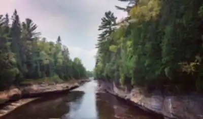
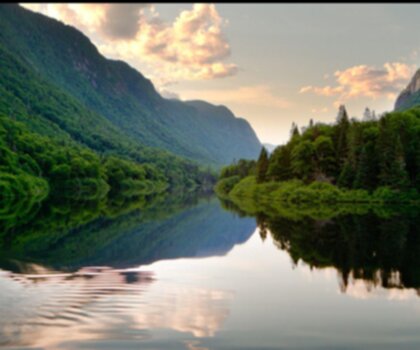
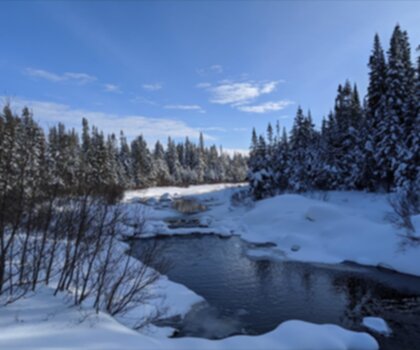
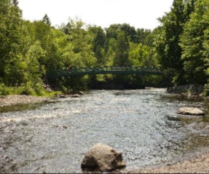
The park's terrain is genuinely varied. You'll move through stretches of thick boreal forest where the canopy closes in and the light filters through in patches, then open up near lakes and calmer stream sections where the mood shifts entirely. Some sections of trail stay relatively flat and sheltered, which makes them good for a relaxed pace or for hikers who want to focus on the surroundings rather than the effort. Other routes climb toward higher ground where the forest gives way to broader views across valleys and countryside.
That contrast is one of the park's strongest qualities. A single outing can take you from a quiet, water-lined path to an exposed ridgeline with a panoramic view, and the transitions feel natural rather than abrupt. The terrain underfoot shifts too—from softer forest tread to rockier sections as you gain elevation—so it's worth wearing footwear that handles both comfortably.
Trail network and planning your day
The park has over 70 kilometers of hiking trails, which gives you real flexibility depending on what kind of day you're after. That's enough trail to keep things fresh across multiple visits, and the range of difficulty means the park works for a wide range of hikers. Whether you want a low-key walk near the water or a longer route with a meaningful climb and a view at the end, the network accommodates both.
With an estimated 17.5 hours of total trail time across the network and a maximum elevation gain of around 206 meters, the park leans toward the accessible end of the spectrum overall. Most of the trails are rated easy, which makes this a solid choice for families, newer hikers, or anyone who wants to cover ground without pushing hard. That said, the longer routes and the sections with more elevation still give experienced hikers something to work with, especially if you're building a full day around a specific destination.
It's worth deciding ahead of time what you want out of the day. If views are the priority, plan a route that includes at least one climb. If you're more interested in the forest and water experience, the flatter trails near streams and lakes deliver that without requiring much effort. Either way, the park rewards a slower pace—there's enough going on in the landscape that rushing through it means missing a lot.
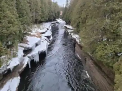
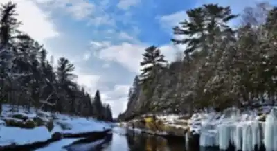
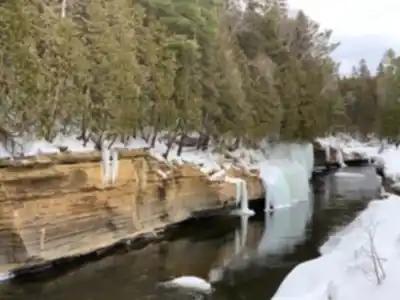
Sentier des Falaises
Among the park's standout trails, Sentier des Falaises is the one most worth planning around if you're visiting for the first time. The trail takes you to cliff edges and valley overlooks that are genuinely dramatic—the kind of viewpoints where you stop walking and just look for a while. The combination of vertical rock faces and the depth of the valley below makes it one of the more photogenic spots in the park, and the changing light across the landscape throughout the day gives you different shots depending on when you arrive.
Approach this one with a steady pace and some patience. The terrain transitions from forest tread to more exposed sections near the cliffs, so watch your footing as you move between them. The payoff is worth it, but the experience is better if you're not rushing to get there and back.
Wildlife and nature watching
The park is a good place to stay observant if wildlife is part of your reason for visiting. Deer and beavers are both present, along with a variety of bird species. The most reliable approach is to slow down near water—beavers in particular are tied to lakes and calmer stream sections, and you're more likely to notice movement or signs of activity if you're not moving quickly through those areas. Scan the edges of trails where the forest meets more open ground, and listen before you look. A lot of what you'll see here is earned by patience rather than luck.
The park has a clear commitment to preserving its natural environment, and that shows up in the overall atmosphere on the trails. It feels like a place that's actively cared for, which tends to translate into a more immersive experience than you'd get in a less managed green space.
Camping and extending your visit
If a day trip isn't enough, the park has designated campsites that let you stay overnight and spread your hiking across more than one window of time. Camping here changes the rhythm of the visit in a useful way: you can head out early before the trails get busier, take a break during the middle of the day, and do a shorter evening walk once things quiet down. The morning hours in particular are worth planning around—the light is good, the wildlife is more active, and the trails feel different when you're not sharing them with the midday crowd.
What to bring
- Footwear: Hiking boots or trail shoes that handle both soft forest paths and rockier terrain. The transitions between surface types are frequent enough that casual footwear will feel limiting on longer routes.
- Water and snacks: Especially on longer routes or anything that includes a climb. The 70-kilometer network gives you plenty of options for extending your day, so plan your supplies accordingly.
- Layers: The shaded forest sections stay cool even on warmer days, but exposed viewpoints can feel quite different. A light layer in your pack covers both.
- Camera or phone: Particularly useful on Sentier des Falaises, where the cliff and valley views are the main event. The light changes significantly throughout the day, so there's no single "best" time—just different versions of the same scene.
- Binoculars: Optional, but they make the birdwatching considerably more rewarding near the lakes and streams.
The park sits in a part of Quebec that doesn't always get the same attention as more heavily promoted destinations in the region, which is part of what makes it worth the drive.
Services and amenities
This information may vary by season.
Recommended gear for this trail


Ready to go?
Everything you need to know before you goStarting Point
To access the hiking trails, you can start at several trailheads. One option is to head to the main entrance located at 3039 Chemin du Lac Sept-Îles, Saint-Raymond, QC G3L 2S8. Another possible starting point is at 1000 Rang Sainte-Croix, Saint-Alban, QC G0A 3B0. Both locations have parking facilities available for visitors.
When?
Tuesday: 8:00 AM – 5:00 PM
Wednesday: 8:00 AM – 5:00 PM
Thursday: 8:00 AM – 5:00 PM
Friday: 8:00 AM – 5:00 PM
Saturday: 8:00 AM – 5:00 PM
Sunday: 8:00 AM – 5:00 PM
How much?
- Hiking shoes Essential
- → Salomon Elixir Tour Mid WP · 203.38 $
- Layered clothing Essential
- Rain jacket Essential
- Trekking poles
- → Black Diamond Trail Ergo Cork · 69.99 $
- Headlamp
- → Petzl Actik Core 625 · 103.95 $
FAQ - Frequently asked questions
Everything you need to knowTuesday: 8:00 AM – 5:00 PM
Wednesday: 8:00 AM – 5:00 PM
Thursday: 8:00 AM – 5:00 PM
Friday: 8:00 AM – 5:00 PM
Saturday: 8:00 AM – 5:00 PM
Sunday: 8:00 AM – 5:00 PM
The Essential Hiking Checklist
Everything you need for your next hike. Bilingual, printable, 1 page.
Download the free checklistSimilar hikes nearby
Discover other trails you might enjoy
Parc National De La Jacques Cartier
Québec City Region
Camp Mercier
Québec City Region
Parc Chauveau
Québec City Region

Mont Sainte-Anne
Québec City Region

Les Marais Du Nord
Québec City Region

Parc De La Forêt Ancienne Du Mont Wright
Québec City Region
Hiking near Quebec City
40 trails to explore ~67 km away
We work hard to provide the most up-to-date and error-free data possible. If something seems incorrect, let us know! Your contribution helps the whole community.
Hikers' opinions