


Ready to explore Sentier De L'Yzeron? Here's everything you need to know before you go!
Discover the trail
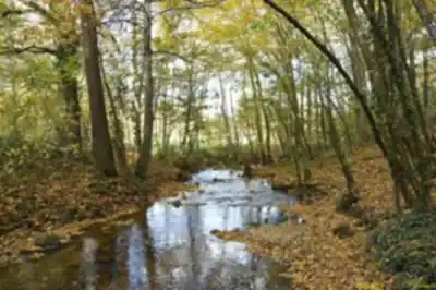
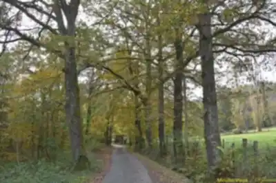
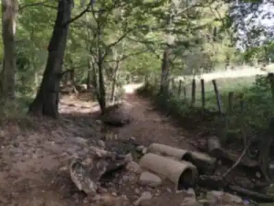
Trail description
The Sentier De L'Yzeron offers hikers a rewarding 12-kilometer journey through the diverse landscapes of the Rhône region in Auvergne-Rhône-Alpes. This moderate trail combines 300 meters of elevation gain with varied terrain that showcases the natural beauty of the Yzeron River valley, creating an engaging outdoor experience that captures the essence of southeastern France's countryside.
What sets this trail apart is its perfect balance of challenge and accessibility. The moderate difficulty rating stems from steady elevation changes distributed throughout the route rather than punishing climbs, making it approachable for hikers with basic experience while still providing a satisfying workout. The 3.5-hour duration allows for a substantial outdoor adventure without requiring a full-day commitment.
Trail Character and Terrain
The Sentier De L'Yzeron takes you through a constantly changing landscape that reflects the rich geographical diversity of the Rhône region. You'll traverse well-maintained dirt paths, navigate rocky sections with sure footing, and wind through forested areas where roots occasionally cross the trail. The terrain variety keeps the hiking experience engaging from start to finish.
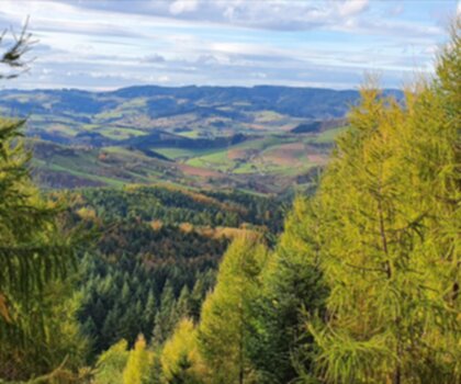
The trail's relationship with the Yzeron River valley creates distinct sections with their own character. Lower elevations bring you close to flowing water, where the sound of streams accompanies your steps and riparian vegetation creates cooler microclimates. As you gain elevation, the perspective opens up to reveal the agricultural patchwork that defines this part of France, with small farms and fields creating a lived-in landscape that feels authentically regional.
Forested sections provide natural rhythm breaks and shelter, particularly valuable during summer hiking. These wooded areas feature mixed stands of oak, beech, and pine that create dappled light conditions and support the diverse wildlife you might encounter. The transition between forest and open areas happens naturally throughout the route, preventing monotony and offering varied photographic opportunities.
Stream crossings add technical interest without creating serious obstacles. The water features range from small tributaries to more substantial creek crossings, each requiring attention but remaining manageable for hikers with basic outdoor experience. These crossings often mark transitions between different landscape zones along the trail.
Seasonal Hiking Experience
Each season transforms the Sentier De L'Yzeron into a different hiking experience. Spring brings wildflower displays to the meadows and fresh growth that makes the forested sections particularly vibrant. The moderate elevation gain means you'll experience subtle seasonal variations as you move between valley bottom and hillside environments.
Summer hiking benefits from the mixed terrain of shaded forests and open areas, though the exposed sections require attention to sun protection and hydration. The full canopy cover in wooded areas provides relief during warmer months, while the open agricultural areas can become quite warm during peak summer conditions.
Fall transforms the deciduous forests with changing leaves, creating some of the year's most spectacular hiking conditions. The elevation changes mean you'll experience different stages of seasonal change as you move through various elevations and exposures along the route.
Winter hiking remains possible but requires careful attention to trail conditions. Shaded forest areas and stream crossings can become slippery, and the moderate elevation gain means you'll encounter varying conditions as you move between different elevations and exposures.
Natural Environment and Wildlife
The Yzeron valley ecosystem represents the transitional landscape between Mediterranean and continental influences that characterizes this part of the Rhône region. This ecological position creates habitat diversity that supports varied plant and animal communities throughout the trail corridor.
Bird life is particularly active along the route, with species adapted to both forest and open habitats. The mixed forest environments support different bird communities than the agricultural areas, giving attentive hikers opportunities to observe this diversity. Small mammals remain largely hidden but leave signs that observant hikers can spot throughout the journey.
The river and tributary systems create distinct riparian zones that harbor different vegetation than the surrounding hillsides. These wetter areas serve as important wildlife corridors and create the lush growth that contrasts with the drier hillside environments you'll encounter at higher elevations.
Rock formations and geological features provide visual interest and natural rest stops throughout the hike. The underlying geology creates the natural viewpoints that offer the best perspectives on the surrounding Rhône countryside, particularly rewarding after the steady climbs that characterize portions of the route.
Practical Hiking Considerations
The 12-kilometer distance and moderate difficulty make this trail suitable for hikers with reasonable fitness levels and basic outdoor experience. Families with older children who are comfortable with longer walks will find the trail manageable, though the length and elevation changes require more planning than shorter local hikes.
Proper hiking footwear becomes important due to the varied terrain and potential for muddy conditions, especially during wet seasons or near water features. The rocky sections and root crossings in forested areas require shoes with good traction and ankle support.
The trail's length and 3.5-hour duration mean carrying adequate water and snacks is essential, particularly during warmer weather when the open sections provide little shade. Weather conditions significantly impact the hiking experience, with rain creating slippery conditions on rocky sections and making stream crossings more challenging.
Regional Context and Access
Located in the heart of the Rhône region, this trail provides an authentic introduction to the area's characteristic landscape of river valleys, mixed forests, and agricultural land. The Yzeron valley represents a quieter alternative to more heavily visited natural areas while delivering substantial hiking rewards and genuine regional character.
The trail connects hikers with the rural heritage of the Rhône countryside, passing through landscapes shaped by both natural processes and centuries of human activity. This combination creates a hiking experience that feels both wild and culturally connected to the region's agricultural traditions.
Access to the trailhead typically requires personal vehicle transportation, as the rural location means limited public transportation options. The trail's position within the broader network of Auvergne-Rhône-Alpes hiking opportunities makes it an excellent choice for visitors exploring multiple outdoor destinations in the region.
The Essential Hiking Checklist
Everything you need for your next hike. Bilingual, printable, 1 page.
Get your free hiking checklistRecommended gear for this trail
As an Amazon Associate I earn from qualifying purchases.


Ready to go?
Everything you need to know before you goWhen?
How much?
As an Amazon Associate I earn from qualifying purchases.
Affiliate links — LGPO may earn a commission at no extra cost to you.
- Hiking shoes Essential
- → Salomon Elixir Tour Mid WP · 203.38 $
- Layered clothing Essential
- Rain jacket Essential
- Trekking poles
- → Black Diamond Trail Ergo Cork · 69.99 $
- Headlamp
- → Petzl Actik Core 625 · 103.95 $
FAQ - Frequently asked questions
Everything you need to knowSimilar hikes nearby
Discover other trails you might enjoy
Hiking near Sydney
22 trails to explore ~4888 km away
We work hard to provide the most up-to-date and error-free data possible. If something seems incorrect, let us know! Your contribution helps the whole community.
Hikers' opinions
Be the first to review!
No hiker has shared their experience yet. Share your impressions and help other hikers!