

Ready to explore Lac de Pontcharal? Here's everything you need to know before you go!
Discover the trail
Trail description
The Lac de Pontcharal trail is a satisfying moderate loop through the forested hills of Corrèze, one of the quieter corners of Nouvelle-Aquitaine that tends to fly under the radar even among seasoned hikers in France. At 4.8 kilometers with 300 meters of elevation gain, it hits a sweet spot — enough terrain to feel like a real hike, but manageable enough to finish in around 2 hours and 15 minutes without rushing.
The trailhead drops you into a mixed forest that sets the tone for the whole route. Lower down, oak and beech dominate, their canopy dense enough to keep things cool and shaded. As you gain elevation, the forest shifts toward pine and fir, and the light changes with it — softer, more filtered, with that particular quiet that comes with coniferous woods. It's a noticeable transition that gives the hike two distinct personalities without ever feeling abrupt.
The Climb
The 300-meter elevation gain is spread across the route rather than concentrated in one brutal push, which makes the effort feel steady rather than punishing. The steepest sections come in the middle portion of the loop, where the trail tightens and the footing demands a bit more attention. You'll move between packed dirt paths, older forest roads, and rockier stretches — the kind of varied terrain that keeps you engaged without requiring technical skills.
After rain, a few sections get muddy, particularly where the trail crosses small seasonal streams that drain toward the lake. Nothing that should stop you, but worth keeping in mind when choosing footwear. Sturdy hiking boots are the right call here — trail runners work in dry conditions, but the mixed terrain and potential for wet patches make ankle support a reasonable priority. Trekking poles are genuinely useful on the steeper middle sections and on the way back down if your knees appreciate the assist.
Lac de Pontcharal
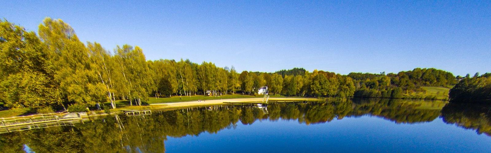
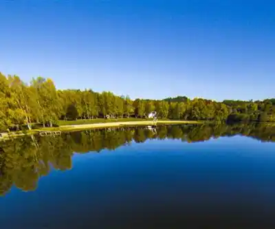
The lake is the clear highlight of the hike, and it earns that status. It sits in a natural depression ringed by forested hills, which gives it a tucked-away feeling even though the trail access is relatively straightforward. The water level shifts with the seasons — highest in late spring and early summer when snowmelt and rain have done their work, lower by late summer and fall.
The shoreline has natural spots to stop — flat rocks, fallen logs, places where you can sit without feeling like you're perched awkwardly. It's a good place to eat lunch, take photos across the water to the hills beyond, or just sit quietly for a few minutes. The open area around the lake is one of the only spots on the route where the sky opens up properly, which makes it stand out from the enclosed forest sections that make up most of the trail.
Wildlife activity is real here, particularly in the early morning and late afternoon. Herons and waterfowl use the lake regularly, and if you arrive quietly and give yourself a few minutes before moving on, you're likely to see something worth watching.
Navigation and Trail Conditions
The loop is marked with standard French hiking blazes, and for most of the route, navigation is easy. The trickier spots come on the return leg, where a handful of unofficial paths branch off from the main trail. None of them are dramatic wrong turns, but they can pull you off course if you're moving quickly and not paying attention to the markers. Staying aware of your general direction and checking for blazes at junctions keeps things on track.
The clockwise direction is worth considering — it introduces the terrain gradually and holds the best lake views for the back half of the hike, which gives you something to look forward to as the elevation gain builds. That said, the trail works in either direction, and the difference isn't dramatic.
Seasonal Notes
Spring is when the forest is most alive — wildflowers along the trail edges, fresh canopy growth, streams running full. The lake is at its highest, and the whole landscape has an energy to it. The tradeoff is mud in places, especially near stream crossings, so plan accordingly.
Summer is the most forgiving season for this hike. The forest cover keeps temperatures reasonable even on warm days, and the lake area becomes a genuinely pleasant place to stop and cool down. Trail conditions are at their most stable, which makes it a good choice for families or hikers who prefer predictable footing.
Fall brings the color shift in the deciduous sections — the mix of oak, beech, and other broadleaf species means varied hues through October. Conditions stay solid, though fallen leaves can hide the path in spots and add some slip to rocky sections. It's a visually rewarding time to be on this trail.
Winter hiking is possible, but the shorter days and potential for snow and ice on the steeper sections and around the lake require more preparation. An early start is smart given the 2-hour-plus duration and reduced daylight.
What to Know Before You Go
- Distance: 4.8 km loop
- Elevation gain: 300 m
- Estimated time: 2h15, depending on pace and time at the lake
- Difficulty: Moderate — suitable for hikers with basic experience and reasonable fitness
- Footwear: Hiking boots recommended; the terrain and potential for wet conditions make ankle support worthwhile
- Water: Carry what you need — there are no reliable water sources along the trail
- Best seasons: Spring through fall; winter requires extra preparation
- Trail marking: Standard French blazes; pay attention at junctions on the return leg
Lac de Pontcharal sits in a part of Corrèze that doesn't get the same foot traffic as more famous destinations in France, which is a big part of its appeal — the forest feels genuinely quiet, the lake feels genuinely remote, and the hike feels like something you found rather than something you were directed to.
The Essential Hiking Checklist
Everything you need for your next hike. Bilingual, printable, 1 page.
Get your free hiking checklistRecommended gear for this trail
As an Amazon Associate I earn from qualifying purchases.


Ready to go?
Everything you need to know before you goWhen?
How much?
As an Amazon Associate I earn from qualifying purchases.
Affiliate links — LGPO may earn a commission at no extra cost to you.
- Hiking shoes Essential
- → Salomon Elixir Tour Mid WP · 203.38 $
- Layered clothing Essential
- Rain jacket Essential
- Trekking poles
- → Black Diamond Trail Ergo Cork · 69.99 $
- Headlamp
- → Petzl Actik Core 625 · 103.95 $
FAQ - Frequently asked questions
Everything you need to knowSimilar hikes nearby
Discover other trails you might enjoy
Hiking near Sydney
22 trails to explore ~4678 km away
We work hard to provide the most up-to-date and error-free data possible. If something seems incorrect, let us know! Your contribution helps the whole community.
Hikers' opinions
Be the first to review!
No hiker has shared their experience yet. Share your impressions and help other hikers!