
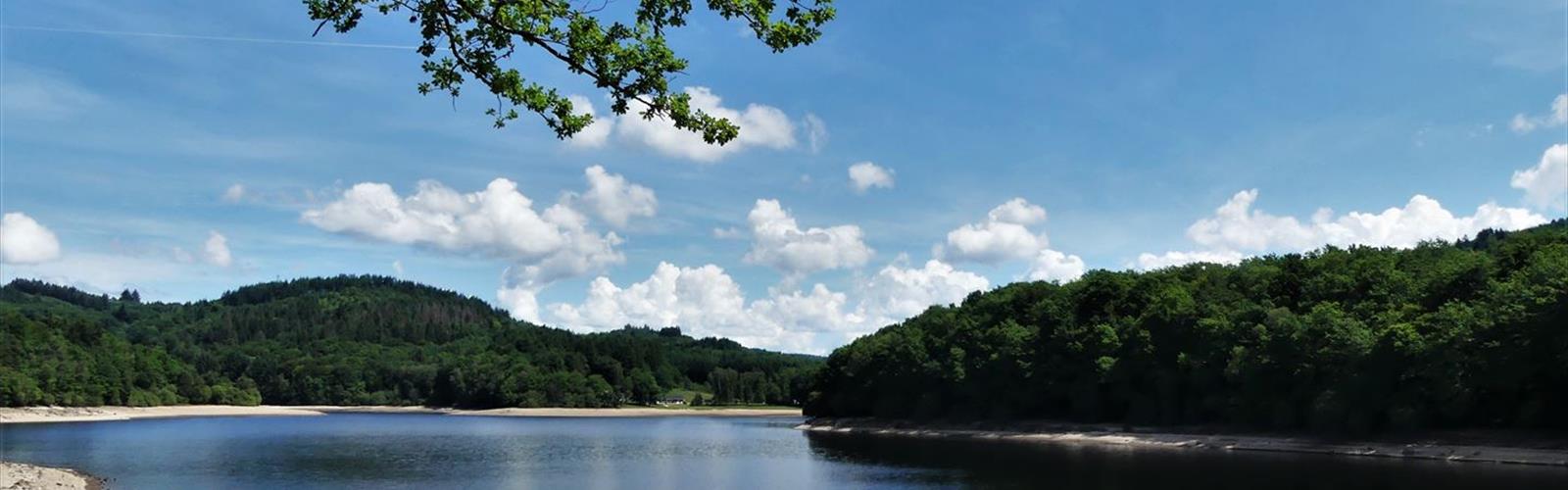

Ready to explore Lac des bariousses? Here's everything you need to know before you go!
Discover the trail
Trail description
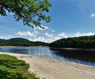
Lac des Bariousses sits at 910 meters elevation in the Corrèze department of Nouvelle-Aquitaine, stretching 1.5 kilometers in length and 500 meters across at its widest point. This glacial lake occupies a striking setting surrounded by dense forest and rolling mountain terrain — an alpine-style landscape that feels genuinely different from the river valleys and medieval towns that most visitors associate with this part of France.
The glacial origins of the lake are easy to read once you're standing at the water's edge. The steep-sided basin, the deep clear water, the large boulders scattered along the shoreline — all of it points to ancient ice movement through this valley. The lake is fed by both the Dordogne River and the smaller Moulin stream, which helps maintain consistent water levels through most of the year. Depths range from around 10 meters near the shallower shoreline areas to 30 meters in the central basin, giving the water that characteristic deep blue-green color that shifts noticeably depending on light and cloud cover.
The Trail
The loop around Lac des Bariousses covers 6 kilometers with 150 meters of elevation gain, and most people complete it in around 2 hours 15 minutes. That puts it firmly in easy territory — enough movement to feel like a real outing, but nothing that requires any special preparation or fitness level. It's a good choice for families, casual hikers, or anyone who wants to spend time in a beautiful mountain setting without committing to a demanding day.
The trail alternates between sections that hug the shoreline closely and stretches that climb into the surrounding hills. The shoreline portions give you direct access to the water — rocky shelves and natural platforms where you can stop, watch the lake, or just sit for a while. The hillside sections open things up, offering broader views across the water toward the surrounding ridgelines. Neither type of terrain dominates; the route moves naturally between the two, which keeps the walk interesting throughout.
Underfoot, the forest floor is generally soft — a mix of fallen leaves, pine needles, and packed earth that makes for comfortable walking. Rocky outcroppings appear regularly, both as natural rest spots and as reminders of the glacial geology beneath everything. After rain, some sections can get slippery, particularly on the steeper cuts where the trail crosses the natural contours of the hillside. Ankle support is worth thinking about if you plan to explore beyond the main loop.
The Forest Environment
The forest surrounding the lake is a mix of deciduous and coniferous trees, which means the landscape shifts noticeably with the seasons. The canopy comes right down to the water's edge in many places, creating a tight relationship between the woodland and the lake that gives the whole area a more enclosed, intimate feel than you'd get at a more open mountain lake.
Wildlife activity is consistent with this kind of mixed forest habitat. The lake's clean water supports healthy fish populations, and the undeveloped shoreline means animal encounters are reasonably common, especially during early morning or evening visits. Bird species are varied throughout the forest, and the transition between woodland and aquatic environments creates the kind of edge habitat that tends to concentrate activity.
Other Activities at the Lake
Fishing is one of the main draws at Lac des Bariousses. The depth variation across the lake — shallow near the edges, significantly deeper in the central basin — means anglers can work different techniques depending on what they're after. Rocky shoreline access points are plentiful, though reaching some of them requires a short scramble down from the main trail.
The lake also sees canoeing and paddling activity. Its size is well-suited to leisurely paddling, and the protected setting means wind and wave conditions are rarely a concern. The connections to the Dordogne River and the Moulin stream extend the possibilities for longer water-based outings. For less experienced paddlers or families with young kids, this is a more forgiving environment than open or exposed water.
Mountain biking uses some of the same forest paths as the hiking trails. The terrain mix — elevation changes, variable forest floor conditions, occasional rocky sections — makes this better suited to intermediate riders than beginners. It's not a dedicated bike park, but the network of paths gives riders enough variety to put together a worthwhile outing.
Practical Notes
At 910 meters, Lac des Bariousses runs cooler than the lower Corrèze valleys year-round. Weather can shift quickly, particularly in spring and fall, and the forested setting means wet conditions linger longer after rain than they would in more open terrain. Layering is a reasonable habit here regardless of the season.
Summer weekends and holiday periods bring noticeable crowds to the most accessible shoreline areas. If you want a quieter experience — better for wildlife observation, more space to move — early morning visits or weekday trips make a real difference. The trail network is varied enough that even on busy days, the higher elevation paths tend to stay less congested.
The lake's depth and cool water temperature are worth keeping in mind for anyone planning water activities. The glacial basin means water stays cold even in summer, and the steep sides in some areas make self-rescue genuinely difficult. Appropriate safety equipment isn't optional for paddlers or swimmers.
Standard hiking footwear handles the trail well under normal conditions, but waterproof boots with decent ankle support are the smarter choice if there's any chance of wet weather or if you're planning to cover multiple trail options in a single visit.
What Sets This Place Apart
The Corrèze department doesn't always get the attention it deserves, and Lac des Bariousses is a good example of why that's worth reconsidering. The combination of glacial lake, mountain forest, and accessible trail in a relatively undeveloped setting is genuinely uncommon in Nouvelle-Aquitaine. The lake has real geological character — you can read the landscape rather than just walk through it — and the variety of ways to spend time here, from a quiet shoreline walk to a full day of paddling and fishing, gives it staying power beyond a single visit.
The Essential Hiking Checklist
Everything you need for your next hike. Bilingual, printable, 1 page.
Get your free hiking checklistRecommended gear for this trail
As an Amazon Associate I earn from qualifying purchases.


Ready to go?
Everything you need to know before you goStarting Point
The start of the Lac des bariousses trails is located in Saint-Pardoux-la-Rivière, in Nouvelle-Aquitaine. To get there, take the D939 in the direction of Saint-Pardoux-la-Rivière and follow the signs to the lake parking lot.
When?
How much?
As an Amazon Associate I earn from qualifying purchases.
Affiliate links — LGPO may earn a commission at no extra cost to you.
- Hiking shoes Essential
- → Salomon Elixir Tour Mid WP · 203.38 $
- Layered clothing Essential
- Rain jacket Essential
- Trekking poles
- → Black Diamond Trail Ergo Cork · 69.99 $
- Headlamp
- → Petzl Actik Core 625 · 103.95 $
FAQ - Frequently asked questions
Everything you need to knowSimilar hikes nearby
Discover other trails you might enjoy
Hiking near Sydney
22 trails to explore ~4689 km away
We work hard to provide the most up-to-date and error-free data possible. If something seems incorrect, let us know! Your contribution helps the whole community.
Hikers' opinions
Be the first to review!
No hiker has shared their experience yet. Share your impressions and help other hikers!