

Ready to explore Les Gorges du Toulourenc? Here's everything you need to know before you go!
Discover the trail
Trail description
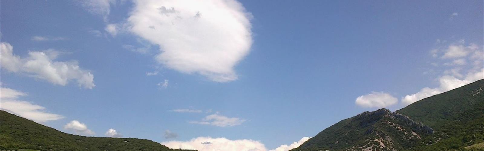
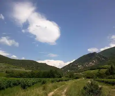
Les Gorges du Toulourenc cut through the limestone heart of Vaucluse with the kind of raw, unpolished drama that's hard to find in more heavily visited corners of southern France. This is a canyon hike in the truest sense — you're not walking alongside the gorge, you're moving through it, with sculpted rock walls rising on both sides and the Toulourenc River as your constant companion. The 4.7 km route with 257 meters of elevation gain takes roughly 2h30 to complete and sits comfortably at a moderate difficulty level, making it accessible to hikers with some experience on uneven terrain. The hike follows the GR91 trail for the first section before descending into the river bed itself.
What the Terrain Actually Feels Like
Don't expect a groomed trail with clear signage at every junction. Les Gorges du Toulourenc is the kind of place where the route is defined as much by the river and the canyon walls as by any marked path. You'll move across water-polished limestone, hop between rocks to cross the river, and occasionally work through tighter passages where the walls narrow and the light drops. None of it requires technical climbing skills, but you do need to be comfortable with your footing and willing to problem-solve on the fly.
The elevation gain is gradual rather than concentrated, which means you won't hit one brutal climb — instead, the effort is spread across the full length of the gorge as you work your way deeper into the canyon system. The real challenge isn't the ascent; it's the cumulative effect of navigating constantly changing terrain underfoot. Smooth, slick rock surfaces alternate with rougher sections, and the stream crossings add a layer of complexity that varies significantly depending on water levels.
Footwear matters more here than on most moderate hikes. Approach shoes or hiking boots with sticky rubber soles and solid ankle support are genuinely worth the investment for this kind of terrain. Standard trail runners can work in dry conditions, but anything with poor grip becomes a liability on wet limestone.
The Water Element
The Toulourenc River is the defining feature of this hike — not just scenically, but logistically. The river has spent thousands of years carving through the limestone, leaving behind a series of pools, cascades, and smooth stone formations that make the gorge feel like a living geology lesson. Water levels typically vary between 5 cm and 1 meter depending on the section and season. Expect to get your feet wet, especially in spring and early summer when water levels are higher.
The water stays notably cool even during the hottest months, which is part of what makes the gorge such a draw in summer. The combination of shade from the canyon walls and the cooling effect of the river creates a microclimate that feels dramatically different from the sun-baked Provençal landscape above. That temperature contrast is one of the things that makes this hike genuinely memorable rather than just scenic.
One practical note: the river water looks clean, and the limestone geology does provide natural filtration, but treat it before drinking if you're planning a longer outing. Clear doesn't always mean safe.
Flora, Wildlife, and the Gorge Ecosystem
The sheltered, moisture-retaining environment inside the gorge supports vegetation that looks out of place compared to the dry Mediterranean scrub on the plateau above. Ferns and mosses colonize the shaded sections of canyon wall, thriving in conditions that would be impossible just a few hundred meters away in the open landscape. Hardy plants have taken root in the cracks and ledges of the limestone, adapted to vertical life in ways that reward a closer look as you move through.
Bird activity is particularly noticeable in the gorge, partly because the narrow canyon acts as a natural amplifier for sound. Calls that might go unnoticed in open terrain become vivid and directional in this enclosed space. Small mammals and reptiles are present but tend to stay out of sight during the hours when hikers are most active.
Seasonal Timing
Spring brings the most dramatic water conditions, with snowmelt and seasonal rain pushing the Toulourenc to fuller flow. The cascades are more impressive, the pools deeper, and the overall visual impact of the gorge is at its peak — but stream crossings are more demanding and wet rock surfaces require extra caution.
Summer shifts the experience toward the cooling and shading qualities of the canyon. Water levels drop, crossings become easier, and the contrast between the gorge interior and the heat outside becomes most pronounced. This is also the busiest season, so early morning starts are worth it both for parking and for experiencing the gorge before crowds arrive.
Fall offers a solid middle ground — moderate water levels, comfortable temperatures, and slightly less foot traffic than peak summer. The reduced vegetation also makes some of the tighter sections easier to navigate.
Winter hiking is possible but requires genuine attention to conditions. Cold temperatures combined with moisture on rock surfaces can create hazardous footing, and the gorge's enclosed nature means you won't always have good visibility of incoming weather until it's already on top of you.
Practical Information
The gorge is accessed from the small bridge near Veaux (Pont de Veaux), where parking has been established. The route can be structured in different ways, with some approaches prioritizing the most dramatic narrow sections of the canyon. Check current conditions before you go, particularly after periods of heavy rain, as water levels can change quickly and what's a manageable crossing one day may not be the next.
Cell coverage is unreliable or nonexistent in the deeper sections of the gorge. That's part of the appeal for some hikers, but it does mean you need to be self-sufficient and prepared to navigate without relying on a data connection. Download offline maps before you leave, and let someone know your plan.
Parking availability varies by access point and time of year, with summer weekends seeing the heaviest use. Getting there early solves most of the parking problem and gives you the added bonus of better light for photography inside the canyon, where the narrow opening above creates striking conditions in the morning hours.
Flash flooding is rare but worth understanding — the gorge sits within a broader watershed, which means heavy rain upstream can affect conditions in the canyon even when local skies look clear. Checking regional weather forecasts, not just the immediate forecast for the trailhead, is a habit worth building before any gorge hike in this part of France.
The Essential Hiking Checklist
Everything you need for your next hike. Bilingual, printable, 1 page.
Get your free hiking checklistRecommended gear for this trail
As an Amazon Associate I earn from qualifying purchases.


Ready to go?
Everything you need to know before you goWhen?
How much?
As an Amazon Associate I earn from qualifying purchases.
Affiliate links — LGPO may earn a commission at no extra cost to you.
- Hiking shoes Essential
- → Salomon Elixir Tour Mid WP · 203.38 $
- Layered clothing Essential
- Rain jacket Essential
- Trekking poles
- → Black Diamond Trail Ergo Cork · 69.99 $
- Headlamp
- → Petzl Actik Core 625 · 103.95 $
FAQ - Frequently asked questions
Everything you need to knowSimilar hikes nearby
Discover other trails you might enjoy

Hiking near Sydney
22 trails to explore ~4995 km away
We work hard to provide the most up-to-date and error-free data possible. If something seems incorrect, let us know! Your contribution helps the whole community.
Hikers' opinions
Be the first to review!
No hiker has shared their experience yet. Share your impressions and help other hikers!