
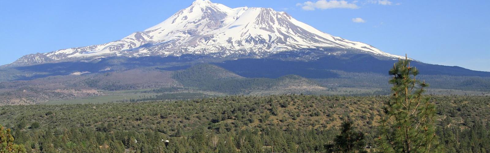
Ready to explore Mount Shasta, California? Here's everything you need to know before you go!
Discover the trail
Trail description
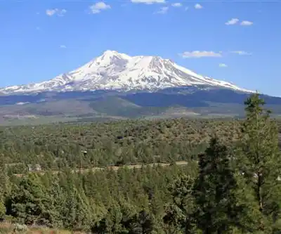
Mount Shasta is one of the most iconic peaks in the American West — a massive, glacier-draped stratovolcano that dominates the skyline of Northern California. Climbing it is a serious undertaking, but it's also one of the most accessible high-altitude mountaineering objectives in the contiguous United States. Whether you're stepping into alpine climbing for the first time or you're a seasoned mountaineer looking for a classic route, Mount Shasta delivers an experience that's hard to match anywhere in California.
The Mountain
Mount Shasta stands as one of the largest stratovolcanoes in the Cascade Range, and its sheer bulk is immediately apparent from every angle. The mountain is glaciated year-round, with several named glaciers draped across its flanks. The summit area is rugged and exposed, and the upper mountain presents genuine alpine terrain — steep snow and ice, unpredictable weather, and significant elevation gain from any starting point.
This is not a hike in the traditional sense. Climbing Mount Shasta requires crampons, an ice axe, and the knowledge to use them. Most climbers also carry a helmet. The mountain demands respect, and conditions can change fast — clear skies at the trailhead don't guarantee a safe summit window. Checking current conditions and weather forecasts before you go is essential, not optional.
Main Routes
The Avalanche Gulch route is the most popular line on the mountain and the standard introduction to Mount Shasta climbing. It approaches from the south side via the Bunny Flat trailhead and gains the summit through a broad glaciated bowl. It's the most traveled, the most documented, and the one with the most support infrastructure — including the Sierra Club's Horse Camp hut, which serves as a popular base camp.
Other routes on the mountain include the Casaval Ridge, the Clear Creek route on the southeast side, and the more technical Whitney Glacier and Hotlum-Bolam Ridge routes on the north and northeast flanks. Each route has its own character, level of commitment, and technical demands. The Clear Creek route is often considered a good alternative when Avalanche Gulch is heavily tracked out or icy late in the season.
Permits and Regulations
Anyone climbing above 10,000 feet on Mount Shasta is required to purchase a Summit Pass. A separate Wilderness Permit is also required for overnight stays in the Mount Shasta Wilderness. Both are managed by the Shasta-Trinity National Forest. Permits can be purchased at the Mount Shasta Ranger District office in the town of Mount Shasta, or at self-issue stations at some trailheads.
There is also a strict pack-out waste policy above treeline. Human waste must be packed out using a WAG bag (Waste Alleviation and Gelling bag). These are available for purchase at the ranger station and at some outdoor retailers in town. This is a hard requirement, not a suggestion — the volume of climbers on the mountain makes it a genuine environmental issue.
Gear and Preparation
The standard gear list for a Mount Shasta climb includes:
- Crampons — 12-point mountaineering crampons are strongly recommended
- Ice axe — essential for self-arrest on steep snow
- Helmet — rockfall and ice fall are real hazards, especially later in the day
- Layering system — temperatures at the summit can be extreme even in summer
- Sun protection — the reflective snow environment at altitude intensifies UV exposure significantly
- Navigation tools — whiteout conditions are possible; a GPS or compass and map are important
- WAG bags — required above treeline
Most climbers attempting Avalanche Gulch do a two-day ascent, camping at Helen Lake (around 10,400 feet) before pushing for the summit in the early morning hours. A pre-dawn start is standard practice — the snow is firmer, the weather is typically more stable, and you want to be off the upper mountain before afternoon heating softens the snow and increases rockfall and avalanche risk.
What to Expect on the Climb
The lower sections of Avalanche Gulch pass through open terrain with views back toward the valley and the surrounding Cascade foothills. As you gain elevation, the landscape becomes increasingly stark — volcanic rock, glacial debris, and wide snowfields. The Red Banks, a prominent band of reddish volcanic rock near the top of the gulch, marks the crux section for many climbers. Above the Red Banks, the route continues to Misery Hill — a long, grinding slope that feels endless when you're at altitude — before the final push to the true summit.
Altitude affects people differently, and Mount Shasta's summit elevation means that even fit, experienced hikers can feel the effects of thin air. Headaches, nausea, and fatigue are common. Acclimatizing with a night at Helen Lake helps, but it's not a guarantee. Know the signs of altitude sickness and be prepared to turn around if needed — the mountain will be there next season.
Getting There
The town of Mount Shasta in Northern California serves as the main gateway and supply point for climbers. The Mount Shasta Ranger District office is located in town and is the best first stop for current conditions, permit information, and any last-minute questions. The Bunny Flat trailhead, the standard starting point for the Avalanche Gulch route, is located on Everitt Memorial Highway, which climbs the south flank of the mountain from the town of Mount Shasta.
Season
The primary climbing season on Mount Shasta runs from late spring through early summer, typically May through July, when snow conditions are most favorable for the standard routes. Earlier in the season, the snowpack is deep and consolidated. By midsummer, the snow on lower elevations melts out and the routes become more rocky and loose. Some climbers also attempt the mountain in late fall and winter, but those conditions require a significantly higher level of experience and commitment.
Conditions vary considerably from year to year depending on snowpack, and what was a straightforward snow climb in May can be a loose, rocky scramble by August on the same route.
In winter
According to the Shasta-Trinity National Forest's Bunny Flat page (updated October 1, 2026), skis or snowshoes may be necessary from November through June; the road may be closed during stormy periods but is usually plowed during the snowy months, and chains may be required. The Forest Service's Mt. Shasta Wilderness page (updated October 1, 2026) says major storms off the Pacific can send high winds and snow across the mountain any time of year, that it is not unusual to get the first significant snows by the beginning of October, and that wilderness permits are free and required year round, with no quotas. Its conditions page (updated November 13, 2026) lists the Bunny Flat trailhead as open and Everitt Memorial Highway as “Closed at Bunny Flat”, and refers visitors to the Mount Shasta Avalanche Center website for avalanche forecasts, climbing advisories and recent observations.
Everything you need for your next hike. Bilingual, printable, 1 page.
Get your free hiking checklistRecommended gear for this trail
As an Amazon Associate I earn from qualifying purchases.


Ready to go?
Everything you need to know before you goWhen?
As an Amazon Associate I earn from qualifying purchases.
Affiliate links — LGPO may earn a commission at no extra cost to you.
- Hiking shoes Essential
- → Salomon Elixir Tour Mid WP · 203.38 $
- Layered clothing Essential
- Rain jacket Essential
- Trekking poles
- → Black Diamond Trail Ergo Cork · 69.99 $
- Headlamp
- → Petzl Actik Core 625 · 103.95 $
FAQ - Frequently asked questions
Everything you need to knowOutings near Mount Shasta, California
Discover other trails you might enjoy
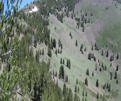
Scott Mountain, California
Shasta Cascade · 42.8 km away
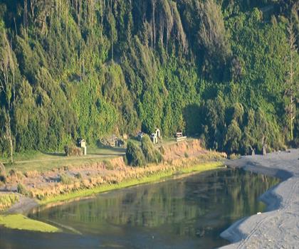
Klamath River
Shasta Cascade · 71.1 km away

Thompsons Peak
Shasta Cascade · 84.7 km away
Marble Mountain, California
Shasta Cascade · 86.7 km away
Mule Mountain, California
Shasta Cascade · 98.8 km away
Kangaroo Mountain, California
Shasta Cascade · 101.1 km away
Hiking near Victoria
105 trails to explore ~785 km away
We work hard to provide the most up-to-date and error-free data possible. If something seems incorrect, let us know! Your contribution helps the whole community.
Hikers' opinions
Be the first to review!
No hiker has shared their experience yet. Share your impressions and help other hikers!