
Ready to explore Sulphur Works? Here's everything you need to know before you go!
Discover the trail
Trail description
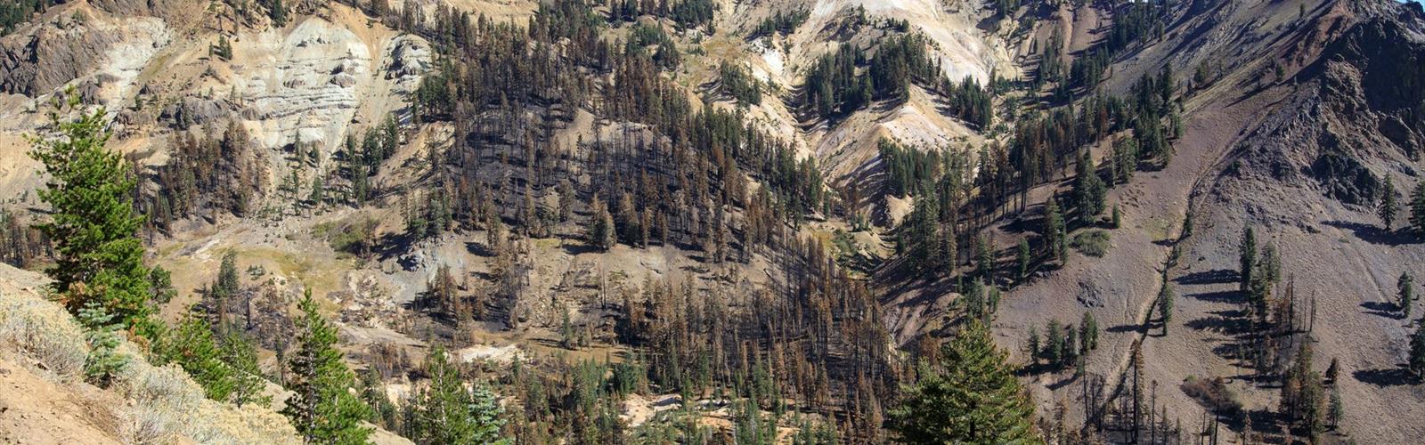
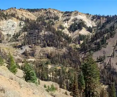
Sulphur Works is one of the most accessible and visually striking hydrothermal areas in Lassen Volcanic National Park, located in northern California. Sitting right alongside the main park road, this spot puts you face to face with active volcanic features — bubbling mud pots, steaming fumaroles, and the unmistakable smell of hydrogen sulfide — without requiring a long hike to get there. It's a legitimate geological spectacle that rewards visitors of all ages and fitness levels.
What You're Looking At
Sulphur Works sits within the caldera of an ancient volcano known as Mount Tehama (also called Brokeoff Volcano), which was once a massive stratovolcano that dominated this landscape. What remains today is a hydrothermal system that's still very much alive. The ground here is thin and unstable in places, and the features you see — the hissing steam vents, the boiling mud, the sulfur-stained earth — are a direct window into the volcanic heat still churning beneath the surface.
The yellow and orange mineral deposits around the vents give the area its name. Sulfur crystals and iron oxide create a vivid color palette against the grey and brown volcanic rock. It's genuinely otherworldly, and it photographs well in almost any light.
The Trail and the Experience
The walkway at Sulphur Works is short and paved, running along the edge of the hydrothermal features with interpretive signs explaining what you're seeing. The path is designed to keep visitors at a safe distance from the active areas — the ground near the mud pots and fumaroles can be dangerously thin, and the water in those features is near boiling. Staying on the designated path isn't just a rule; it's genuinely important here.
Because of its location right off the road, Sulphur Works tends to get busy during peak season. If you want a quieter experience, arriving early in the morning or later in the afternoon makes a real difference. The hydrothermal activity doesn't slow down regardless of the time of day, so you're not missing anything by avoiding the midday crowds.
Geology Worth Understanding
Lassen Volcanic National Park is one of the few places in the contiguous United States where all four types of volcanoes are represented — plug dome, shield, cinder cone, and composite. Sulphur Works sits in the heart of this volcanic landscape and is considered one of the most hydrothermally active areas in the park. The features here are part of the same system that feeds Bumpass Hell, the park's largest hydrothermal area, located further along the main road.
The mud pots at Sulphur Works are particularly interesting. They form when sulfuric acid breaks down the surrounding rock into clay, which then mixes with water to create that characteristic bubbling, grey-brown mud. The consistency and activity level of the mud pots can vary depending on precipitation and seasonal conditions — they tend to be more active when water levels are higher.
Getting There
Sulphur Works is located on Lassen Park Road (Highway 89) inside Lassen Volcanic National Park. There is a small pullout and parking area directly adjacent to the site. The park charges an entrance fee, and a valid pass is required to access this area. America the Beautiful passes and other federal recreation passes are accepted.
The road through the park is typically open from late spring through early fall, depending on snowpack. The Sulphur Works area is one of the first stops you reach when entering the park from the southwest entrance, making it a natural first stop on any visit to Lassen.
Practical Notes
- Entrance fee: A national park pass is required. America the Beautiful passes are accepted.
- Accessibility: The paved walkway makes this one of the more accessible stops in the park for visitors with mobility considerations.
- Stay on the path: The hydrothermal crust near active features can be extremely thin. Stepping off the designated walkway is dangerous and prohibited.
- The smell: The hydrogen sulfide odor is strong. It's harmless at the concentrations present outdoors, but it's noticeable — some visitors find it intense.
- Pets: Check current park regulations regarding pets on the walkway. National park rules generally restrict pets to paved areas and parking lots.
- Best combined with: Bumpass Hell, Lassen Peak Trail, and Devastated Area are all within the same park and make for a full day of exploration.
Who It's Right For
Sulphur Works works well for families with young kids, visitors who aren't up for a long hike, or anyone who wants to experience Lassen's volcanic character without committing to a full trail. That said, it also makes a solid warm-up stop for hikers heading deeper into the park. The combination of easy access and genuine geological drama makes it one of the more memorable quick stops in California's national park system.
If you've never seen an active hydrothermal area up close, Sulphur Works is a compelling introduction — the kind of place that makes the volcanic history of the Sierra Nevada feel immediate and real rather than abstract.
In winter
According to the National Park Service (NPS), the Sulphur Works hydrothermal area in Lassen Volcanic National Park is accessible year-round, but during the snow season (approximately November through April), when the highway is snow-covered, only by an over-snow route: the park highway closes to through traffic, and visitors follow the snow-covered highway for one mile from the Southwest Area parking area, past the Kohm Yah-mah-nee Visitor Center and a sledding area. The NPS describes it as the only hydrothermal area in the park that is accessible in those months, and says heat from the features often keeps the portion of road between them clear of snow.
An NPS page (updated December 29, 2020) gives 2 miles round-trip, about 1 hour on snowshoes, with a climb of 300 feet in one mile. Snowshoes are the mode of travel it describes. For cross-country skiing, it recommends the route for advanced skiers only, because footprints and snowshoe tracks freeze and make skiing more difficult (the 2026 conditions page below rates Sulphur Works as beginner level). It does not recommend walking without snowshoes unless the route is completely hardpacked, since you may break through the snow frequently. Bring your own equipment: rentals are not available in the park, and pets are not permitted on snow-covered routes. The NPS warns of avalanche danger and asks visitors to watch for movement on the steep slopes above; the left side of the route is bordered by steep side hills. The NPS oversnow conditions page (updated November 9, 2026) says accumulated snow warrants the use of skis or snowshoes to reach Sulphur Works; it adds that a packed-down surface may at times make the route passable without winter equipment, and that snowshoes, skis or boot spikes are advisable.
Everything you need for your next hike. Bilingual, printable, 1 page.
Get your free hiking checklistRecommended gear for this trail
As an Amazon Associate I earn from qualifying purchases.


Ready to go?
Everything you need to know before you goWhen?
As an Amazon Associate I earn from qualifying purchases.
Affiliate links — LGPO may earn a commission at no extra cost to you.
- Hiking shoes Essential
- → Salomon Elixir Tour Mid WP · 203.38 $
- Layered clothing Essential
- Rain jacket Essential
- Trekking poles
- → Black Diamond Trail Ergo Cork · 69.99 $
- Headlamp
- → Petzl Actik Core 625 · 103.95 $
FAQ - Frequently asked questions
Everything you need to knowOutings near Sulphur Works
Discover other trails you might enjoy
Lassen Volcanic National Park
Shasta Cascade · 11.6 km away
Cinder Cone, California
Shasta Cascade · 21.3 km away

Butte County High Point, California
Shasta Cascade · 37.7 km away
Round Valley Reservoir
Shasta Cascade · 61.6 km away
Bald Mountain, California
Shasta Cascade · 63.9 km away
Diamond Mountain, California
Shasta Cascade · 73.1 km away
Hiking near Victoria
105 trails to explore ~898 km away
We work hard to provide the most up-to-date and error-free data possible. If something seems incorrect, let us know! Your contribution helps the whole community.
Hikers' opinions
Be the first to review!
No hiker has shared their experience yet. Share your impressions and help other hikers!