

Ready to explore Potawatomi Trail? Here's everything you need to know before you go!
Discover the trail
Oh no! We don't have any photos 😢
This trail hasn't been captured yet. Be the first to share your adventure!Trail description
The Potawatomi Trail is one of the most well-regarded backcountry loops in Michigan's Lower Peninsula. Located in the Pinckney Recreation Area in Livingston County, this trail draws hikers, backpackers, and trail runners looking for a genuine wilderness feel without having to drive to the Upper Peninsula. The terrain is rugged by Lower Peninsula standards — rolling glacial hills, dense hardwood forest, and a string of lakes and wetlands that keep the scenery changing throughout the loop.
The Terrain
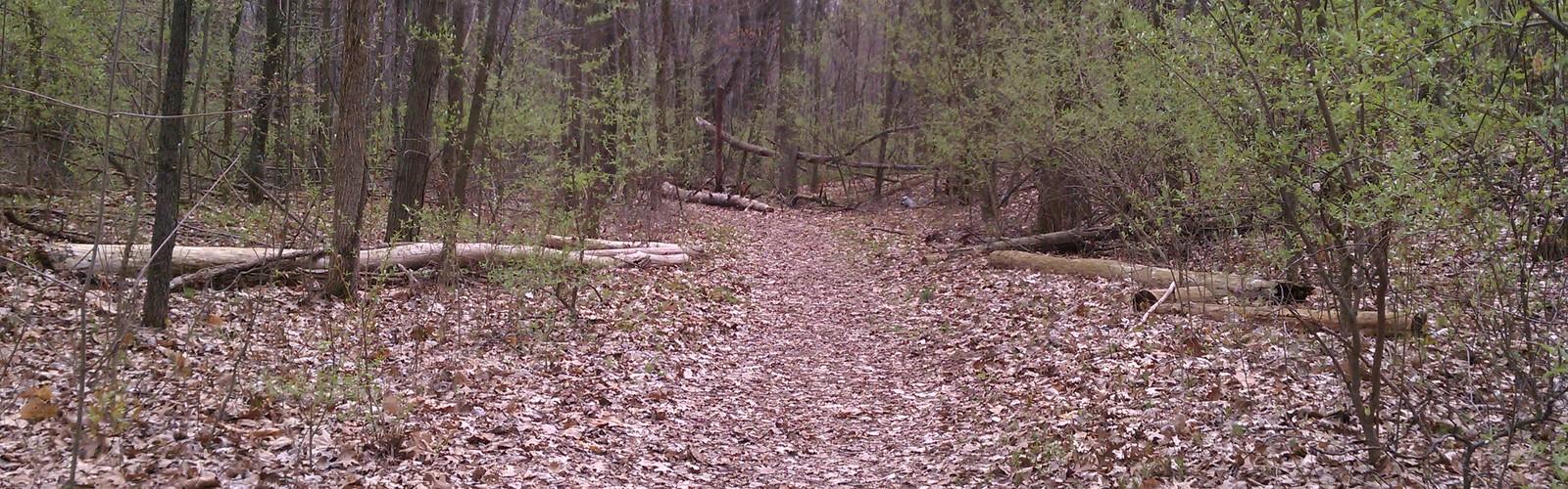
What sets the Potawatomi Trail apart from most trails in central Michigan is the topography. The glaciers left behind a landscape of steep-sided moraines, kettle lakes, and boggy lowlands, and the trail threads through all of it. You'll climb and descend repeatedly — short but punchy hills that add up over the course of the loop. The footing is rooty and uneven in many sections, especially after rain, so trekking poles are a smart call.
The forest cover is predominantly mixed hardwood — oak, maple, beech, and hickory — with pockets of pine and hemlock near the water. In fall, the color is exceptional. In spring and early summer, the lowland sections can be muddy and wet, which is worth knowing before you head out.
Lakes and Water Features
One of the defining characteristics of this trail is how often you're near water. The Pinckney Recreation Area is dotted with lakes, and the Potawatomi Trail passes close to several of them. Crooked Lake, Blind Lake, and Gosling Lake are among the water bodies you'll encounter along the route. These aren't just scenic backdrops — they also mark good rest spots and, for backpackers, help orient you on the map as you move through the loop.
The wetland crossings and lake edges also mean you're in good habitat for wildlife. Waterfowl, great blue herons, and white-tailed deer are commonly spotted. Bring bug spray from late spring through midsummer — the low-lying areas near water can be intense for mosquitoes.
Backpacking on the Potawatomi
The Potawatomi Trail is one of the few trails in the Lower Peninsula that genuinely supports a multi-day backpacking trip. There are designated backcountry campsites along the loop, which means you can break the trail into sections and spend a night or two out. This makes it a popular destination for backpackers who want to practice overnight skills without committing to a remote wilderness area.
A Michigan Recreation Passport is required for vehicle entry into the Pinckney Recreation Area. Backcountry camping also requires a permit, so check current requirements with the Michigan DNR before your trip. The trail is managed by the Michigan Department of Natural Resources.
Trail Connections
The Potawatomi Trail connects with the Losee Lake Trail, a shorter loop that shares part of the same trail system. This gives hikers some flexibility — you can tackle just the Losee Lake section for a shorter outing, or combine both loops for a longer day. The trailhead is located off Dexter-Townhall Road, and there is a parking area available on site.
Who This Trail Is For
This trail is best suited for hikers who are comfortable with uneven terrain and some physical challenge. The repeated elevation changes and rooty trail surface mean it's not ideal for young children or anyone who needs a smooth, predictable path. That said, experienced hikers of most fitness levels can handle it — it's demanding but not technical.
Trail runners also use the Potawatomi regularly, and it has hosted organized trail running events. The varied terrain and natural surface make it a solid training ground for anyone building off-road running fitness.
Seasonal Considerations
The trail is open year-round. Winter hiking and snowshoeing are possible, and the snow-covered hills and frozen lakes create a completely different atmosphere than the warmer months. Cross-country skiing is also permitted on portions of the trail system. Spring is the muddiest season — the low sections near water can be significantly degraded, and some hikers choose to wait until late May or June before attempting the full loop to avoid causing trail damage.
Fall is widely considered the best time to hike the Potawatomi. The hardwood canopy puts on a strong show, the bugs are gone, and the cooler temperatures make the climbs more comfortable. Weekends in October can be busy at the trailhead, so an early start is worth it.
Practical Information
- Location: Pinckney Recreation Area, Livingston County, Michigan
- Trailhead: Off Dexter-Townhall Road, with a designated parking area
- Entry fee: Michigan Recreation Passport required for vehicle access
- Backcountry camping: Permitted at designated sites with a valid DNR permit
- Trail surface: Natural — rooty, hilly, and variable; can be muddy in spring
- Managed by: Michigan Department of Natural Resources (DNR)
- Trail connections: Connects with the Losee Lake Trail for a shorter loop option
The Potawatomi Trail delivers a backcountry experience that's genuinely hard to find in the Lower Peninsula — technical enough to keep experienced hikers engaged, scenic enough to reward the effort at every turn.
The Essential Hiking Checklist
Everything you need for your next hike. Bilingual, printable, 1 page.
Get your free hiking checklistRecommended gear for this trail
As an Amazon Associate I earn from qualifying purchases.


Ready to go?
Everything you need to know before you goWhen?
How much?
As an Amazon Associate I earn from qualifying purchases.
Affiliate links — LGPO may earn a commission at no extra cost to you.
- Hiking shoes Essential
- → Salomon Elixir Tour Mid WP · 203.38 $
- Layered clothing Essential
- Rain jacket Essential
- Trekking poles
- → Black Diamond Trail Ergo Cork · 69.99 $
- Headlamp
- → Petzl Actik Core 625 · 103.95 $
FAQ - Frequently asked questions
Everything you need to knowHiking near Kitchener
142 trails to explore ~310 km away
We work hard to provide the most up-to-date and error-free data possible. If something seems incorrect, let us know! Your contribution helps the whole community.
Hikers' opinions
Be the first to review!
No hiker has shared their experience yet. Share your impressions and help other hikers!