
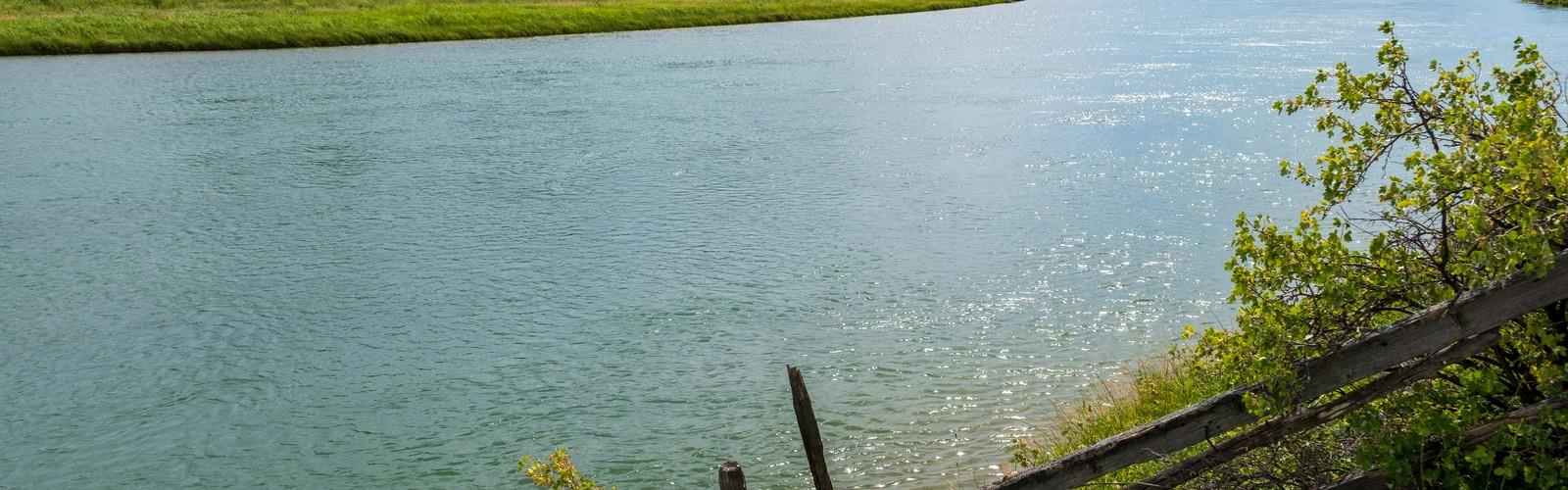

Ready to explore Marias River From Two Medicine River and Cut Bank Creek to the Missouri River? Here's everything you need to know before you go!
Discover the trail
Oh no! We don't have any photos 😢
This trail hasn't been captured yet. Be the first to share your adventure!Trail description
The Marias River corridor — stretching from the confluence of the Two Medicine River and Cut Bank Creek all the way to the Missouri River — is one of Montana's most historically significant and scenically raw waterways. This is Lewis and Clark country, wide-open plains country, and a stretch of river that most hikers and outdoor enthusiasts have never set foot on. That's exactly what makes it worth knowing about.
The Route and the River
The Marias River begins where the Two Medicine River and Cut Bank Creek meet in north-central Montana, then flows southeast until it empties into the Missouri River near Loma. The route follows this river system across the high plains of Montana, moving through a landscape that feels genuinely remote and largely unchanged from what early explorers encountered in the early 1800s.
This isn't a groomed trail with trailhead kiosks and numbered posts. It's a route — a corridor that follows a natural waterway through open terrain. Expect river bottomlands, cottonwood groves, prairie benchlands, and the kind of big sky that Montana is known for. The land along the Marias shifts between agricultural areas, public land, and river access points, so knowing where you're going before you go is essential.
Historical Significance
The Marias River carries serious historical weight. Meriwether Lewis explored this river during the 1804–1806 Corps of Discovery Expedition, famously uncertain whether the Marias or the Missouri was the main channel the expedition should follow. Lewis named the river after his cousin Maria Wood, and the Marias became one of the more debated geographic puzzles of the entire journey.
The river also marks the site of the Marias Massacre of January 1870, one of the darkest episodes in the history of the American West. A U.S. Army detachment attacked a peaceful Blackfeet camp on the Marias River, killing a large number of Blackfeet people — mostly women, children, and elderly. This history is part of the land here, and it deserves acknowledgment when you travel through it.
For anyone interested in Indigenous history, the Marias River corridor sits within the traditional territory of the Blackfeet Nation (Niitsitapi), and the landscape reflects thousands of years of human presence long before European exploration.
What the Terrain Looks Like
The Marias River flows through the northern Montana plains, and the terrain reflects that. You're not looking at mountain scenery here — you're looking at wide river valleys, eroded coulees, sagebrush flats, and cottonwood-lined riverbanks. The river itself cuts through soft sedimentary terrain, creating bluffs and breaks that add visual interest to what might otherwise seem like flat country.
Wildlife in this corridor includes white-tailed and mule deer, pronghorn antelope, coyotes, and a strong variety of raptors and shorebirds along the water. The cottonwood gallery forests along the river provide important habitat and shade, and the river itself supports fish populations that attract both wildlife and anglers.
The sky here is enormous. On a clear day, you can see the Rocky Mountain Front rising to the west, with the Glacier-area peaks visible in the distance. That contrast — open plains in the foreground, mountains on the horizon — is one of the defining visual experiences of this part of Montana.
Access and Practical Considerations
Access to the Marias River corridor varies along its length. The upper section near the Two Medicine River and Cut Bank Creek confluence is in the vicinity of Browning and the Blackfeet Reservation. Travelers should be aware of land ownership and access rights in this area, as portions of the corridor cross private land and tribal land where different rules apply. Always verify current access before heading out.
The lower section near the Missouri River confluence at Loma is more accessible and connects to the broader Missouri River Breaks area. The town of Loma sits near the mouth of the Marias and provides a logical endpoint or starting point for anyone approaching from the south.
Road access along the corridor is primarily via Montana state highways and county roads. Many of these roads are unpaved and can become impassable in wet conditions — this is something to take seriously in spring or after heavy rain. A high-clearance vehicle is a practical asset for exploring the more remote sections.
Who This Route Is For
This corridor appeals most to a specific kind of outdoor traveler: someone interested in history, river ecosystems, and wide-open landscapes rather than summit views or technical terrain. It's well-suited for:
- History enthusiasts following the Lewis and Clark trail or researching Blackfeet history and the events of 1870
- Birders and wildlife watchers drawn to the river bottomlands and prairie habitat
- Anglers interested in the Marias River fishery
- Paddlers and floaters looking at the river as a water route rather than a hiking corridor
- Photographers working with big sky, river light, and plains landscapes
Hikers looking for a defined trail with consistent footing and clear waypoints will find this corridor challenging to navigate. The route requires self-sufficiency, good map skills, and comfort with route-finding in open terrain.
Planning Your Visit
Water is available from the river but must be treated before drinking. There are no developed facilities along most of the corridor — no restrooms, no picnic areas, no designated campsites in the backcountry sense. If you're spending time out here, plan accordingly with everything you need carried in.
Cell service is limited to nonexistent across much of this route. A paper map or downloaded offline map is not optional — it's necessary. Let someone know your itinerary before heading into the more remote sections.
Weather on the northern Montana plains can shift quickly. Wind is a near-constant presence, and temperatures can swing significantly between morning and afternoon, especially in spring and fall. Check forecasts carefully and dress in layers.
The Marias River from the Two Medicine River and Cut Bank Creek to the Missouri River is the kind of place that rewards preparation and punishes assumptions — but for the traveler who comes ready, it offers a genuinely rare experience of Montana's plains landscape and the deep history written into this river valley.
The Essential Hiking Checklist
Everything you need for your next hike. Bilingual, printable, 1 page.
Get your free hiking checklistRecommended gear for this trail
As an Amazon Associate I earn from qualifying purchases.


Ready to go?
Everything you need to know before you goWhen?
How much?
As an Amazon Associate I earn from qualifying purchases.
Affiliate links — LGPO may earn a commission at no extra cost to you.
- Hiking shoes Essential
- → Salomon Elixir Tour Mid WP · 203.38 $
- Layered clothing Essential
- Rain jacket Essential
- Trekking poles
- → Black Diamond Trail Ergo Cork · 69.99 $
- Headlamp
- → Petzl Actik Core 625 · 103.95 $
FAQ - Frequently asked questions
Everything you need to knowSimilar hikes nearby
Discover other trails you might enjoy


Hiking near Calgary
120 trails to explore ~314 km away
We work hard to provide the most up-to-date and error-free data possible. If something seems incorrect, let us know! Your contribution helps the whole community.
Hikers' opinions
Be the first to review!
No hiker has shared their experience yet. Share your impressions and help other hikers!