
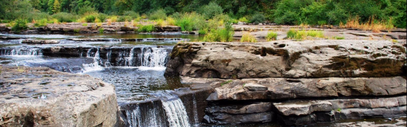

Ready to explore Smith River (Montana)? Here's everything you need to know before you go!
Discover the trail
2
community photos


Trail description
Smith River is a tributary of the Missouri River, in central Montana, in the United States. It rises in southern Meagher County in the Castle Mountains and flows northwest in the valley between the Big Belt and Little Belt mountains, past White Sulphur Springs and past Smith River State Park. It turns north-northwest (NNW), and is joined by Hound Creek in Cascade County, and joins the Missouri approximately 9 miles (14 km) southwest of Great Falls.
The Smith is a Class I river from the Camp Baker Fishing Access site near Ft. Logan to its confluence with the Missouri River for public access for recreational purposes.
Noted for its spectacular scenery and blue-ribbon trout fishery, the Smith River is unique in that it has only one public put-in and one public take-out for the entire 59-mile (95 km) segment of river. Boat camps located along the remote river canyon help preserve the unique quality of this area. The Smith River between Camp Baker and Eden Bridge is the only river corridor managed by Montana Fish, Wildlife & Parks as a permitted river. Permits for private floats on the Smith River are allocated to the public via a lottery system prior to the spring season. Permit applications are typically available the first week of January each year, with an application deadline of mid-February.
The Smith River is currently threatened by a large copper mine that is proposed to be built directly adjacent to and underneath its most important tributary, Sheep Creek.
Free
1 pages
The Essential Hiking Checklist
Everything you need for your next hike. Bilingual, printable, 1 page.
Get your free hiking checklistRecommended gear for this trail
As an Amazon Associate I earn from qualifying purchases.
LGPO Pick

Salomon
Elixir Tour Mid WP
Waterproof mid-height boot ideal for rocky terrain
203.38 $


Affiliate links — LGPO may earn a commission at no extra cost to you.
Ready to go?
Everything you need to know before you goWhen?
Opening hours
No information
Varies by season
Best season
Fall
Spectacular colors
Best time
Early morning
Less crowded
Weather (next days)
Loading
How much?
Entry fees
Adult
Not available
Child
—
What to bring?
As an Amazon Associate I earn from qualifying purchases.
Affiliate links — LGPO may earn a commission at no extra cost to you.
Gear
- Hiking shoes Essential
- → Salomon Elixir Tour Mid WP · 203.38 $
- Layered clothing Essential
- Rain jacket Essential
- Trekking poles
- → Black Diamond Trail Ergo Cork · 69.99 $
- Headlamp
- → Petzl Actik Core 625 · 103.95 $
Water & food
2L minimum
No water point on the trail
Bring energy snacks for a 4h+ hike
Good to know
Safety
Download the GPX before you go
Limited cellular coverage on the trail
Slippery after rain
Be careful on rocky sections
In an emergency
Emergency
911
Parking GPS
47.413611, -111.47861
Center
Not available
FAQ - Frequently asked questions
Everything you need to knowSmith River (Montana) is rated moderate.
The elevation gain of Smith River (Montana) is 400 m.
The summit of Smith River (Montana) is at 665 m.
Allow about 2h15 for Smith River (Montana) (5 km).
No, Smith River (Montana) has no visitor centre on site.
Didn't find your answer?
Similar hikes nearby
Discover other trails you might enjoy

Top 10 best hiking in Central Montana
Our ranking based on hiker reviews
Hiking near Calgary
120 trails to explore ~446 km away
Did you spot an error?
We work hard to provide the most up-to-date and error-free data possible. If something seems incorrect, let us know! Your contribution helps the whole community.
Hikers' opinions
Be the first to review!
No hiker has shared their experience yet. Share your impressions and help other hikers!