

Ready to explore Mount Jefferson, Nevada? Here's everything you need to know before you go!
Discover the trail
Trail description
Mount Jefferson is one of the most compelling and underrated alpine objectives in the Great Basin. Rising as the highest peak in the Toquima Range and the third to sixth highest peak in Nevada (sources vary, but definitively not second), this massive shield volcano dominates the central part of the state and rewards climbers with a genuine wilderness experience far removed from the crowds you'd find on more famous western summits. If you're looking for a serious mountain day in Nevada that goes well beyond a casual hike, Jefferson delivers.
The Mountain and Its Character
Mount Jefferson sits within the Toquima Range in central Nevada, a remote and rugged corner of the state that most people drive past without a second glance. The mountain itself is a remnant of ancient volcanic activity, and its broad, multi-summited ridgeline gives it a distinctive profile that's visible for miles across the surrounding valleys. The terrain is open, exposed, and unforgiving — classic Great Basin alpine country.
What sets Jefferson apart from many Nevada peaks is the genuine technical challenge it presents. This isn't a walk-up. The upper mountain involves scrambling over loose volcanic rock, route-finding across talus fields, and navigating a summit ridge that demands attention and solid footwork. Climbers who underestimate the objective or the remoteness of the area can find themselves in a difficult situation quickly.
The Approach and Route
Access to Mount Jefferson runs through the Toquima Range via dirt roads that require a high-clearance vehicle, particularly after wet weather. The approach itself is part of the adventure — you're driving deep into central Nevada's basin-and-range landscape, passing through sagebrush flats and pinyon-juniper woodland before the terrain begins to climb toward the alpine zone.
The standard climbing route gains significant elevation as it moves through several distinct vegetation bands. Lower slopes are covered in sagebrush and scattered pinyon pine. As you gain altitude, the vegetation thins and transitions to subalpine shrubs and grasses before giving way to the rocky, open terrain of the upper mountain. The summit area sits above treeline in a stark, windswept environment that feels genuinely remote.
Route-finding on the upper mountain requires care. The volcanic rock is often loose, and the broad ridgeline can be disorienting in poor visibility. Staying on track and moving efficiently matters here. Most parties approach this as a full-day objective, starting early to avoid afternoon thunderstorms — a serious concern during summer months in Nevada's mountains.
What to Expect on the Climb
The climbing on Mount Jefferson is best described as a sustained scramble rather than a technical rock climb. You'll use your hands regularly on the upper sections, and there are exposed moves that require confidence on loose terrain. Trekking poles are useful on the lower approach but become a liability on the steeper rocky sections — be prepared to stow them.
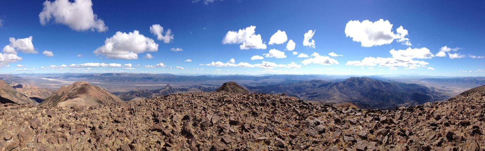
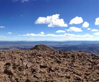
The summit ridge offers multiple high points, and identifying the true summit requires some attention to the terrain. Views from the top are expansive and genuinely impressive — the Great Basin stretches out in every direction, a vast mosaic of mountain ranges and dry valleys that gives you a real sense of the scale of this landscape. On a clear day, the visibility extends for an extraordinary distance across central Nevada.
Wind is a constant factor on the upper mountain. Even on calm days in the valleys below, the summit ridge can be breezy to outright gusty. Bring a wind layer regardless of the forecast, and be prepared for temperatures that drop significantly above treeline.
Wildlife and Natural Environment
The Toquima Range supports a healthy population of Great Basin wildlife. Mule deer are common on the lower slopes, and pronghorn can sometimes be spotted in the valleys during the approach drive. Higher up, keep an eye out for raptors riding thermals above the ridgeline — golden eagles are a regular presence in this part of Nevada. The alpine zone on Jefferson's upper slopes is sparse but not lifeless, with hardy grasses and wildflowers tucked into sheltered spots among the rocks.
The area around Mount Jefferson also falls within the traditional territory of the Western Shoshone people, who have deep historical and cultural connections to the Toquima Range. The mountain and surrounding landscape carry significance that extends well beyond its geological features.
Practical Considerations
Central Nevada is genuinely remote. The nearest services — fuel, food, emergency assistance — are a significant drive from the trailhead. Come fully prepared and self-sufficient. Cell service is essentially nonexistent in this area, so a satellite communicator is a smart addition to your kit for a climb of this nature.
- Vehicle: High-clearance is strongly recommended for the access road. Four-wheel drive is an asset in wet or snowy conditions.
- Water: Carry all the water you need. Sources in the alpine zone may be available depending on the season, but treat anything you collect.
- Weather: Afternoon thunderstorms are a real hazard in summer. Start early and be off exposed terrain by early afternoon.
- Navigation: Bring a topographic map and know how to use it. GPS is helpful but not a substitute for map skills in complex terrain.
- Gear: Sturdy hiking boots with ankle support are the minimum. Trekking poles, wind layers, sun protection, and a first aid kit are all essential.
- Season: The mountain is typically accessible from late spring through early fall, depending on snowpack. Early season climbs may require an ice axe and crampons on the upper slopes.
- Camping: Camping is allowed in the Alta Toquima Wilderness on Mount Jefferson Trail, with options for campsites, dispersed camping, and in-town accommodations.
Who This Climb Is For
Mount Jefferson is best suited for experienced hikers and scramblers who are comfortable on loose, exposed terrain and have solid route-finding skills. The remoteness of the location adds a layer of seriousness to the objective — this is not the place to push beyond your experience level. That said, for those with the right background, it's one of the most rewarding climbs in Nevada: a genuine wilderness summit with outstanding views and very little company.
If you've been looking for a Nevada mountain that offers real challenge, real solitude, and a real sense of accomplishment, Mount Jefferson is worth the drive into the heart of the Great Basin.
The Essential Hiking Checklist
Everything you need for your next hike. Bilingual, printable, 1 page.
Get your free hiking checklistRecommended gear for this trail
As an Amazon Associate I earn from qualifying purchases.


Ready to go?
Everything you need to know before you goWhen?
How much?
As an Amazon Associate I earn from qualifying purchases.
Affiliate links — LGPO may earn a commission at no extra cost to you.
- Hiking shoes Essential
- → Salomon Elixir Tour Mid WP · 203.38 $
- Layered clothing Essential
- Rain jacket Essential
- Trekking poles
- → Black Diamond Trail Ergo Cork · 69.99 $
- Headlamp
- → Petzl Actik Core 625 · 103.95 $
FAQ - Frequently asked questions
Everything you need to knowSimilar hikes nearby
Discover other trails you might enjoy

Hiking near Victoria
93 trails to explore ~1193 km away
We work hard to provide the most up-to-date and error-free data possible. If something seems incorrect, let us know! Your contribution helps the whole community.
Hikers' opinions
Be the first to review!
No hiker has shared their experience yet. Share your impressions and help other hikers!