

Ready to explore Mount Grant, Nevada? Here's everything you need to know before you go!
Discover the trail
Trail description
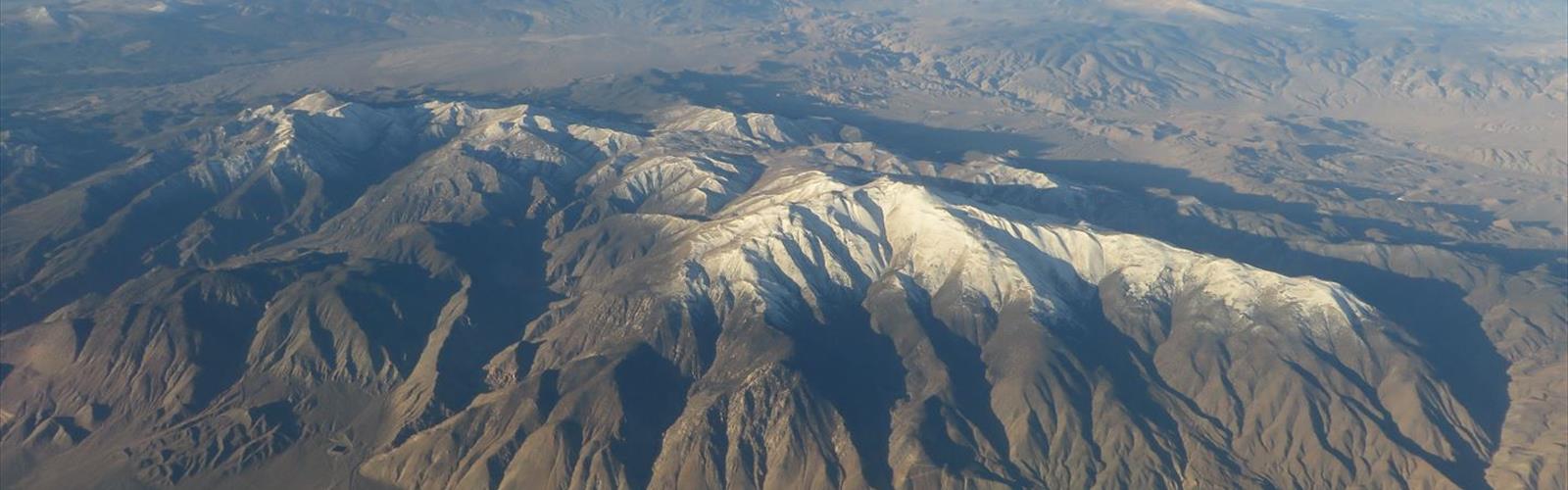
Mount Grant is one of the more compelling summit objectives in the Great Basin region of Nevada, rising prominently above the Walker Lake basin and the surrounding desert landscape. Located in the Wassuk Range, this peak offers a genuine mountaineering experience in a part of the state that doesn't always get the attention it deserves from the hiking and climbing community. If you're based in the Reno-Tahoe area and looking for a serious day out that takes you well off the beaten path, Mount Grant is worth putting on your radar.
The Terrain
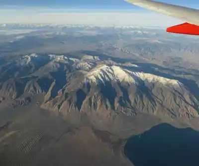
The Wassuk Range is a fault-block mountain range that rises sharply from the desert floor, and Mount Grant sits at the high point of that range. The approach and climb take you through a dramatic transition of terrain — from the arid, scrubby lower slopes typical of the Great Basin desert to rocky alpine terrain near the summit. The mountain's flanks are steep and rugged, and the upper reaches involve loose rock and exposed ridgelines that demand attention and solid footing.
This is not a groomed trail experience. Much of the route involves route-finding on unmaintained terrain, and the surface underfoot can be unpredictable — a mix of talus, scree, and compacted dirt depending on where you are on the mountain. Trekking poles are useful here, and footwear with solid ankle support is strongly recommended.
What Makes This Climb Distinctive
What sets Mount Grant apart from many Nevada peaks is the combination of isolation and dramatic vertical relief. Walker Lake sits below to the east, and on a clear day the views from the upper mountain stretch across an enormous swath of the Great Basin — a landscape of playas, distant ranges, and open sky that you simply don't get from more crowded destinations closer to Reno or Lake Tahoe.
The mountain also has historical significance tied to the region's mining and military history, which adds a layer of context to the experience for those interested in the broader story of this part of Nevada. The area around Walker Lake and the Wassuk Range has a long human history, from Indigenous use to the ranching and mining activity that shaped the region in the 19th and early 20th centuries.
Because this peak sits in a less-trafficked part of Nevada, you're unlikely to encounter crowds. That solitude is a genuine draw, but it also means you need to be more self-sufficient than you would be on a popular trail. Cell service is limited or nonexistent in this area, so planning ahead matters.
Getting There
Mount Grant is located in Mineral County, Nevada, in the Wassuk Range west of Walker Lake. The town of Hawthorne serves as the nearest service hub, where you can fuel up and pick up any last-minute supplies before heading out. Access roads into the range are typically dirt or gravel, and road conditions can vary significantly depending on recent weather. A high-clearance vehicle is advisable, and four-wheel drive may be necessary depending on conditions.
It's worth checking current road conditions before you go, as washouts and seasonal closures can affect access. There is no formal trailhead infrastructure in the way you'd find at a developed park or recreation area — this is backcountry Nevada, and the experience reflects that.
Difficulty and What to Expect
Mount Grant is a serious undertaking. The climb involves significant elevation gain, technical route-finding, and exposure on the upper mountain. This is not a hike for beginners or those unfamiliar with off-trail travel in rugged terrain. Previous experience with scrambling and backcountry navigation is genuinely useful here.
The physical demands are substantial. The combination of altitude, steep terrain, and the loose rock typical of Great Basin ranges means you'll be working hard throughout the climb. Start early to give yourself plenty of time and to avoid afternoon weather, which can develop quickly in the mountains even in summer.
Hydration is critical. The desert environment means the air is dry and the sun is intense, and water sources on the mountain are not reliable. Carry more water than you think you'll need.
Practical Considerations
- Navigation: A topographic map and compass — or a GPS device with downloaded maps — are essential. Do not rely solely on cell service for navigation.
- Water: Carry all the water you'll need for the day. Do not count on finding reliable water sources on the mountain.
- Vehicle: High-clearance is recommended for access roads; four-wheel drive may be needed depending on conditions.
- Weather: Check forecasts carefully before heading out. Afternoon thunderstorms are a real risk in summer, and the exposed upper mountain is not a place to be caught in lightning.
- Leave No Trace: This is a remote, lightly visited area. Pack out everything you bring in and stay on durable surfaces where possible to minimize impact on the terrain.
- Emergency planning: Let someone know your plans and expected return time. Cell service is unreliable in this area, and self-rescue may be the only option in an emergency.
Best Time to Go
Late spring through early fall is generally the most accessible window for climbing Mount Grant, with summer being the most common season. Snow can linger on the upper mountain well into spring and return early in fall, adding complexity to the route. Midsummer heat at lower elevations can be intense, making an early start even more important. Fall offers cooler temperatures and often stable weather, making it a strong choice for those who can time their visit accordingly.
Winter conditions on Mount Grant are serious and require mountaineering experience and appropriate gear — this is not a casual winter outing.
Who This Is For
Mount Grant appeals to experienced hikers and scramblers who are comfortable with off-trail travel, route-finding, and the physical demands of a long day in rugged terrain. It's a strong choice for anyone based in the Reno-Tahoe region who wants a genuine backcountry summit experience without driving to California, and for those drawn to the stark, open beauty of the Great Basin landscape that surrounds Walker Lake and the Wassuk Range.
The Essential Hiking Checklist
Everything you need for your next hike. Bilingual, printable, 1 page.
Get your free hiking checklistRecommended gear for this trail
As an Amazon Associate I earn from qualifying purchases.


Ready to go?
Everything you need to know before you goWhen?
How much?
As an Amazon Associate I earn from qualifying purchases.
Affiliate links — LGPO may earn a commission at no extra cost to you.
- Hiking shoes Essential
- → Salomon Elixir Tour Mid WP · 203.38 $
- Layered clothing Essential
- Rain jacket Essential
- Trekking poles
- → Black Diamond Trail Ergo Cork · 69.99 $
- Headlamp
- → Petzl Actik Core 625 · 103.95 $
FAQ - Frequently asked questions
Everything you need to knowSimilar hikes nearby
Discover other trails you might enjoy

Hiking near Victoria
93 trails to explore ~1156 km away
We work hard to provide the most up-to-date and error-free data possible. If something seems incorrect, let us know! Your contribution helps the whole community.
Hikers' opinions
Be the first to review!
No hiker has shared their experience yet. Share your impressions and help other hikers!