
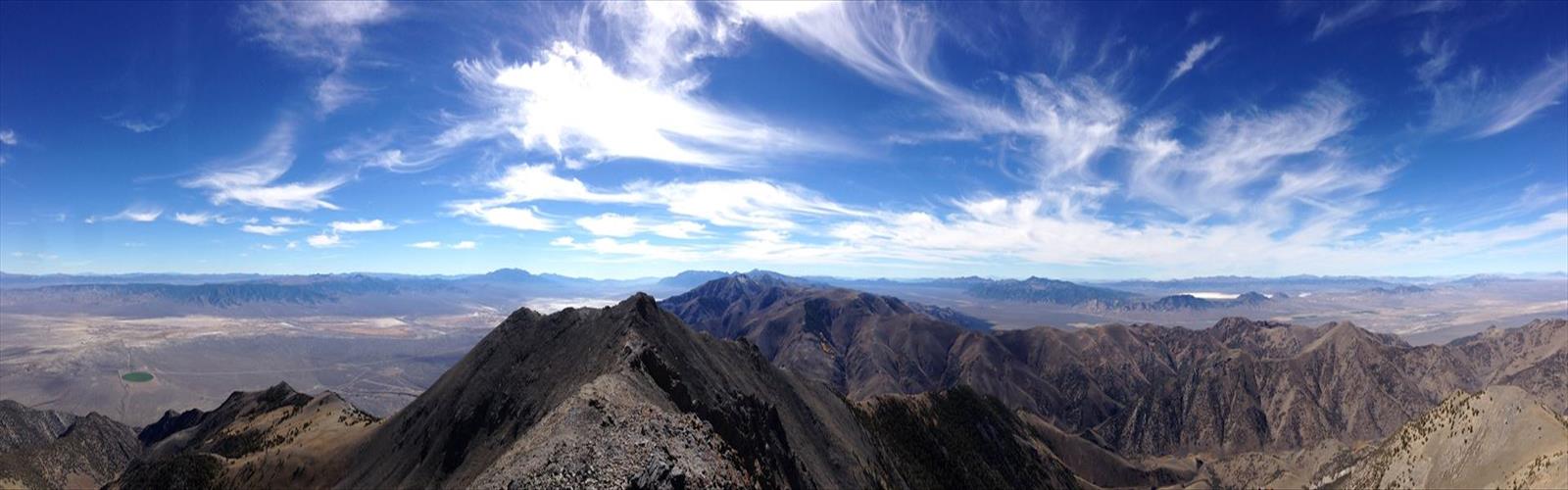

Ready to explore Bunker Hill, Nevada? Here's everything you need to know before you go!
Discover the trail
Trail description
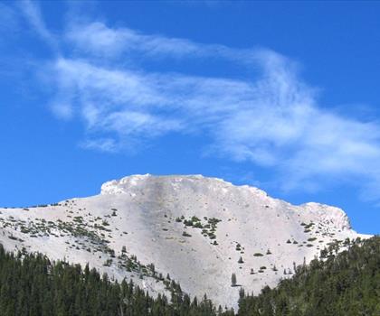
Bunker Hill in central Nevada is a straightforward peak climb that rewards you with wide-open desert views and a genuine sense of accomplishment. This is the kind of objective that draws climbers and hikers who want something more than a groomed trail — a real summit push through open terrain, with the Basin and Range landscape stretching out in every direction once you get up top.
The Terrain
Bunker Hill sits in the heart of central Nevada, a region defined by its stark, wide valleys and isolated mountain ranges. The approach and ascent move through classic Great Basin terrain — sagebrush flats giving way to rocky slopes as you gain elevation. The ground underfoot shifts from compacted desert soil to loose rock and talus as you near the summit, so solid footwear with ankle support is worth it here.
There's no maintained trail in the traditional sense. Route-finding is part of the experience, and that's exactly what makes Bunker Hill appealing to people who want something a little more raw than a marked path. You'll be reading the terrain, picking your line, and moving at your own pace through open country.
What to Expect on the Climb
The climb itself is a physical push. The slopes steepen noticeably as you get higher, and the rocky, uneven surface demands attention. This isn't technical climbing in the roped sense, but it's not a casual stroll either — loose rock sections require careful foot placement, and the exposure increases as you approach the top.
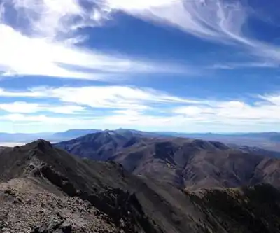
Once you're on the summit, the payoff is real. Central Nevada's Basin and Range geography means you're looking out over a landscape of parallel ridgelines and broad valleys that seems to go on indefinitely. On a clear day, the visibility is exceptional — this part of Nevada doesn't have the haze or tree cover that blocks views in other regions, so you get the full panorama.
Wind can be a factor near the top, especially in the morning and late afternoon. Layers are a smart call even if the valley feels warm when you start out.
Who This Climb Is For
Bunker Hill suits hikers and scramblers who are comfortable with off-trail travel and uneven, rocky terrain. If you've done peak climbs in the Great Basin before, you'll feel right at home. If this is your first off-trail summit push, it's a solid introduction — challenging enough to feel meaningful, but not so technical that it requires specialized gear or experience.
Families with younger kids or anyone looking for a flat, easy walk will want to look elsewhere. The rocky terrain and route-finding component make this better suited to people who are already comfortable moving through open desert mountain terrain.
Getting There
Access in central Nevada often means driving on unpaved roads, and Bunker Hill is no exception. A high-clearance vehicle is strongly recommended for reaching the trailhead area. Check road conditions before you go — desert roads in this region can be affected by seasonal weather, and what's passable in dry conditions can become a problem after rain.
Cell service is limited to nonexistent in this part of Nevada. Download your maps offline before leaving, and make sure someone knows your plan and expected return time.
Practical Information
- Terrain type: Off-trail desert peak climb with rocky, talus slopes near the summit
- Navigation: No marked trail — map and compass or GPS navigation required
- Vehicle access: High-clearance vehicle recommended for approach roads
- Water: No water sources on route — carry all water you'll need from the start
- Cell service: Unreliable in central Nevada — plan accordingly
- Best conditions: Spring and fall typically offer the most comfortable temperatures for this kind of exposed climb
Gear and Preparation
Because there's no marked trail and no infrastructure on the route, preparation matters more here than on a typical day hike. Beyond the standard ten essentials, a few things are worth highlighting for Bunker Hill specifically:
- Footwear: Sturdy hiking boots with ankle support — trail runners are workable for experienced scramblers, but the talus sections are easier with more structure underfoot
- Navigation tools: A downloaded topo map and GPS device or app — don't rely on cell signal
- Sun protection: Central Nevada's high desert means intense sun exposure with minimal shade on the upper slopes
- Wind layers: Summit winds can be significant — a windproof layer takes up almost no space and makes a real difference
- Water: Carry more than you think you'll need — there are no sources on the route
The Central Nevada Context
Part of what makes a climb like Bunker Hill worthwhile is the setting itself. Central Nevada is one of the least-visited parts of the American West, and that solitude is a genuine draw. You're unlikely to share the summit with a crowd. The Basin and Range landscape — those repeating patterns of north-south mountain ranges separated by flat valleys — gives the region a visual rhythm that's unlike anywhere else in the country.
Wildlife in this part of Nevada includes pronghorn, mule deer, and various raptor species that use the thermals rising off the desert floor. The high desert plant communities — sagebrush, bitterbrush, and scattered pinyon-juniper at higher elevations — are worth paying attention to as you move through the terrain.
Bunker Hill is the kind of place that doesn't advertise itself. It rewards the people who show up prepared, comfortable with self-reliance, and genuinely interested in what the Nevada high desert has to offer on its own terms.
The Essential Hiking Checklist
Everything you need for your next hike. Bilingual, printable, 1 page.
Get your free hiking checklistRecommended gear for this trail
As an Amazon Associate I earn from qualifying purchases.


Ready to go?
Everything you need to know before you goWhen?
How much?
As an Amazon Associate I earn from qualifying purchases.
Affiliate links — LGPO may earn a commission at no extra cost to you.
- Hiking shoes Essential
- → Salomon Elixir Tour Mid WP · 203.38 $
- Layered clothing Essential
- Rain jacket Essential
- Trekking poles
- → Black Diamond Trail Ergo Cork · 69.99 $
- Headlamp
- → Petzl Actik Core 625 · 103.95 $
FAQ - Frequently asked questions
Everything you need to knowSimilar hikes nearby
Discover other trails you might enjoy
Hiking near Victoria
93 trails to explore ~1135 km away
We work hard to provide the most up-to-date and error-free data possible. If something seems incorrect, let us know! Your contribution helps the whole community.
Hikers' opinions
Be the first to review!
No hiker has shared their experience yet. Share your impressions and help other hikers!