
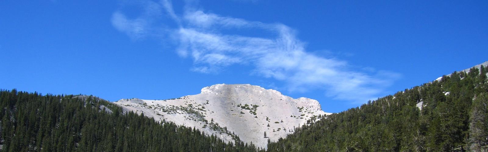

Ready to explore Mount Moriah, Nevada? Here's everything you need to know before you go!
Discover the trail
Oh no! We don't have any photos 😢
This trail hasn't been captured yet. Be the first to share your adventure!Trail description
Mount Moriah is one of eastern Nevada's most rewarding and underrated alpine destinations. Rising above the Snake Range in White Pine County, this peak offers a genuine wilderness experience far removed from the crowds you'd find at more well-known Nevada summits. If you're looking for a serious mountain objective in the Great Basin, Mount Moriah delivers.
The Mountain and Its Setting
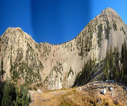
Mount Moriah sits within the Humboldt-Toiyabe National Forest and is part of the Mount Moriah Wilderness Area. The Snake Range runs north to south through this corner of Nevada, and Mount Moriah anchors the northern end of that range. The landscape here is classic Great Basin — dramatic elevation changes, bristlecone pine forests, open alpine terrain, and sweeping views across the basin and range country that stretches in every direction.
The summit area is known for a broad, relatively flat plateau sometimes called "The Table," a distinctive feature that sets Mount Moriah apart from more pointed peaks. This plateau sits at high elevation and gives climbers an unusual experience of walking across open, exposed terrain near the top rather than scrambling to a single narrow summit point.
The Climb
Reaching the summit of Mount Moriah is a serious undertaking. The approach involves significant elevation gain through varied terrain — you'll move through sagebrush and pinyon-juniper zones in the lower elevations before transitioning into subalpine forest and eventually the open rocky terrain near the top. The route is not a casual day hike; it demands solid fitness, proper footwear, and good route-finding skills, especially in the upper sections where the trail becomes less defined.
The most commonly used approach starts from the Hampton Creek Trailhead, accessed via a dirt road that requires a high-clearance vehicle, particularly after wet weather. The road conditions can change seasonally, so checking current access information before heading out is strongly recommended.
Once on the trail, the climb follows Hampton Creek through a canyon before gaining the ridge and pushing toward the summit plateau. The terrain is rugged and the exposure increases as you gain elevation. Navigation on the plateau itself requires attention — the broad, open nature of The Table means landmarks are less obvious, and weather can move in quickly at that altitude.
What You'll See
The flora on Mount Moriah is one of its genuine highlights. Ancient bristlecone pines grow in the higher elevations — some of the oldest living organisms on Earth — and spending time among them adds a dimension to the climb that goes well beyond the physical challenge. These gnarled, wind-sculpted trees thrive in the harsh conditions near treeline and are a defining feature of the Great Basin's high mountain environment.
Wildlife in the area includes mule deer, mountain lions, and various raptors. The remote nature of the Mount Moriah Wilderness means animal activity is relatively undisturbed, and quiet, attentive hikers have a reasonable chance of wildlife encounters, particularly in the early morning hours.
From the summit plateau, the views extend across an enormous swath of the Great Basin. On clear days, you can see ranges stacking up to the horizon in multiple directions — a reminder of just how vast and open this part of Nevada really is. To the south, the Snake Range continues toward Great Basin National Park and Wheeler Peak.
Practical Information
- Access road: High-clearance vehicle strongly recommended for the approach to the Hampton Creek Trailhead. Road conditions vary with weather and season.
- Wilderness area: Mount Moriah falls within the Mount Moriah Wilderness, managed by the Humboldt-Toiyabe National Forest. Wilderness regulations apply — no motorized or mechanized equipment.
- Water: Hampton Creek provides water along the lower portions of the route, but treat all backcountry water before drinking. Higher on the mountain, water sources become scarce.
- Navigation: A topographic map and compass — or a GPS device with downloaded maps — are essential, particularly for the summit plateau where the terrain is open and trails are faint.
- Leave No Trace: The wilderness designation means packing out all waste and minimizing impact. Campfires may be restricted depending on conditions — check with the local ranger district before your trip.
Best Season
The summit is typically accessible from late spring through early fall, with the window depending heavily on snowpack in any given year. Snow can linger well into June at the higher elevations, and early season attempts may require travel over snow on the upper mountain. Late summer and early fall generally offer the most stable conditions, though afternoon thunderstorms are a real concern during monsoon season — an early start is essential to be off exposed terrain before storms build.
Who This Climb Is For
Mount Moriah is best suited for experienced hikers and peak baggers who are comfortable with long days, significant elevation gain, and route-finding in remote terrain. It's not a technical climb in the mountaineering sense — no ropes or specialized gear required — but the distance, elevation, and isolation mean you need to be self-sufficient and well-prepared. This is not a mountain where you want to be underprepared or caught out by weather.
For those who put in the effort, Mount Moriah offers something increasingly rare: a genuine wilderness summit experience in a part of Nevada that most people drive right past on their way somewhere else.
The Essential Hiking Checklist
Everything you need for your next hike. Bilingual, printable, 1 page.
Get your free hiking checklistRecommended gear for this trail
As an Amazon Associate I earn from qualifying purchases.


Ready to go?
Everything you need to know before you goWhen?
How much?
As an Amazon Associate I earn from qualifying purchases.
Affiliate links — LGPO may earn a commission at no extra cost to you.
- Hiking shoes Essential
- → Salomon Elixir Tour Mid WP · 203.38 $
- Layered clothing Essential
- Rain jacket Essential
- Trekking poles
- → Black Diamond Trail Ergo Cork · 69.99 $
- Headlamp
- → Petzl Actik Core 625 · 103.95 $
FAQ - Frequently asked questions
Everything you need to knowSimilar hikes nearby
Discover other trails you might enjoy
Hiking near Kelowna
45 trails to explore ~1252 km away
We work hard to provide the most up-to-date and error-free data possible. If something seems incorrect, let us know! Your contribution helps the whole community.
Hikers' opinions
Be the first to review!
No hiker has shared their experience yet. Share your impressions and help other hikers!