
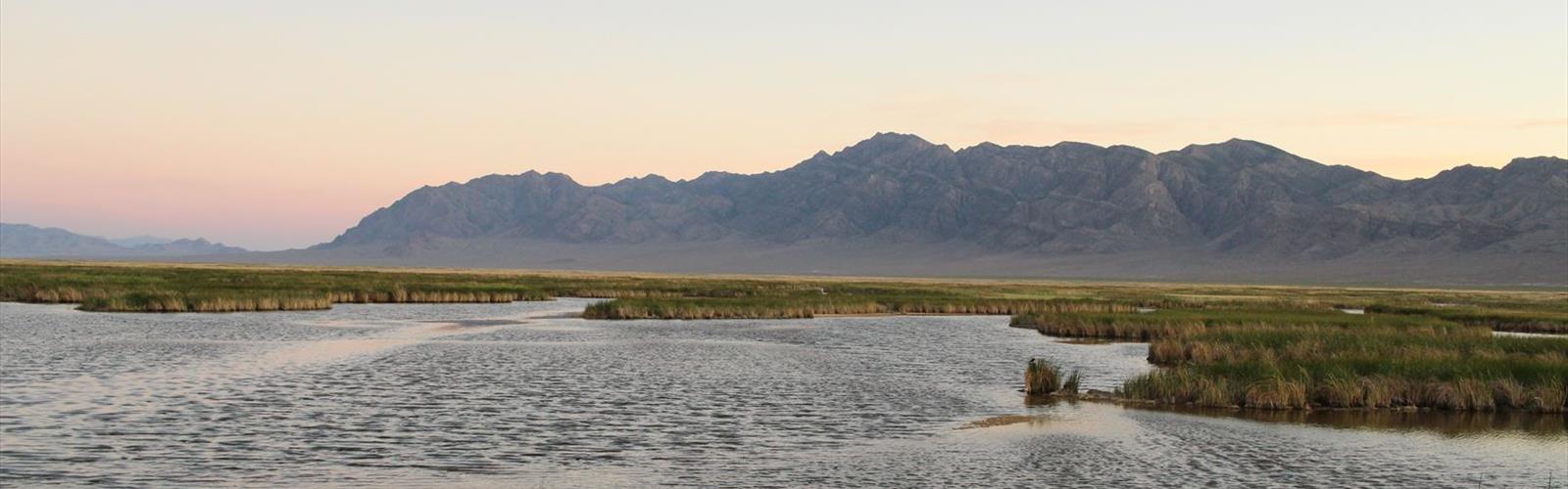
Ready to explore Fish Springs National Wildlife Refuge? Here's everything you need to know before you go!
Discover the trail
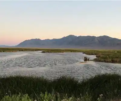
Trail description
Fish Springs National Wildlife Refuge is located at the southern end of the Great Salt Lake Desert, part of the Great Basin in Juab County, Utah. The Refuge is managed by the United States Fish and Wildlife Service. As an oasis in the Great Basin Desert in western Utah, Fish Springs serves a variety of species including fish, migratory birds, deer, coyotes, pronghorn, cougars and other native species. The reserve can be reached by paved road from Lynndyl, Utah to Topaz Mountain and then by improved dirt road to the Pony Express Road/Lincoln Highway improved dirt road which runs through the Refuge. The Refuge also serves as a recreational area for permitted outdoor activities. The Fish Springs Range runs north to south and is immediately west of the Wildlife Refuge.
Fish Springs started as a Pony Express and Overland Stage station, and got its name from the fish that populated the springs, which were reported to be over 6 inches (15 cm) in length.
The fish are left over from ancient Lake Bonneville which receded about 14,000 years ago. Several natural springs feed the wetlands. These are along a linear path at the range front (i.e. fault controlled), and include North Springs, Deadman Springs, House Springs, Middle Springs, Thomas Springs, South Springs, and Percy Springs. Fish Springs is thought to be the end of a long flowpath of groundwater, starting in the Schell Creek Range and Snake Range area and flowing along permeable bedrock (e.g. limestones) or faults toward Fish Springs. This comes from the fact that the annual discharge of the springs is 27,500 acre feet (33,900,000 m3)/year, and the annual recharge for the drainage area (the range front and Fish Springs Flat) is about 4,000 acre feet (4,900,000 m3)/year, meaning over 6 times more water flows out of the springs than falls in the valley annually by precipitation. The springs and several wells in the area are monitored by Fish and Wildlife personnel and/or the Utah Geological Survey. The water of Fish Springs is not suited for human consumption, being warm (~80 °F (27 °C)) and highly saline.
In winter
According to the U.S. Fish and Wildlife Service, the refuge is open from sunrise to sunset, 365 days of the year. It describes itself as one of the most isolated refuges in the lower 48 states, 75 miles from the closest town with any services. Getting there means driving 25 to 80 miles of gravel roads, which the refuge calls very slippery, with corrugations and potholes. For cold weather, it says to prepare, to carry warm clothing and sleeping bags, and notes that snow drifts have stranded many travelers. Cell phones do not work for many miles in any direction, and travelers who followed their GPS have had to spend nights in their vehicles and walk many miles for help. The refuge also advises filling up on gasoline and having a good spare tire, since flat tires are common on gravel roads. According to a notice from the refuge, with no date shown, public bathrooms and drinking water are no longer available until further notice. According to the refuge, winter highlights often include tundra swan, numerous ducks, raptors and the secretive American bittern.
Everything you need for your next hike. Bilingual, printable, 1 page.
Get your free hiking checklistRecommended gear for this trail
As an Amazon Associate I earn from qualifying purchases.


Ready to go?
Everything you need to know before you goWhen?
As an Amazon Associate I earn from qualifying purchases.
Affiliate links — LGPO may earn a commission at no extra cost to you.
- Hiking shoes Essential
- → Salomon Elixir Tour Mid WP · 203.38 $
- Layered clothing Essential
- Rain jacket Essential
- Trekking poles
- → Black Diamond Trail Ergo Cork · 69.99 $
- Headlamp
- → Petzl Actik Core 625 · 103.95 $
FAQ - Frequently asked questions
Everything you need to knowOutings near Fish Springs National Wildlife Refuge
Discover other trails you might enjoy
Mount Moriah, Nevada
Pony Express Territory · 96.8 km away

South Rim
Northern Utah · 102.7 km away
Wheeler Peak, Nevada
Pony Express Territory · 126.8 km away
Mount Washington, Nevada
Pony Express Territory · 132.7 km away
Mount Nebo, Utah
Central Utah · 137.3 km away
Hiking near Kelowna
50 trails to explore ~1214 km away
We work hard to provide the most up-to-date and error-free data possible. If something seems incorrect, let us know! Your contribution helps the whole community.
Hikers' opinions
Be the first to review!
No hiker has shared their experience yet. Share your impressions and help other hikers!