


Ready to explore Mount Nebo, Utah? Here's everything you need to know before you go!
Discover the trail

Trail description
Mount Nebo is the highest peak in the Wasatch Range and the highest point in all of Utah's Wasatch Mountains, rising dramatically above the surrounding landscape in western Utah. It's a serious mountain — the kind that demands respect, preparation, and a genuine love for high-alpine terrain. Whether you're drawn to the summit challenge or simply want to explore the rugged ridgelines and sweeping views that define this corner of Utah, Mount Nebo delivers an experience that sticks with you.
The Mountain and Its Setting
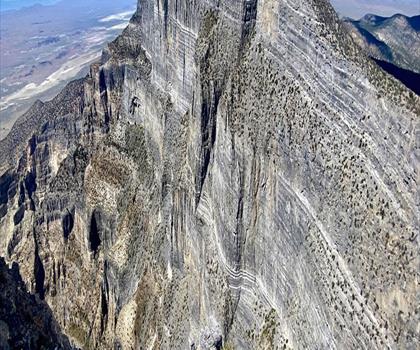
Mount Nebo sits at the southern end of the Wasatch Range, anchoring the Mount Nebo Wilderness Area. The mountain has three distinct summits — North Peak, South Peak, and a central ridge connecting them — giving it a dramatic, multi-pronged silhouette that's visible from a wide stretch of central Utah. The terrain here is steep, rocky, and exposed, with loose scree fields, sharp ridgelines, and sections that require careful foot placement. This is not a casual stroll — it's a genuine alpine objective.
The wilderness area surrounding the peak protects a landscape that shifts dramatically with elevation. Lower slopes are covered in dense stands of aspen and conifer, while higher up the trees give way to open alpine meadows, talus fields, and bare rock. Wildflowers push through the rocky soil during summer, and the views from the upper ridges stretch across an enormous swath of Utah — the valley floors far below, distant ranges layered on the horizon, and the Great Basin opening up to the west.
The Trail Experience
The most commonly used route to the summit of Mount Nebo begins at the Andrews Ridge Trailhead, accessed via the Mount Nebo Scenic Byway. The trail climbs steadily through forested terrain before breaking out onto the open ridge. From there, the route follows the ridgeline toward the summit, with significant exposure and elevation gain along the way. The final push to the summit involves scrambling over loose rock and navigating narrow sections where the ridge drops steeply on both sides.
The North Peak is generally considered the true high point, and reaching it requires committing to the full ridge traverse — a demanding undertaking that experienced hikers find deeply rewarding. The South Peak is also accessible and offers its own commanding views, though the terrain between the two summits is not trivial. Route-finding skills and comfort on exposed terrain are genuine assets here.
Conditions on the mountain can change quickly. Even in midsummer, afternoon thunderstorms are a real concern on the exposed upper ridges. Starting early is not just good advice — it's essential. Snow can linger well into summer on north-facing slopes and in sheltered couloirs, and early-season hikers should be prepared for icy patches and potentially significant snowpack.
What Makes Mount Nebo Stand Out
What sets Mount Nebo apart from other high peaks in Utah is the combination of its prominence, its wilderness character, and the sheer scale of the views it offers. Because it sits at the southern end of the Wasatch Range rather than in the middle of a cluster of high peaks, it rises with unusual independence from the surrounding terrain. That isolation translates into panoramic views that feel genuinely vast — you're not looking at a wall of nearby peaks, you're looking at the whole of central Utah spread out below you.
The Mount Nebo Wilderness designation also means the area has been kept free of motorized use and significant development. The trails are maintained but not manicured. The experience feels raw and earned in a way that more accessible peaks sometimes don't. Wildlife is present throughout the wilderness area — mule deer, black bears, and raptors are all part of the ecosystem here, and the high alpine zones support their own specialized communities of plants and animals adapted to the short growing season and harsh conditions.
Practical Information
The Andrews Ridge Trailhead is the primary access point for summit attempts and is reached via the Mount Nebo Scenic Byway, which connects Nephi to the north and Payson to the south. The byway itself is worth the drive — it winds through some of the most scenic terrain in the region and offers multiple pullouts and overlooks along the way.
Parking at the trailhead is limited, and on busy summer weekends the lot fills early. Arriving before sunrise is a practical strategy both for securing a parking spot and for getting a head start on the elevation gain before afternoon heat and storms build. There are no fees to access the trailhead or enter the wilderness area, but Leave No Trace principles apply throughout.
Dogs are permitted on the trail but must be under control at all times. Given the exposed terrain and the presence of wildlife, keeping dogs leashed or under very reliable voice command is strongly recommended. The rocky scrambling sections near the summit can also be hard on paws, so consider your dog's experience level before bringing them on a full summit attempt.
Water sources on the upper mountain are limited and unreliable. Carry more than you think you'll need — the combination of high elevation, physical exertion, and dry Utah air means dehydration can sneak up on you faster than expected. A water filter or purification tablets are useful if you plan to rely on any streams encountered lower on the trail.
Who This Hike Is For
Mount Nebo is best suited to hikers with solid experience on steep, rocky terrain and a comfort level with exposure. The summit ridge is not technical climbing, but it's not a straightforward trail either — loose rock, narrow sections, and significant drop-offs are part of the deal. Hikers who are new to alpine terrain or uncomfortable with heights should consider building experience on less exposed peaks before tackling Nebo's upper ridges.
For those with the right background, Mount Nebo offers one of the most satisfying summit experiences in Utah — a genuine wilderness peak with hard-earned views and the quiet satisfaction of standing on the highest point in the Wasatch Range.
The Essential Hiking Checklist
Everything you need for your next hike. Bilingual, printable, 1 page.
Get your free hiking checklistRecommended gear for this trail
As an Amazon Associate I earn from qualifying purchases.


Ready to go?
Everything you need to know before you goWhen?
How much?
As an Amazon Associate I earn from qualifying purchases.
Affiliate links — LGPO may earn a commission at no extra cost to you.
- Hiking shoes Essential
- → Salomon Elixir Tour Mid WP · 203.38 $
- Layered clothing Essential
- Rain jacket Essential
- Trekking poles
- → Black Diamond Trail Ergo Cork · 69.99 $
- Headlamp
- → Petzl Actik Core 625 · 103.95 $
FAQ - Frequently asked questions
Everything you need to knowSimilar hikes nearby
Discover other trails you might enjoy
Hiking near Calgary
120 trails to explore ~1260 km away
We work hard to provide the most up-to-date and error-free data possible. If something seems incorrect, let us know! Your contribution helps the whole community.
Hikers' opinions
Be the first to review!
No hiker has shared their experience yet. Share your impressions and help other hikers!