
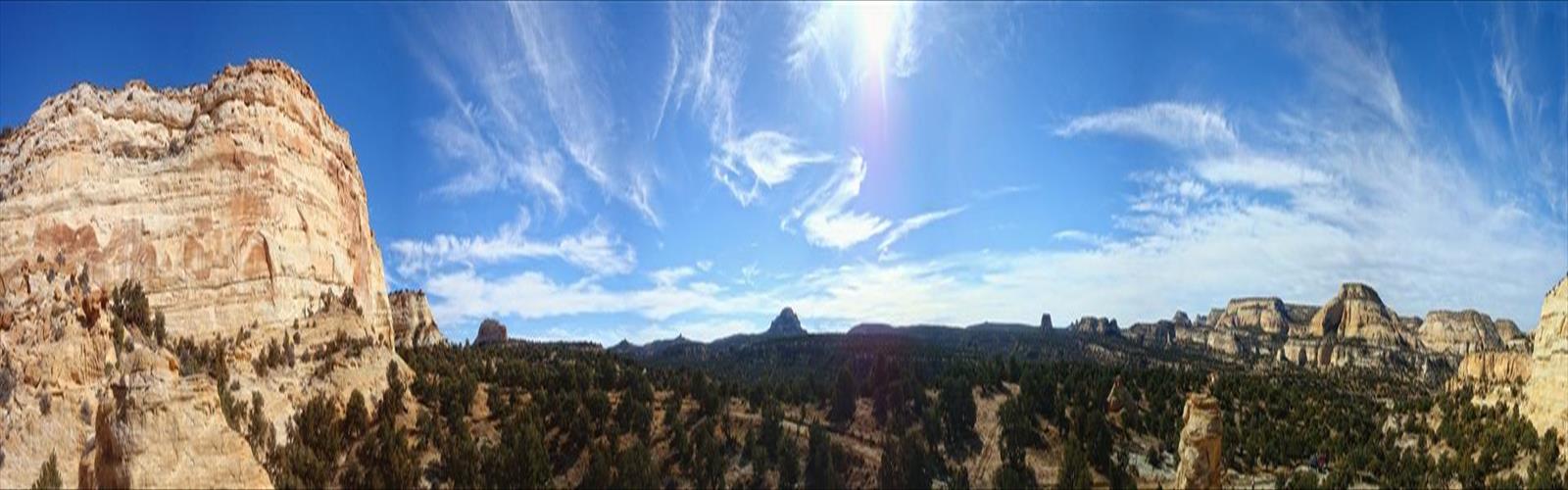

Ready to explore Reds Canyon Trail? Here's everything you need to know before you go!
Discover the trail
Trail description
The New Hance Trail (a.k.a. Red Canyon Trail) is a hiking trail on the South Rim of the Grand Canyon National Park, located in the U.S. state of Arizona. It is one of the "unmaintained" trails and, along with the similar Tanner Trail, is considered one of the most difficult trails on the South Rim. Unlike the Tanner Trail, there is no parking available at the trailhead, which is located about a 5 minute walk north of the South Rim main road. The trail ends at the Hance Rapids on the Colorado River. It is approximately 6.5 hiking miles and a 4400' descent from the South Rim main road at ~7040' to the Colorado River at ~2600' elevation.
This trail has become used more in recent years. It is no longer only marked by the occasional cairn. While it remains a very rugged trail, the New Hance is now a real single track trail that is very distinct and relatively straightforward to follow the entire way from the South Rim Drive down to the river. Well-engineered switchbacks and other trail maintenance indicate that significant work, however irregularly, has been done on the trail over the years since John Hance first created the trail in the 1890s.
The top one mile is the steepest and most rugged part of the trail, featuring hard switchbacks down a steep slope and numerous big step downs, two to four feet high, that must be carefully negotiated. Below the top one mile, the big steps become fewer in number and farther apart, and the trail becomes progressively less steep. However, occasional steep stretches and big steps may still be found along the entire length of the trail. There are a couple of isolated spots in the bottom wider areas of Red Canyon where the trail splits into multiple paths but they eventually converge again after a relatively short distance.
While rugged and somewhat challenging to navigate, the New Hance Trail does not require specialized technical skills or equipment. It has graduated to a full-fledged "hiking trail". The trail's ruggedness and remote location has placed it out of reach of most tourists, so the New Hance Trail is almost exclusively used by overnight hikers and the occasional day hiker, typically well trained and properly prepared.
There is no reliable source of water between the TH and the Colorado River. The small creeks and springs in the lower portions of Red Canyon may be flowing early in the year. However, the GCNP issues a warning on back country permits noting that the spring water may exceed municipal water standards for arsenic.
Free
1 pages
The Essential Hiking Checklist
Everything you need for your next hike. Bilingual, printable, 1 page.
Get your free hiking checklistRecommended gear for this trail
As an Amazon Associate I earn from qualifying purchases.
LGPO Pick

Salomon
Elixir Tour Mid WP
Waterproof mid-height boot ideal for rocky terrain
203.38 $


Affiliate links — LGPO may earn a commission at no extra cost to you.
Ready to go?
Everything you need to know before you goWhen?
Opening hours
No information
Varies by season
Best season
Fall
Spectacular colors
Best time
Early morning
Less crowded
Weather (next days)
Loading
How much?
Entry fees
Adult
Not available
Child
—
What to bring?
As an Amazon Associate I earn from qualifying purchases.
Affiliate links — LGPO may earn a commission at no extra cost to you.
Gear
- Hiking shoes Essential
- → Salomon Elixir Tour Mid WP · 203.38 $
- Layered clothing Essential
- Rain jacket Essential
- Trekking poles
- → Black Diamond Trail Ergo Cork · 69.99 $
- Headlamp
- → Petzl Actik Core 625 · 103.95 $
Water & food
2L minimum
No water point on the trail
Bring energy snacks for a 4h+ hike
Good to know
Safety
Download the GPX before you go
Limited cellular coverage on the trail
Slippery after rain
Be careful on rocky sections
In an emergency
Emergency
911
Parking GPS
38.7772, -110.9304357
Center
Not available
FAQ - Frequently asked questions
Everything you need to knowAllow about 2.5 hours for Reds Canyon Trail (61 km).
No, Reds Canyon Trail has no visitor centre on site.
Didn't find your answer?
Similar hikes nearby
Discover other trails you might enjoy

Top 10 best hiking in Central Utah
Our ranking based on hiker reviews
Hiking near Calgary
120 trails to explore ~1385 km away
Did you spot an error?
We work hard to provide the most up-to-date and error-free data possible. If something seems incorrect, let us know! Your contribution helps the whole community.
Hikers' opinions
Be the first to review!
No hiker has shared their experience yet. Share your impressions and help other hikers!